Miller Topo Map Missouri
To zoom in, hover over the map of Miller
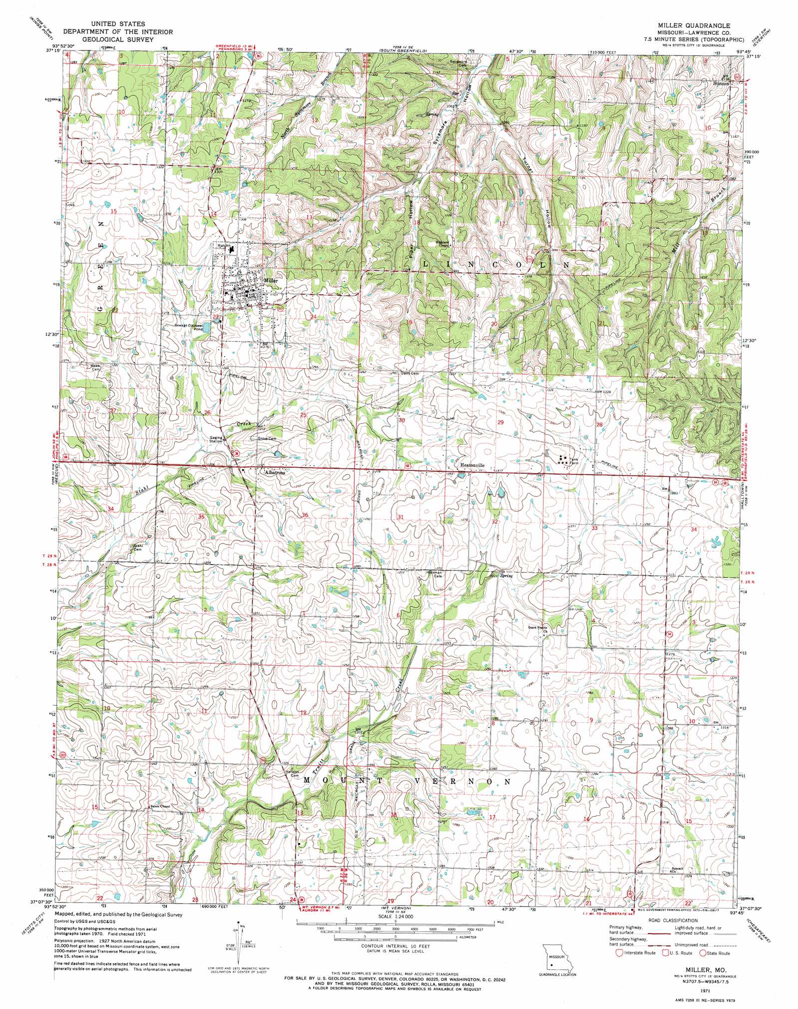
USGS Topo Quad 37093b7 - 1:24,000 scale
| Topo Map Name: | Miller |
| USGS Topo Quad ID: | 37093b7 |
| Print Size: | ca. 21 1/4" wide x 27" high |
| Southeast Coordinates: | 37.125° N latitude / 93.75° W longitude |
| Map Center Coordinates: | 37.1875° N latitude / 93.8125° W longitude |
| U.S. State: | MO |
| Filename: | o37093b7.jpg |
| Download Map JPG Image: | Miller topo map 1:24,000 scale |
| Map Type: | Topographic |
| Topo Series: | 7.5´ |
| Map Scale: | 1:24,000 |
| Source of Map Images: | United States Geological Survey (USGS) |
| Alternate Map Versions: |
Miller MO 1971, updated 1973 Download PDF Buy paper map Miller MO 2011 Download PDF Buy paper map Miller MO 2015 Download PDF Buy paper map |
1:24,000 Topo Quads surrounding Miller
Golden City |
Lockwood |
Greenfield |
Dadeville |
Walnut Grove |
Dudenville |
Kings Point |
South Greenfield |
Everton |
Ash Grove |
La Russell |
Rescue |
Miller |
Halltown |
Halltown Ne |
Sarcoxie |
Stotts City |
Mount Vernon |
Chesapeake |
Billings |
Pierce City |
Monett |
Verona |
Aurora |
Crane |
> Back to 37093a1 at 1:100,000 scale
> Back to 37092a1 at 1:250,000 scale
> Back to U.S. Topo Maps home
Miller topo map: Gazetteer
Miller: Populated Places
Albatross elevation 377m 1236′Call elevation 405m 1328′
Heatonville elevation 400m 1312′
Miller elevation 397m 1302′
Stinson elevation 345m 1131′
Miller: Valleys
Piper Hollow elevation 338m 1108′Turner Hollow elevation 323m 1059′
Miller digital topo map on disk
Buy this Miller topo map showing relief, roads, GPS coordinates and other geographical features, as a high-resolution digital map file on DVD: