Ash Grove Topo Map Missouri
To zoom in, hover over the map of Ash Grove
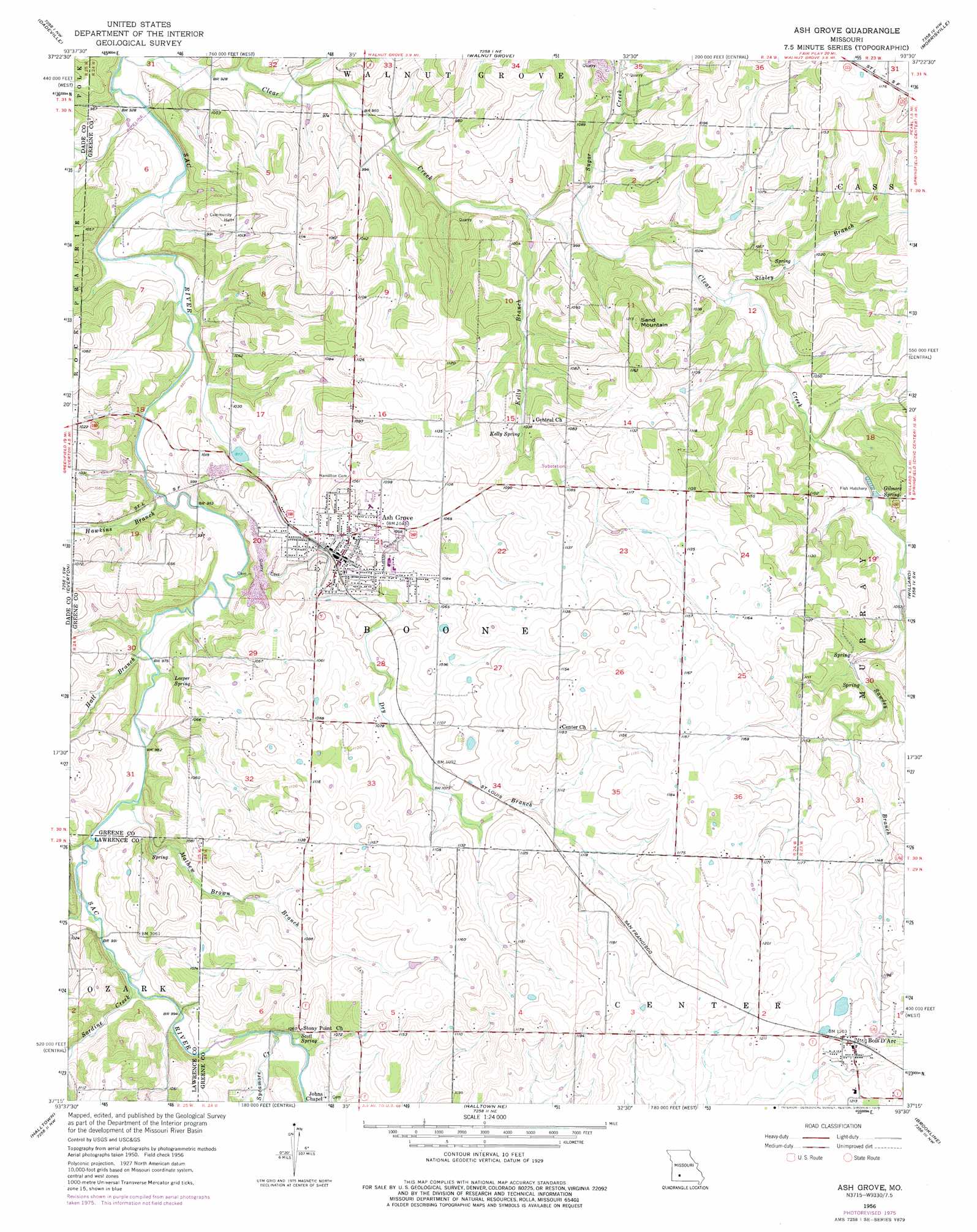
USGS Topo Quad 37093c5 - 1:24,000 scale
| Topo Map Name: | Ash Grove |
| USGS Topo Quad ID: | 37093c5 |
| Print Size: | ca. 21 1/4" wide x 27" high |
| Southeast Coordinates: | 37.25° N latitude / 93.5° W longitude |
| Map Center Coordinates: | 37.3125° N latitude / 93.5625° W longitude |
| U.S. State: | MO |
| Filename: | o37093c5.jpg |
| Download Map JPG Image: | Ash Grove topo map 1:24,000 scale |
| Map Type: | Topographic |
| Topo Series: | 7.5´ |
| Map Scale: | 1:24,000 |
| Source of Map Images: | United States Geological Survey (USGS) |
| Alternate Map Versions: |
Ash Grove MO 1956, updated 1957 Download PDF Buy paper map Ash Grove MO 1956, updated 1975 Download PDF Buy paper map Ash Grove MO 2011 Download PDF Buy paper map Ash Grove MO 2015 Download PDF Buy paper map |
1:24,000 Topo Quads surrounding Ash Grove
Crisp |
Bona |
Aldrich |
Bolivar |
Cedar Vista |
Greenfield |
Dadeville |
Walnut Grove |
Morrisville |
Pleasant Hope |
South Greenfield |
Everton |
Ash Grove |
Willard |
Ebenezer |
Miller |
Halltown |
Halltown Ne |
Brookline |
Springfield |
Mount Vernon |
Chesapeake |
Billings |
Republic |
Nixa |
> Back to 37093a1 at 1:100,000 scale
> Back to 37092a1 at 1:250,000 scale
> Back to U.S. Topo Maps home
Ash Grove topo map: Gazetteer
Ash Grove: Populated Places
Ash Grove elevation 319m 1046′Bois D'Arc elevation 369m 1210′
Ash Grove: Springs
Gilmore Spring elevation 308m 1010′Kelly Spring elevation 314m 1030′
Leeper Spring elevation 295m 967′
Scott Spring elevation 310m 1017′
Ash Grove: Streams
Dry Branch elevation 293m 961′Hall Branch elevation 296m 971′
Hawkins Branch elevation 290m 951′
Kelly Branch elevation 287m 941′
Mathew Brown Branch elevation 296m 971′
Province Branch elevation 300m 984′
Sardine Creek elevation 302m 990′
Sawdey Branch elevation 308m 1010′
Staley Branch elevation 299m 980′
Sugar Creek elevation 293m 961′
Sycamore Creek elevation 304m 997′
Ash Grove: Summits
Sand Mountain elevation 369m 1210′Ash Grove digital topo map on disk
Buy this Ash Grove topo map showing relief, roads, GPS coordinates and other geographical features, as a high-resolution digital map file on DVD: