Cedarville Topo Map Missouri
To zoom in, hover over the map of Cedarville
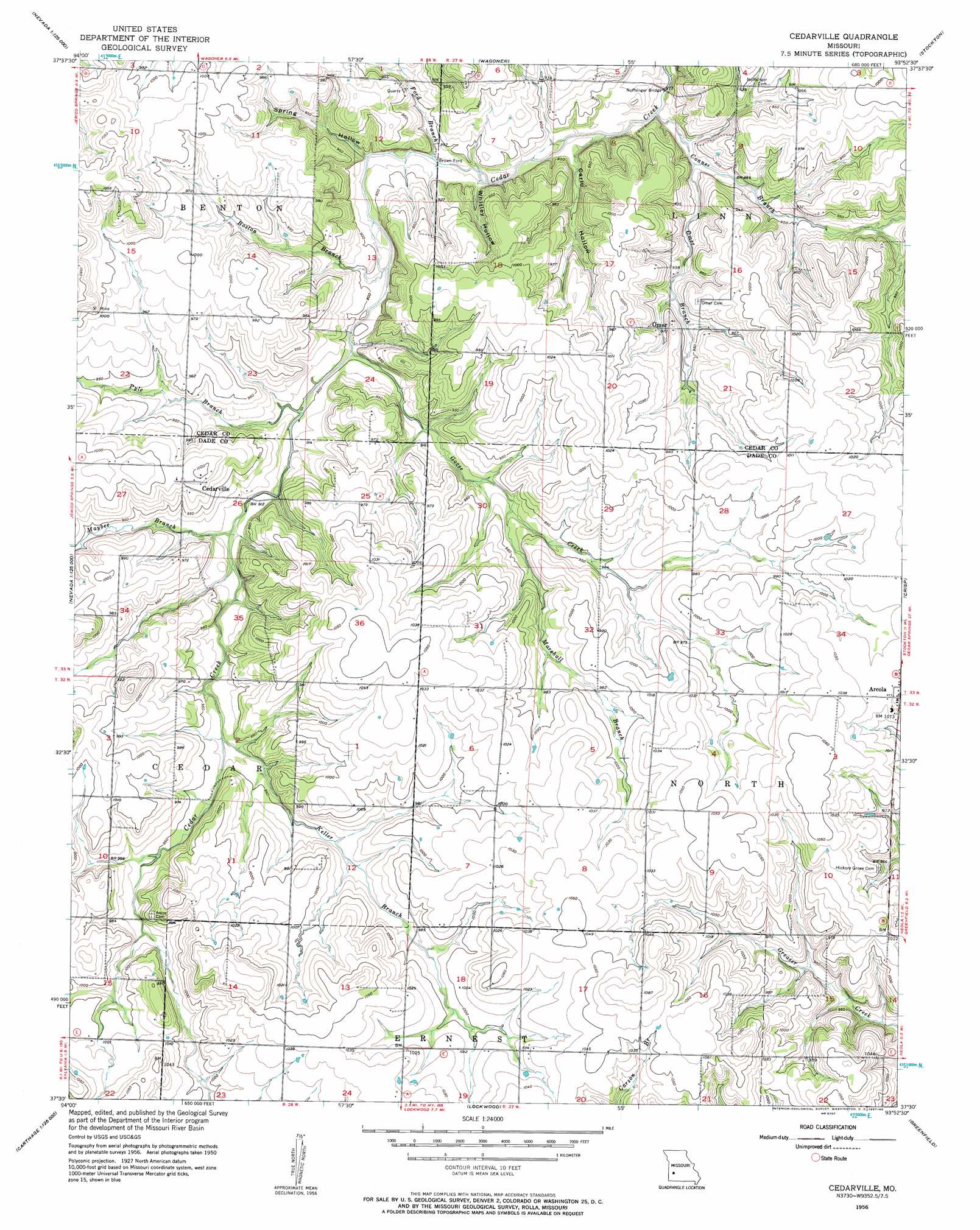
USGS Topo Quad 37093e8 - 1:24,000 scale
| Topo Map Name: | Cedarville |
| USGS Topo Quad ID: | 37093e8 |
| Print Size: | ca. 21 1/4" wide x 27" high |
| Southeast Coordinates: | 37.5° N latitude / 93.875° W longitude |
| Map Center Coordinates: | 37.5625° N latitude / 93.9375° W longitude |
| U.S. State: | MO |
| Filename: | o37093e8.jpg |
| Download Map JPG Image: | Cedarville topo map 1:24,000 scale |
| Map Type: | Topographic |
| Topo Series: | 7.5´ |
| Map Scale: | 1:24,000 |
| Source of Map Images: | United States Geological Survey (USGS) |
| Alternate Map Versions: |
Cedarville MO 1956, updated 1957 Download PDF Buy paper map Cedarville MO 2011 Download PDF Buy paper map Cedarville MO 2015 Download PDF Buy paper map |
1:24,000 Topo Quads surrounding Cedarville
Dederick |
Eldorado Springs South |
Filley |
Caplinger Mills |
Arnica |
Bellamy |
Montevallo |
Wagoner |
Stockton |
Bearcreek |
Milford |
Jerico Springs |
Cedarville |
Crisp |
Bona |
Kenoma |
Golden City |
Lockwood |
Greenfield |
Dadeville |
Maple Grove |
Dudenville |
Kings Point |
South Greenfield |
Everton |
> Back to 37093e1 at 1:100,000 scale
> Back to 37092a1 at 1:250,000 scale
> Back to U.S. Topo Maps home
Cedarville topo map: Gazetteer
Cedarville: Bridges
Noffsinger Bridge elevation 259m 849′Cedarville: Populated Places
Arcola elevation 312m 1023′Cedarville elevation 302m 990′
Cedarville: Post Offices
Horse Creek Post Office elevation 302m 990′Cedarville: Streams
Boston Branch elevation 268m 879′Conner Branch elevation 260m 853′
Ford Branch elevation 266m 872′
Goose Creek elevation 270m 885′
Keller Branch elevation 283m 928′
Marshall Branch elevation 282m 925′
Maybee Branch elevation 275m 902′
Omer Branch elevation 266m 872′
Pyle Branch elevation 272m 892′
Cedarville: Valleys
Carlo Hollow elevation 266m 872′Spring Hollow elevation 267m 875′
Whitley Hollow elevation 265m 869′
Cedarville digital topo map on disk
Buy this Cedarville topo map showing relief, roads, GPS coordinates and other geographical features, as a high-resolution digital map file on DVD: