Polk Topo Map Missouri
To zoom in, hover over the map of Polk
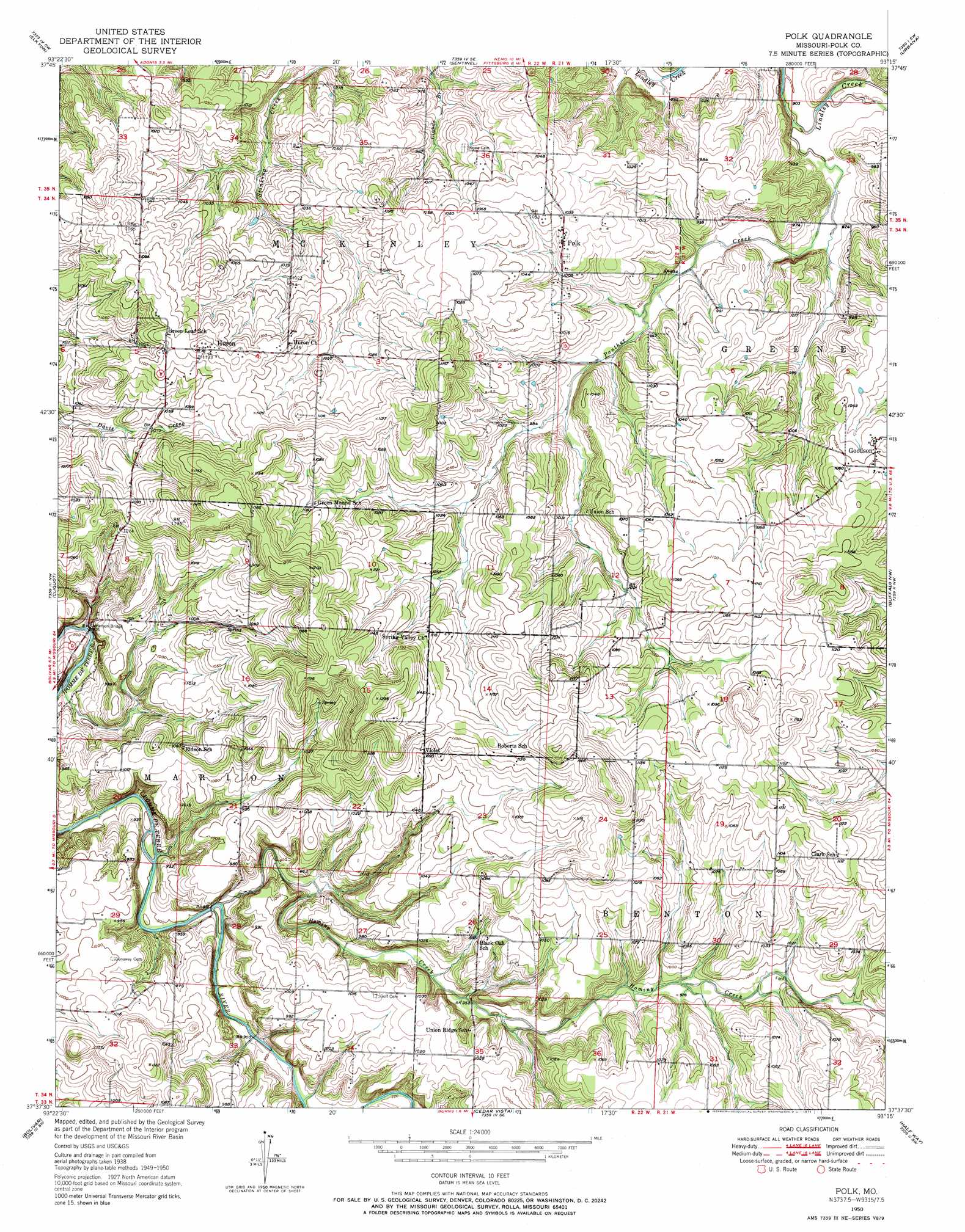
USGS Topo Quad 37093f3 - 1:24,000 scale
| Topo Map Name: | Polk |
| USGS Topo Quad ID: | 37093f3 |
| Print Size: | ca. 21 1/4" wide x 27" high |
| Southeast Coordinates: | 37.625° N latitude / 93.25° W longitude |
| Map Center Coordinates: | 37.6875° N latitude / 93.3125° W longitude |
| U.S. State: | MO |
| Filename: | o37093f3.jpg |
| Download Map JPG Image: | Polk topo map 1:24,000 scale |
| Map Type: | Topographic |
| Topo Series: | 7.5´ |
| Map Scale: | 1:24,000 |
| Source of Map Images: | United States Geological Survey (USGS) |
| Alternate Map Versions: |
Polk MO 1950, updated 1966 Download PDF Buy paper map Polk MO 1950, updated 1971 Download PDF Buy paper map Polk MO 1951 Download PDF Buy paper map Polk MO 2011 Download PDF Buy paper map Polk MO 2015 Download PDF Buy paper map |
1:24,000 Topo Quads surrounding Polk
Weaubleau |
Wheatland |
Hermitage |
Preston |
Branch |
Humansville |
Elkton |
Sentinel |
Urbana |
Tunas |
Fair Play |
Cliquot |
Polk |
Buffalo Nw |
Buffalo |
Aldrich |
Bolivar |
Cedar Vista |
Half Way |
Charity |
Walnut Grove |
Morrisville |
Pleasant Hope |
Fair Grove |
Elkland |
> Back to 37093e1 at 1:100,000 scale
> Back to 37092a1 at 1:250,000 scale
> Back to U.S. Topo Maps home
Polk topo map: Gazetteer
Polk: Bridges
Jefferson Bridge elevation 268m 879′Polk: Dams
Gordon Lake Dam elevation 301m 987′Warren Lake Dam elevation 283m 928′
Polk: Populated Places
Dewey (historical) elevation 341m 1118′Goodson elevation 325m 1066′
Huron elevation 346m 1135′
Polk elevation 317m 1040′
Violet elevation 331m 1085′
Polk: Post Offices
Polk County Post Office (historical) elevation 317m 1040′Polk: Streams
Hominy Creek elevation 273m 895′Panther Creek elevation 272m 892′
Polk digital topo map on disk
Buy this Polk topo map showing relief, roads, GPS coordinates and other geographical features, as a high-resolution digital map file on DVD: