Stockton Topo Map Missouri
To zoom in, hover over the map of Stockton
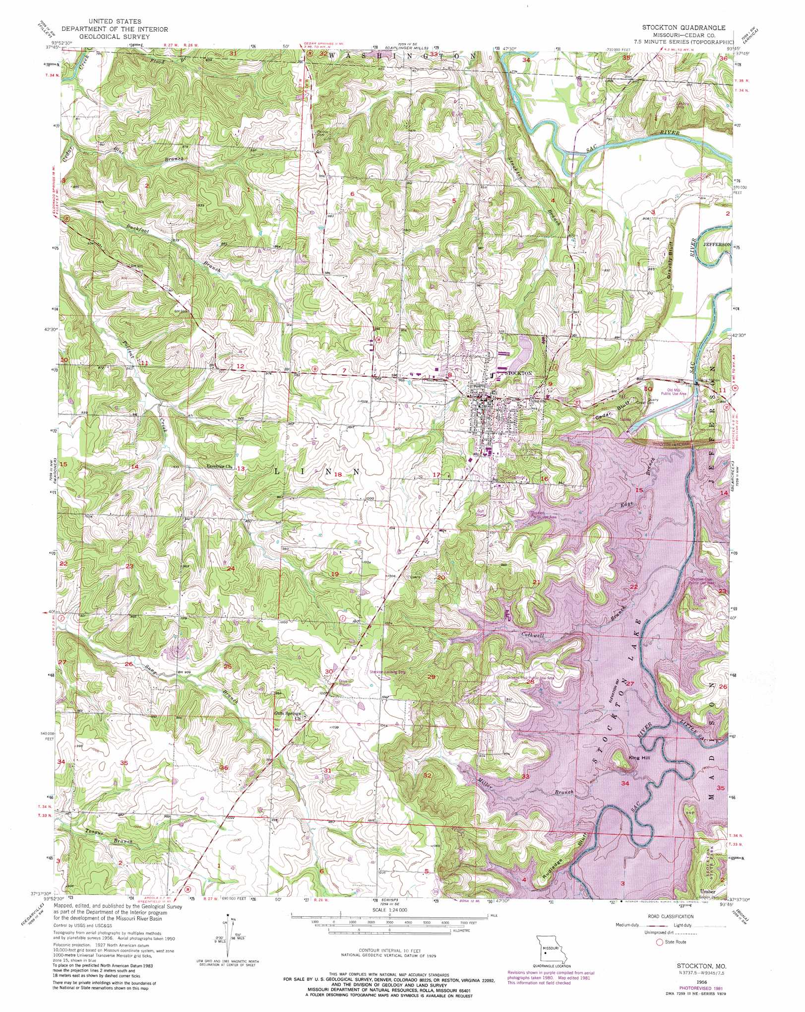
USGS Topo Quad 37093f7 - 1:24,000 scale
| Topo Map Name: | Stockton |
| USGS Topo Quad ID: | 37093f7 |
| Print Size: | ca. 21 1/4" wide x 27" high |
| Southeast Coordinates: | 37.625° N latitude / 93.75° W longitude |
| Map Center Coordinates: | 37.6875° N latitude / 93.8125° W longitude |
| U.S. State: | MO |
| Filename: | o37093f7.jpg |
| Download Map JPG Image: | Stockton topo map 1:24,000 scale |
| Map Type: | Topographic |
| Topo Series: | 7.5´ |
| Map Scale: | 1:24,000 |
| Source of Map Images: | United States Geological Survey (USGS) |
| Alternate Map Versions: |
Stockton MO 1956, updated 1976 Download PDF Buy paper map Stockton MO 1956, updated 1982 Download PDF Buy paper map Stockton MO 2011 Download PDF Buy paper map Stockton MO 2015 Download PDF Buy paper map |
1:24,000 Topo Quads surrounding Stockton
Eldorado Springs North |
Tiffin |
Roscoe |
Vista |
Weaubleau |
Eldorado Springs South |
Filley |
Caplinger Mills |
Arnica |
Humansville |
Montevallo |
Wagoner |
Stockton |
Bearcreek |
Fair Play |
Jerico Springs |
Cedarville |
Crisp |
Bona |
Aldrich |
Golden City |
Lockwood |
Greenfield |
Dadeville |
Walnut Grove |
> Back to 37093e1 at 1:100,000 scale
> Back to 37092a1 at 1:250,000 scale
> Back to U.S. Topo Maps home
Stockton topo map: Gazetteer
Stockton: Airports
Stockton Municipal Airport elevation 317m 1040′Stockton: Cliffs
Cedar Bluff elevation 280m 918′Gravel Bluff elevation 249m 816′
Rudledge Bluff elevation 264m 866′
Stockton: Dams
Stockton Lake Dam elevation 264m 866′Stockton: Parks
Crabtree Cove Public Use Area elevation 274m 898′Old Mill Public Use Area elevation 238m 780′
Orleans Trail Public Use Area elevation 281m 921′
Stockton Public Use Area elevation 273m 895′
Stockton: Populated Places
Stockton elevation 289m 948′Stockton: Reservoirs
Stockton Lake elevation 264m 866′Stockton: Streams
Blue Branch elevation 240m 787′Cothwell Branch elevation 264m 866′
Edge Branch elevation 235m 770′
Hawker Branch elevation 264m 866′
Little Sac River elevation 264m 866′
Miller Branch elevation 264m 866′
Stockton: Summits
King Hill elevation 271m 889′Stockton digital topo map on disk
Buy this Stockton topo map showing relief, roads, GPS coordinates and other geographical features, as a high-resolution digital map file on DVD: