Wagoner Topo Map Missouri
To zoom in, hover over the map of Wagoner
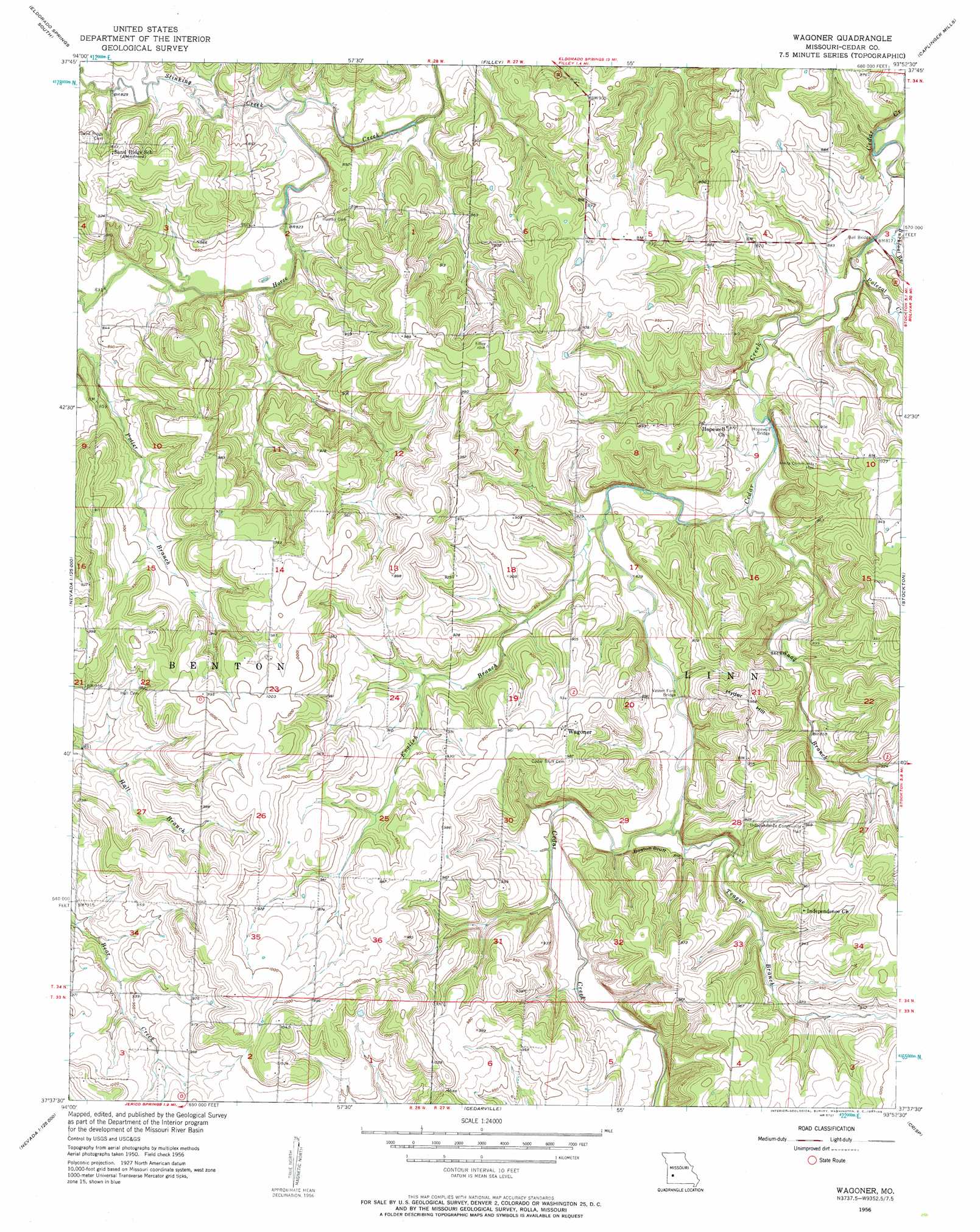
USGS Topo Quad 37093f8 - 1:24,000 scale
| Topo Map Name: | Wagoner |
| USGS Topo Quad ID: | 37093f8 |
| Print Size: | ca. 21 1/4" wide x 27" high |
| Southeast Coordinates: | 37.625° N latitude / 93.875° W longitude |
| Map Center Coordinates: | 37.6875° N latitude / 93.9375° W longitude |
| U.S. State: | MO |
| Filename: | o37093f8.jpg |
| Download Map JPG Image: | Wagoner topo map 1:24,000 scale |
| Map Type: | Topographic |
| Topo Series: | 7.5´ |
| Map Scale: | 1:24,000 |
| Source of Map Images: | United States Geological Survey (USGS) |
| Alternate Map Versions: |
Wagoner MO 1956, updated 1957 Download PDF Buy paper map Wagoner MO 1956, updated 1957 Download PDF Buy paper map Wagoner MO 2011 Download PDF Buy paper map Wagoner MO 2015 Download PDF Buy paper map |
1:24,000 Topo Quads surrounding Wagoner
Harwood |
Eldorado Springs North |
Tiffin |
Roscoe |
Vista |
Dederick |
Eldorado Springs South |
Filley |
Caplinger Mills |
Arnica |
Bellamy |
Montevallo |
Wagoner |
Stockton |
Bearcreek |
Milford |
Jerico Springs |
Cedarville |
Crisp |
Bona |
Kenoma |
Golden City |
Lockwood |
Greenfield |
Dadeville |
> Back to 37093e1 at 1:100,000 scale
> Back to 37092a1 at 1:250,000 scale
> Back to U.S. Topo Maps home
Wagoner topo map: Gazetteer
Wagoner: Bridges
Bell Bridge elevation 240m 787′Hopewell Bridge elevation 246m 807′
Vasser Ford Bridge elevation 252m 826′
Wagoner: Cliffs
Boston Bluff elevation 262m 859′Wagoner: Dams
Mossy Hill Dam elevation 294m 964′Wagoner: Populated Places
Edsall (historical) elevation 280m 918′Tingley elevation 299m 980′
Wagoner elevation 293m 961′
Wagoner: Reservoirs
Lake Louise elevation 294m 964′Wagoner: Streams
Buckfoot Branch elevation 241m 790′English Branch elevation 249m 816′
Polecat Creek elevation 241m 790′
Snag Branch elevation 246m 807′
Stinking Creek elevation 245m 803′
Teague Branch elevation 253m 830′
Wagoner: Summits
Hyder Hill elevation 297m 974′Wagoner digital topo map on disk
Buy this Wagoner topo map showing relief, roads, GPS coordinates and other geographical features, as a high-resolution digital map file on DVD: