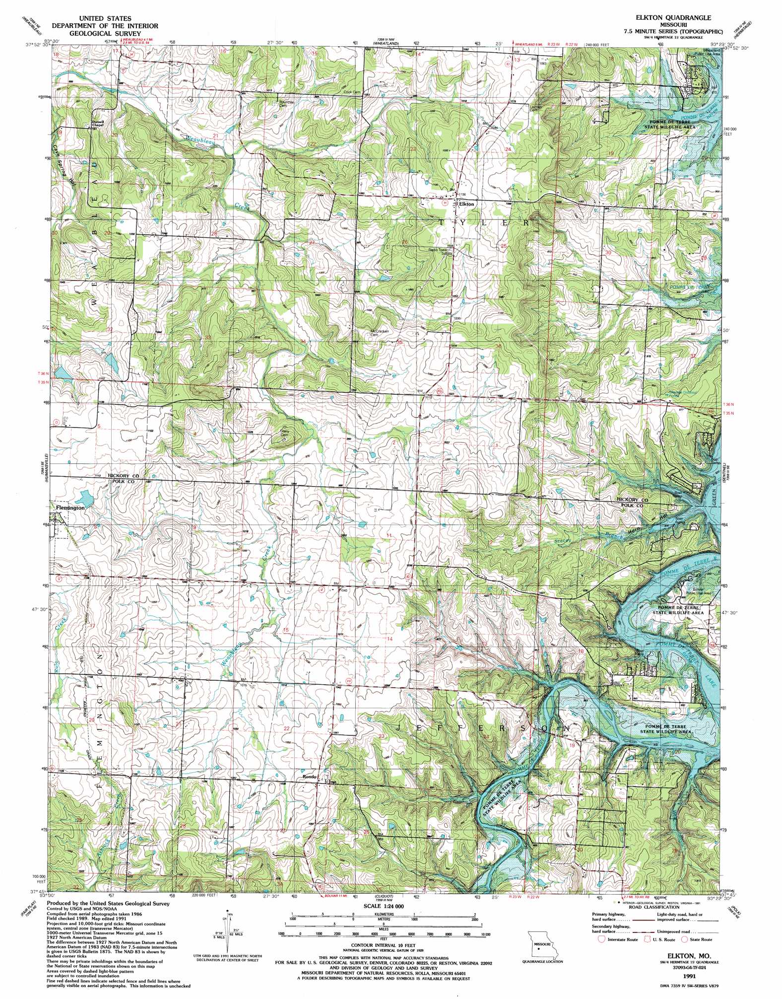
Elkton Topo Map Missouri
To zoom in, hover over the map of Elkton
USGS Topo Quad 37093g4 - 1:24,000 scale
| Topo Map Name: | Elkton |
| USGS Topo Quad ID: | 37093g4 |
| Print Size: | ca. 21 1/4" wide x 27" high |
| Southeast Coordinates: | 37.75° N latitude / 93.375° W longitude |
| Map Center Coordinates: | 37.8125° N latitude / 93.4375° W longitude |
| U.S. State: | MO |
| Filename: | o37093g4.jpg |
| Download Map JPG Image: | Elkton topo map 1:24,000 scale |
| Map Type: | Topographic |
| Topo Series: | 7.5´ |
| Map Scale: | 1:24,000 |
| Source of Map Images: | United States Geological Survey (USGS) |
| Alternate Map Versions: |
Elkton MO 1942, updated 1982 Download PDF Buy paper map Elkton MO 1949, updated 1969 Download PDF Buy paper map Elkton MO 1949, updated 1977 Download PDF Buy paper map Elkton MO 1950 Download PDF Buy paper map Elkton MO 1950 Download PDF Buy paper map Elkton MO 1980, updated 1982 Download PDF Buy paper map Elkton MO 1991, updated 1991 Download PDF Buy paper map Elkton MO 2011 Download PDF Buy paper map Elkton MO 2015 Download PDF Buy paper map |
1:24,000 Topo Quads surrounding Elkton
Osceola |
Iconium |
Quincy |
Fristoe |
Cross Timbers |
Vista |
Weaubleau |
Wheatland |
Hermitage |
Preston |
Arnica |
Humansville |
Elkton |
Sentinel |
Urbana |
Bearcreek |
Fair Play |
Cliquot |
Polk |
Buffalo Nw |
Bona |
Aldrich |
Bolivar |
Cedar Vista |
Half Way |
> Back to 37093e1 at 1:100,000 scale
> Back to 37092a1 at 1:250,000 scale
> Back to U.S. Topo Maps home
Elkton topo map: Gazetteer
Elkton: Airports
Skyriders Airport elevation 256m 839′Elkton: Dams
Vanderford Number Three Dam elevation 335m 1099′Vanderford Number Two Dam elevation 320m 1049′
Elkton: Parks
Bolivar Public Use Area elevation 268m 879′Elkton: Populated Places
Elkton elevation 339m 1112′Rondo elevation 327m 1072′
Elkton: Streams
Stacey Branch elevation 256m 839′West Branch elevation 256m 839′
Elkton: Valleys
Cave Spring Hollow elevation 269m 882′Horn Hollow elevation 256m 839′
Elkton digital topo map on disk
Buy this Elkton topo map showing relief, roads, GPS coordinates and other geographical features, as a high-resolution digital map file on DVD: