Arnica Topo Map Missouri
To zoom in, hover over the map of Arnica
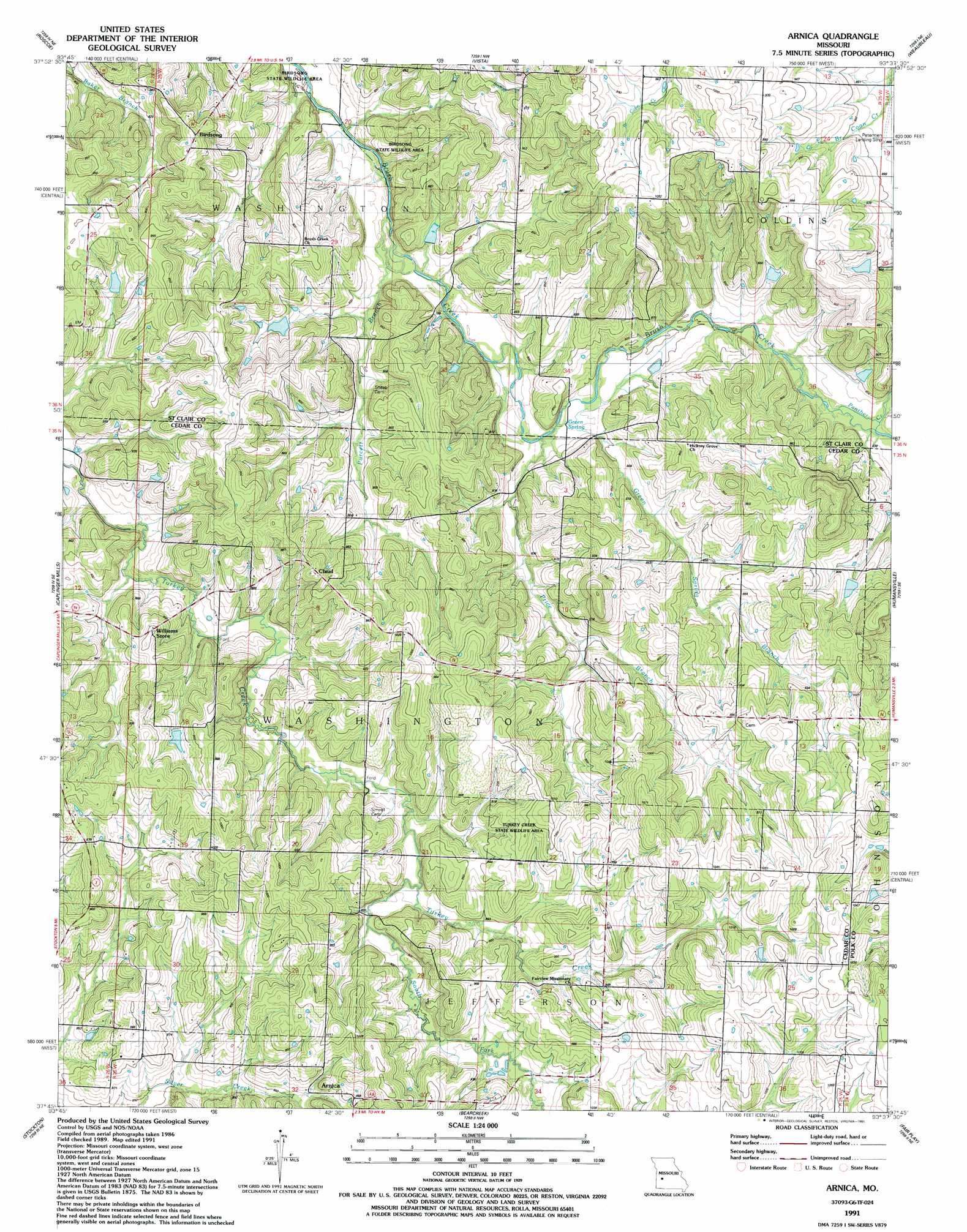
USGS Topo Quad 37093g6 - 1:24,000 scale
| Topo Map Name: | Arnica |
| USGS Topo Quad ID: | 37093g6 |
| Print Size: | ca. 21 1/4" wide x 27" high |
| Southeast Coordinates: | 37.75° N latitude / 93.625° W longitude |
| Map Center Coordinates: | 37.8125° N latitude / 93.6875° W longitude |
| U.S. State: | MO |
| Filename: | o37093g6.jpg |
| Download Map JPG Image: | Arnica topo map 1:24,000 scale |
| Map Type: | Topographic |
| Topo Series: | 7.5´ |
| Map Scale: | 1:24,000 |
| Source of Map Images: | United States Geological Survey (USGS) |
| Alternate Map Versions: |
Arnica MO 1939, updated 1965 Download PDF Buy paper map Arnica MO 1939, updated 1983 Download PDF Buy paper map Arnica MO 1941 Download PDF Buy paper map Arnica MO 1941, updated 1941 Download PDF Buy paper map Arnica MO 1991, updated 1991 Download PDF Buy paper map Arnica MO 2011 Download PDF Buy paper map Arnica MO 2015 Download PDF Buy paper map |
1:24,000 Topo Quads surrounding Arnica
Taberville |
Monegaw Springs |
Osceola |
Iconium |
Quincy |
Tiffin |
Roscoe |
Vista |
Weaubleau |
Wheatland |
Filley |
Caplinger Mills |
Arnica |
Humansville |
Elkton |
Wagoner |
Stockton |
Bearcreek |
Fair Play |
Cliquot |
Cedarville |
Crisp |
Bona |
Aldrich |
Bolivar |
> Back to 37093e1 at 1:100,000 scale
> Back to 37092a1 at 1:250,000 scale
> Back to U.S. Topo Maps home
Arnica topo map: Gazetteer
Arnica: Airports
Petermen Landing Strip elevation 269m 882′Arnica: Dams
Number 514 Dam elevation 254m 833′Arnica: Parks
Birdsong State Wildlife Area elevation 229m 751′Arnica: Populated Places
Arnica elevation 285m 935′Birdsong elevation 284m 931′
Claud elevation 297m 974′
Hamlet elevation 308m 1010′
Arnica: Springs
Green Spring elevation 241m 790′Arnica: Streams
Green Spring Branch elevation 238m 780′Panther Creek elevation 249m 816′
Price Branch elevation 238m 780′
Purcett Branch elevation 233m 764′
South Fork Turkey Creek elevation 266m 872′
Arnica digital topo map on disk
Buy this Arnica topo map showing relief, roads, GPS coordinates and other geographical features, as a high-resolution digital map file on DVD: