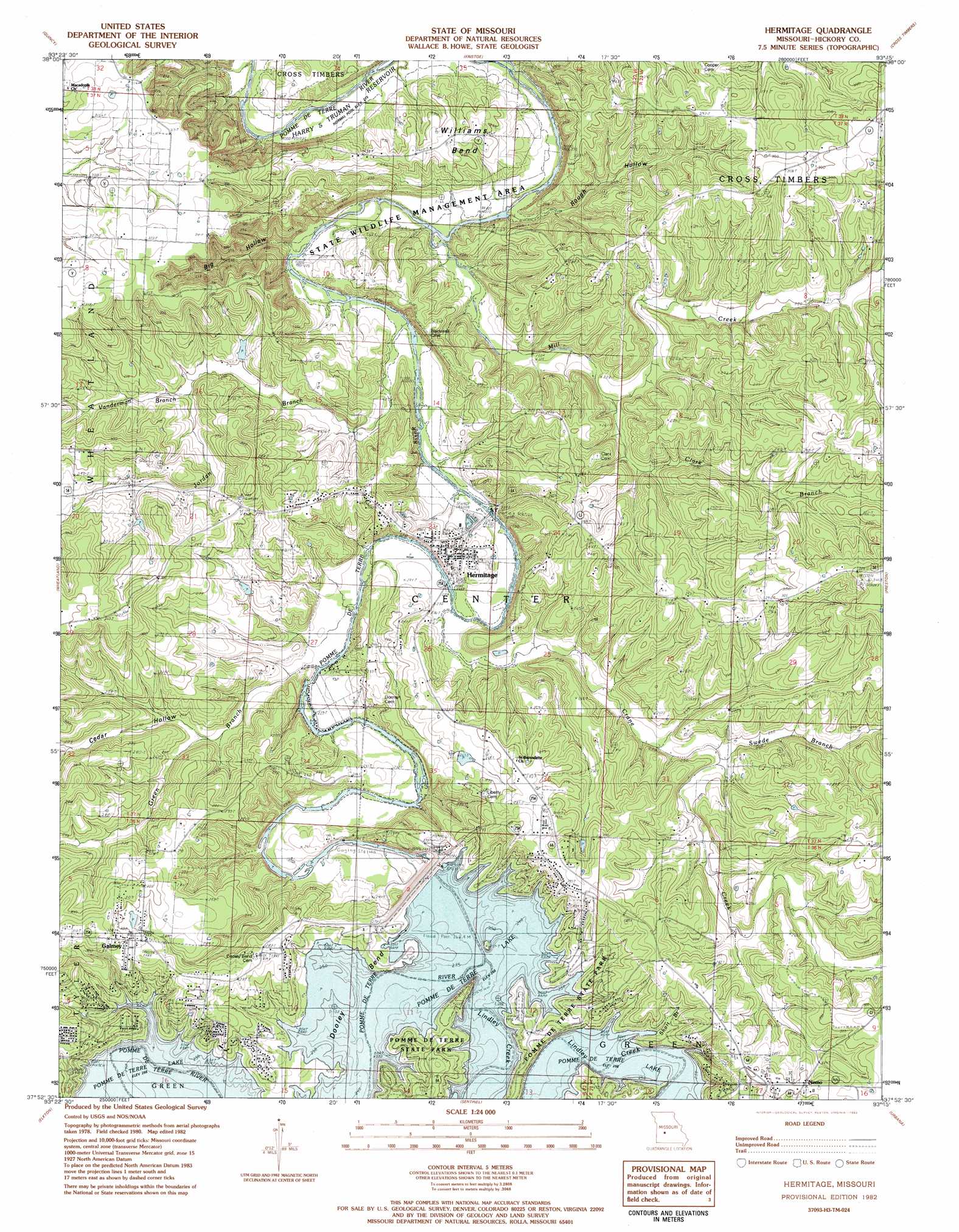
Hermitage Topo Map Missouri
To zoom in, hover over the map of Hermitage
USGS Topo Quad 37093h3 - 1:24,000 scale
| Topo Map Name: | Hermitage |
| USGS Topo Quad ID: | 37093h3 |
| Print Size: | ca. 21 1/4" wide x 27" high |
| Southeast Coordinates: | 37.875° N latitude / 93.25° W longitude |
| Map Center Coordinates: | 37.9375° N latitude / 93.3125° W longitude |
| U.S. State: | MO |
| Filename: | o37093h3.jpg |
| Download Map JPG Image: | Hermitage topo map 1:24,000 scale |
| Map Type: | Topographic |
| Topo Series: | 7.5´ |
| Map Scale: | 1:24,000 |
| Source of Map Images: | United States Geological Survey (USGS) |
| Alternate Map Versions: |
Hermitage MO 1980, updated 1982 Download PDF Buy paper map Hermitage MO 1982, updated 1982 Download PDF Buy paper map Hermitage MO 2011 Download PDF Buy paper map Hermitage MO 2015 Download PDF Buy paper map |
1:24,000 Topo Quads surrounding Hermitage
Valhalla |
Warsaw West |
Warsaw East |
Edwards |
Knobby |
Iconium |
Quincy |
Fristoe |
Cross Timbers |
Climax Springs |
Weaubleau |
Wheatland |
Hermitage |
Preston |
Branch |
Humansville |
Elkton |
Sentinel |
Urbana |
Tunas |
Fair Play |
Cliquot |
Polk |
Buffalo Nw |
Buffalo |
> Back to 37093e1 at 1:100,000 scale
> Back to 37092a1 at 1:250,000 scale
> Back to U.S. Topo Maps home
Hermitage topo map: Gazetteer
Hermitage: Bends
Dooley Bend elevation 256m 839′Williams Bend elevation 257m 843′
Hermitage: Capes
Indian Backbone (historical) elevation 256m 839′Indian Point elevation 256m 839′
Hermitage: Dams
Pomme de Terre Dam elevation 266m 872′Hermitage: Islands
Lost Hill Island elevation 258m 846′Hermitage: Mines
Peterson Mine elevation 270m 885′Hermitage: Parks
Cross Timbers Public Use Area elevation 227m 744′Dam Site Public Use Area elevation 273m 895′
Outlet Public Use Area elevation 231m 757′
Quarry Point Public Use Area elevation 265m 869′
Wheatland Public Use Area elevation 266m 872′
Hermitage: Populated Places
Carsons Corner elevation 291m 954′Galmey elevation 295m 967′
Hermitage elevation 250m 820′
Nemo elevation 302m 990′
Hermitage: Reservoirs
Pomme de Terre Lake elevation 256m 839′Hermitage: Streams
Clark Branch elevation 234m 767′Crane Creek elevation 226m 741′
Green Branch elevation 223m 731′
Jordan Branch elevation 220m 721′
Lindley Creek elevation 256m 839′
Mill Creek elevation 220m 721′
Short Branch elevation 256m 839′
Swede Branch elevation 240m 787′
Vanderman Branch elevation 250m 820′
Hermitage: Valleys
Big Hollow elevation 226m 741′Cedar Hollow elevation 240m 787′
Rough Hollow elevation 220m 721′
Hermitage digital topo map on disk
Buy this Hermitage topo map showing relief, roads, GPS coordinates and other geographical features, as a high-resolution digital map file on DVD: