La Russell Topo Map Missouri
To zoom in, hover over the map of La Russell
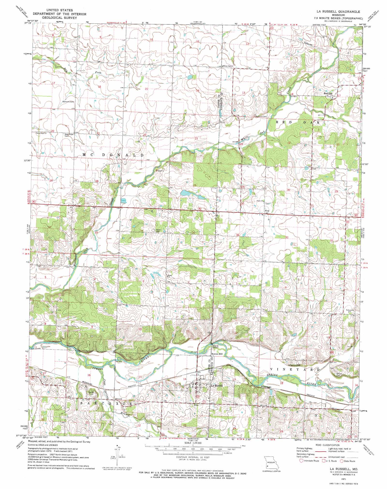
USGS Topo Quad 37094b1 - 1:24,000 scale
| Topo Map Name: | La Russell |
| USGS Topo Quad ID: | 37094b1 |
| Print Size: | ca. 21 1/4" wide x 27" high |
| Southeast Coordinates: | 37.125° N latitude / 94° W longitude |
| Map Center Coordinates: | 37.1875° N latitude / 94.0625° W longitude |
| U.S. State: | MO |
| Filename: | o37094b1.jpg |
| Download Map JPG Image: | La Russell topo map 1:24,000 scale |
| Map Type: | Topographic |
| Topo Series: | 7.5´ |
| Map Scale: | 1:24,000 |
| Source of Map Images: | United States Geological Survey (USGS) |
| Alternate Map Versions: |
La Russell MO 1971, updated 1973 Download PDF Buy paper map La Russell MO 2011 Download PDF Buy paper map La Russell MO 2015 Download PDF Buy paper map |
1:24,000 Topo Quads surrounding La Russell
Lamar South |
Kenoma |
Golden City |
Lockwood |
Greenfield |
Jasper |
Maple Grove |
Dudenville |
Kings Point |
South Greenfield |
Carthage |
Avilla |
La Russell |
Rescue |
Miller |
Fidelity |
Reeds |
Sarcoxie |
Stotts City |
Mount Vernon |
Granby |
Newtonia |
Pierce City |
Monett |
Verona |
> Back to 37094a1 at 1:100,000 scale
> Back to 37094a1 at 1:250,000 scale
> Back to U.S. Topo Maps home
La Russell topo map: Gazetteer
La Russell: Populated Places
Bowers Mill elevation 315m 1033′La Russell elevation 324m 1062′
Plew elevation 361m 1184′
Red Oak elevation 351m 1151′
La Russell: Streams
Cave Spring Branch elevation 308m 1010′La Russell digital topo map on disk
Buy this La Russell topo map showing relief, roads, GPS coordinates and other geographical features, as a high-resolution digital map file on DVD: