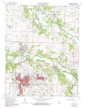
Webb City Topo Map Missouri
To zoom in, hover over the map of Webb City
USGS Topo Quad 37094b4 - 1:24,000 scale
| Topo Map Name: | Webb City |
| USGS Topo Quad ID: | 37094b4 |
| Print Size: | ca. 21 1/4" wide x 27" high |
| Southeast Coordinates: | 37.125° N latitude / 94.375° W longitude |
| Map Center Coordinates: | 37.1875° N latitude / 94.4375° W longitude |
| U.S. State: | MO |
| Filename: | o37094b4.jpg |
| Download Map JPG Image: | Webb City topo map 1:24,000 scale |
| Map Type: | Topographic |
| Topo Series: | 7.5´ |
| Map Scale: | 1:24,000 |
| Source of Map Images: | United States Geological Survey (USGS) |
| Alternate Map Versions: |
Webb City MO 1963, updated 1964 Download PDF Buy paper map Webb City MO 1963, updated 1984 Download PDF Buy paper map Webb City MO 2011 Download PDF Buy paper map Webb City MO 2015 Download PDF Buy paper map |
1:24,000 Topo Quads surrounding Webb City
> Back to 37094a1 at 1:100,000 scale
> Back to 37094a1 at 1:250,000 scale
> Back to U.S. Topo Maps home
Webb City topo map: Gazetteer
Webb City: Airports
Cooper Flying Service Airport elevation 299m 980′Joplin Municipal Airport elevation 296m 971′
Webb City: Parks
Hatten Park elevation 300m 984′Sunset Park elevation 295m 967′
Webb City: Populated Places
Alba elevation 302m 990′Brooklyn Heights elevation 302m 990′
Carterville elevation 300m 984′
Lakeside elevation 301m 987′
Oronogo elevation 280m 918′
Prosperity elevation 313m 1026′
Purcell elevation 294m 964′
Webb City elevation 305m 1000′
Webb City: Streams
Bens Branch elevation 271m 889′Webb City digital topo map on disk
Buy this Webb City topo map showing relief, roads, GPS coordinates and other geographical features, as a high-resolution digital map file on DVD:


