Crestline Topo Map Kansas
To zoom in, hover over the map of Crestline
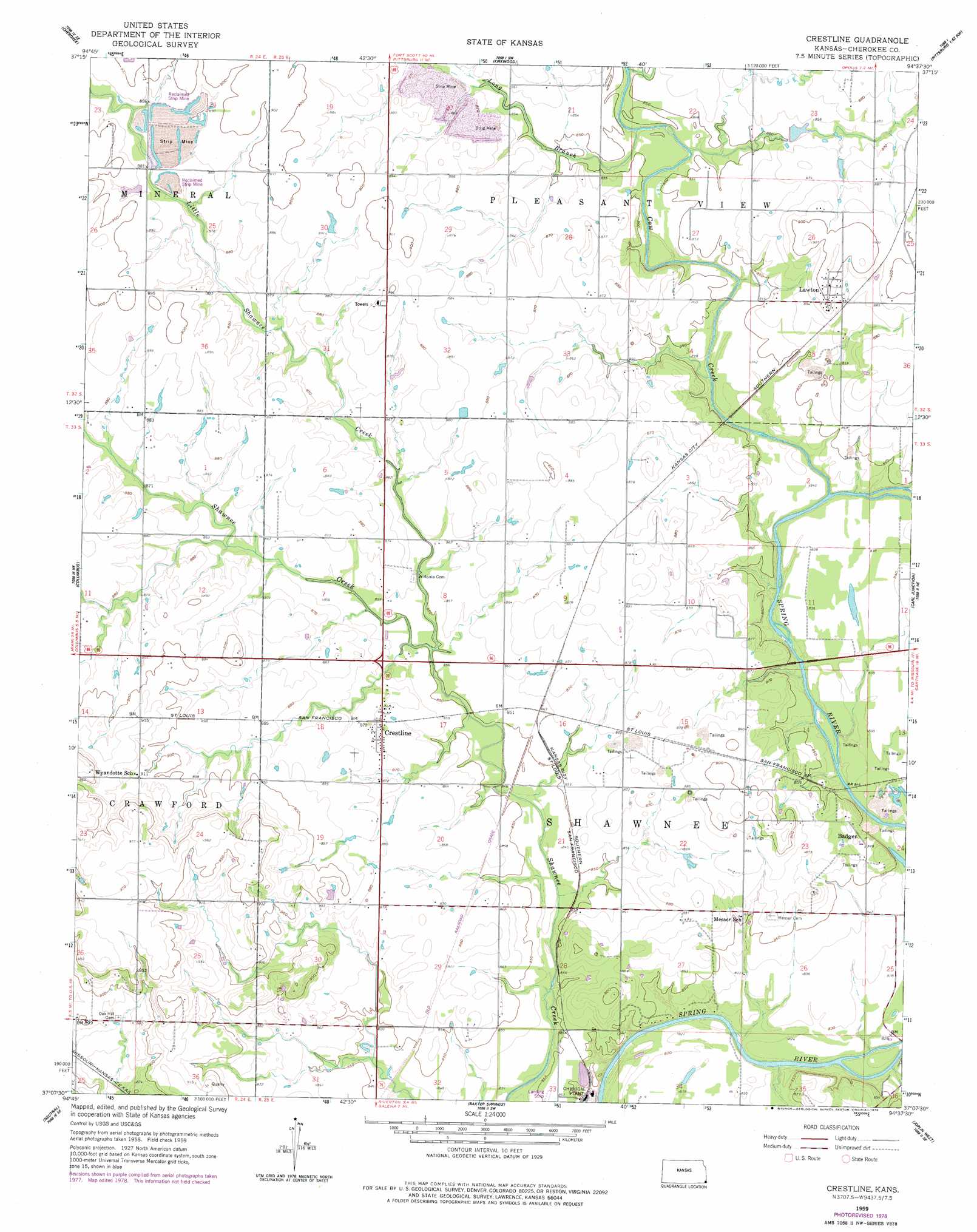
USGS Topo Quad 37094b6 - 1:24,000 scale
| Topo Map Name: | Crestline |
| USGS Topo Quad ID: | 37094b6 |
| Print Size: | ca. 21 1/4" wide x 27" high |
| Southeast Coordinates: | 37.125° N latitude / 94.625° W longitude |
| Map Center Coordinates: | 37.1875° N latitude / 94.6875° W longitude |
| U.S. State: | KS |
| Filename: | o37094b6.jpg |
| Download Map JPG Image: | Crestline topo map 1:24,000 scale |
| Map Type: | Topographic |
| Topo Series: | 7.5´ |
| Map Scale: | 1:24,000 |
| Source of Map Images: | United States Geological Survey (USGS) |
| Alternate Map Versions: |
Crestline KS 1959, updated 1960 Download PDF Buy paper map Crestline KS 1959, updated 1979 Download PDF Buy paper map Crestline KS 2010 Download PDF Buy paper map Crestline KS 2012 Download PDF Buy paper map Crestline KS 2015 Download PDF Buy paper map |
1:24,000 Topo Quads surrounding Crestline
Grindstone Creek |
Radley |
Pittsburg |
Mindenmines |
Nashville |
West Mineral |
Cherokee |
Kirkwood |
Asbury |
Neck City |
Hallowell |
Columbus |
Crestline |
Carl Junction |
Webb City |
Melrose |
Neutral |
Baxter Springs |
Joplin West |
Joplin East |
Miami Nw |
Picher |
Peoria |
Racine |
Tipton Ford |
> Back to 37094a1 at 1:100,000 scale
> Back to 37094a1 at 1:250,000 scale
> Back to U.S. Topo Maps home
Crestline topo map: Gazetteer
Crestline: Populated Places
Badger elevation 265m 869′Crestline elevation 265m 869′
Lawton elevation 268m 879′
Crestline: Streams
Cow Creek elevation 250m 820′Little Shawnee Creek elevation 259m 849′
Long Branch elevation 256m 839′
Turkey Creek elevation 250m 820′
Turkey Creek elevation 247m 810′
Crestline digital topo map on disk
Buy this Crestline topo map showing relief, roads, GPS coordinates and other geographical features, as a high-resolution digital map file on DVD: