Kenoma Topo Map Missouri
To zoom in, hover over the map of Kenoma
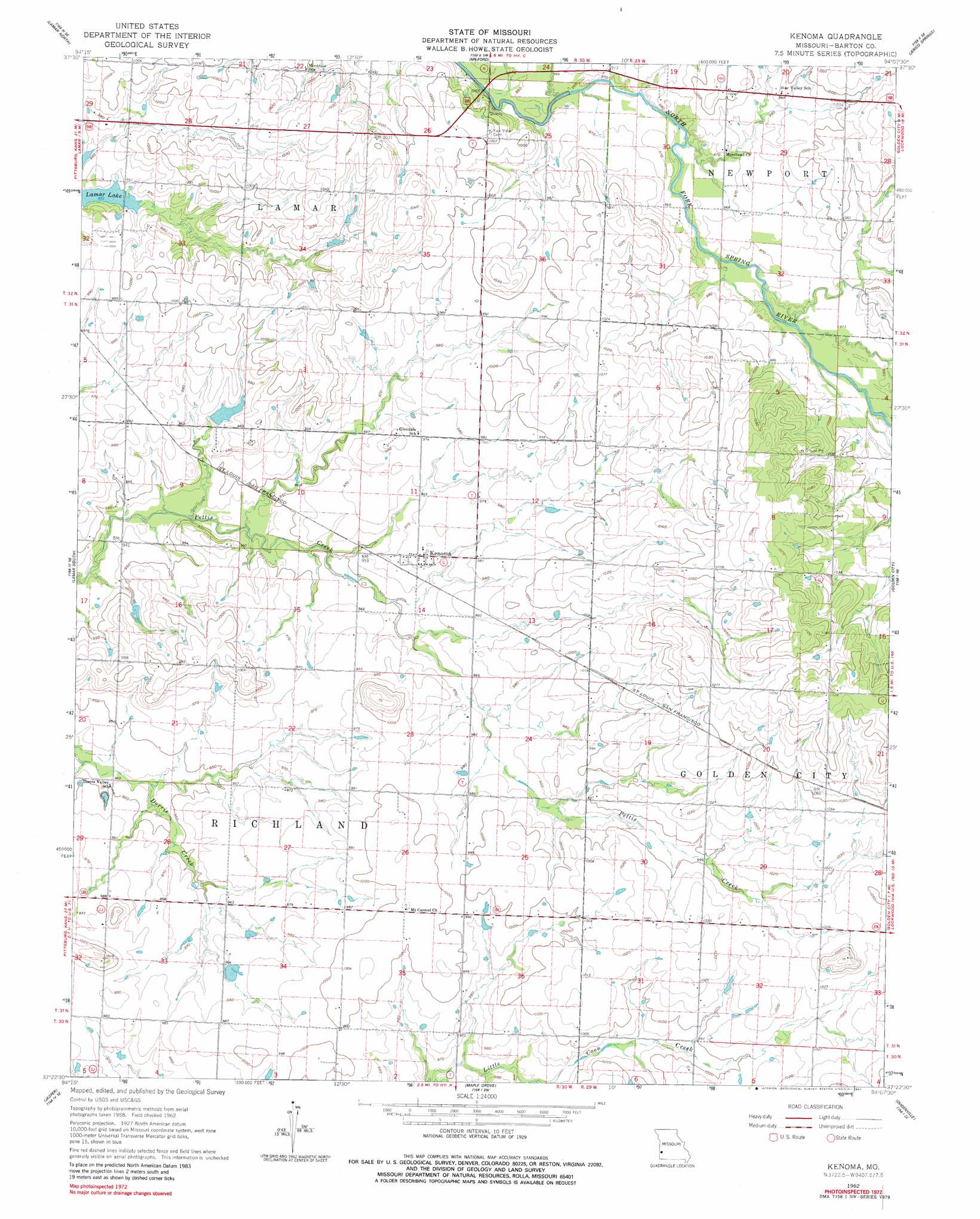
USGS Topo Quad 37094d2 - 1:24,000 scale
| Topo Map Name: | Kenoma |
| USGS Topo Quad ID: | 37094d2 |
| Print Size: | ca. 21 1/4" wide x 27" high |
| Southeast Coordinates: | 37.375° N latitude / 94.125° W longitude |
| Map Center Coordinates: | 37.4375° N latitude / 94.1875° W longitude |
| U.S. State: | MO |
| Filename: | o37094d2.jpg |
| Download Map JPG Image: | Kenoma topo map 1:24,000 scale |
| Map Type: | Topographic |
| Topo Series: | 7.5´ |
| Map Scale: | 1:24,000 |
| Source of Map Images: | United States Geological Survey (USGS) |
| Alternate Map Versions: |
Kenoma MO 1962, updated 1963 Download PDF Buy paper map Kenoma MO 1962, updated 1981 Download PDF Buy paper map Kenoma MO 2011 Download PDF Buy paper map Kenoma MO 2015 Download PDF Buy paper map |
1:24,000 Topo Quads surrounding Kenoma
Bronaugh |
Sheldon |
Bellamy |
Montevallo |
Wagoner |
Iantha |
Lamar North |
Milford |
Jerico Springs |
Cedarville |
Nashville |
Lamar South |
Kenoma |
Golden City |
Lockwood |
Neck City |
Jasper |
Maple Grove |
Dudenville |
Kings Point |
Webb City |
Carthage |
Avilla |
La Russell |
Rescue |
> Back to 37094a1 at 1:100,000 scale
> Back to 37094a1 at 1:250,000 scale
> Back to U.S. Topo Maps home
Kenoma topo map: Gazetteer
Kenoma: Dams
Number 700 Dam elevation 301m 987′Number 704 Dam elevation 302m 990′
Sagehorn Lake Dam elevation 299m 980′
Kenoma: Populated Places
Bushnell elevation 307m 1007′Kenoma elevation 297m 974′
Sherwood (historical) elevation 304m 997′
Kenoma: Reservoirs
Bentlages Lake elevation 301m 987′Old Schreiner Lake elevation 299m 980′
Kenoma: Woods
Golden Grove elevation 302m 990′Kenoma digital topo map on disk
Buy this Kenoma topo map showing relief, roads, GPS coordinates and other geographical features, as a high-resolution digital map file on DVD: