Mindenmines Topo Map Missouri
To zoom in, hover over the map of Mindenmines
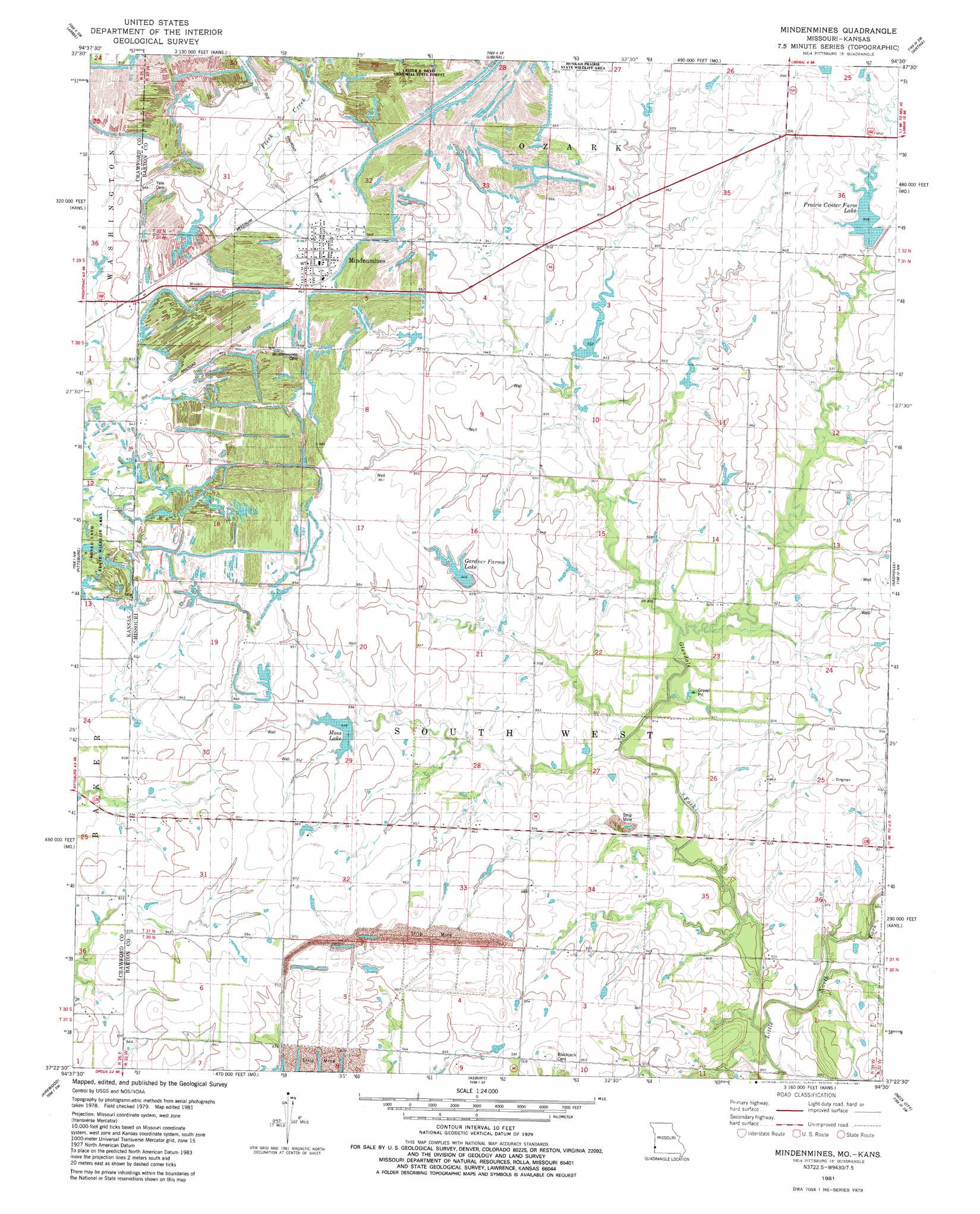
USGS Topo Quad 37094d5 - 1:24,000 scale
| Topo Map Name: | Mindenmines |
| USGS Topo Quad ID: | 37094d5 |
| Print Size: | ca. 21 1/4" wide x 27" high |
| Southeast Coordinates: | 37.375° N latitude / 94.5° W longitude |
| Map Center Coordinates: | 37.4375° N latitude / 94.5625° W longitude |
| U.S. States: | MO, KS |
| Filename: | o37094d5.jpg |
| Download Map JPG Image: | Mindenmines topo map 1:24,000 scale |
| Map Type: | Topographic |
| Topo Series: | 7.5´ |
| Map Scale: | 1:24,000 |
| Source of Map Images: | United States Geological Survey (USGS) |
| Alternate Map Versions: |
Mindenmines MO 1981, updated 1982 Download PDF Buy paper map Mindenmines MO 2010 Download PDF Buy paper map Mindenmines MO 2011 Download PDF Buy paper map Mindenmines MO 2015 Download PDF Buy paper map |
1:24,000 Topo Quads surrounding Mindenmines
Hiattville |
Cato |
Garland |
Bronaugh |
Sheldon |
Girard |
Arma |
Liberal |
Iantha |
Lamar North |
Radley |
Pittsburg |
Mindenmines |
Nashville |
Lamar South |
Cherokee |
Kirkwood |
Asbury |
Neck City |
Jasper |
Columbus |
Crestline |
Carl Junction |
Webb City |
Carthage |
> Back to 37094a1 at 1:100,000 scale
> Back to 37094a1 at 1:250,000 scale
> Back to U.S. Topo Maps home
Mindenmines topo map: Gazetteer
Mindenmines: Dams
Gardner Farms Lake Dam elevation 288m 944′Moss Lake Dam elevation 284m 931′
Prairie Center Farm Dam elevation 293m 961′
Mindenmines: Populated Places
Mindenmines elevation 293m 961′Mindenmines: Post Offices
Mindenmines Post Office elevation 296m 971′Mindenmines: Reservoirs
Finley Lake elevation 293m 961′Gardner Farms Lake elevation 289m 948′
John Gardner Lake elevation 288m 944′
Moss Lake elevation 285m 935′
Number 180 Reservoir elevation 284m 931′
Prairie Center Farm Lake elevation 293m 961′
Mindenmines: Streams
Glendale Fork elevation 271m 889′Mindenmines digital topo map on disk
Buy this Mindenmines topo map showing relief, roads, GPS coordinates and other geographical features, as a high-resolution digital map file on DVD: