Grindstone Creek Topo Map Kansas
To zoom in, hover over the map of Grindstone Creek
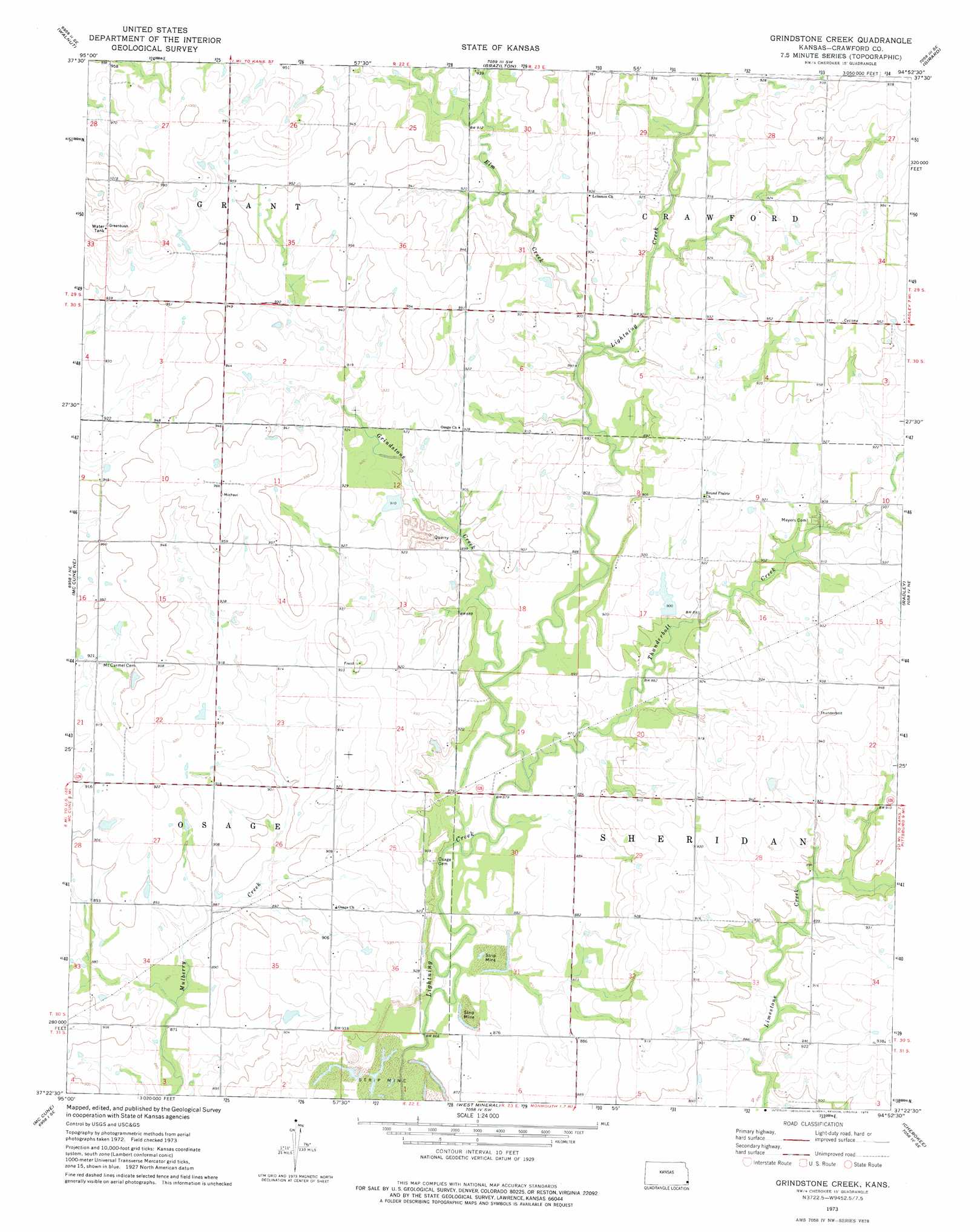
USGS Topo Quad 37094d8 - 1:24,000 scale
| Topo Map Name: | Grindstone Creek |
| USGS Topo Quad ID: | 37094d8 |
| Print Size: | ca. 21 1/4" wide x 27" high |
| Southeast Coordinates: | 37.375° N latitude / 94.875° W longitude |
| Map Center Coordinates: | 37.4375° N latitude / 94.9375° W longitude |
| U.S. State: | KS |
| Filename: | o37094d8.jpg |
| Download Map JPG Image: | Grindstone Creek topo map 1:24,000 scale |
| Map Type: | Topographic |
| Topo Series: | 7.5´ |
| Map Scale: | 1:24,000 |
| Source of Map Images: | United States Geological Survey (USGS) |
| Alternate Map Versions: |
Grindstone Creek KS 1973, updated 1975 Download PDF Buy paper map Grindstone Creek KS 2010 Download PDF Buy paper map Grindstone Creek KS 2012 Download PDF Buy paper map Grindstone Creek KS 2015 Download PDF Buy paper map |
1:24,000 Topo Quads surrounding Grindstone Creek
Stark |
Porterville |
Hepler |
Hiattville |
Cato |
Erie |
Walnut |
Brazilton |
Girard |
Arma |
South Mound |
Mccune Ne |
Grindstone Creek |
Radley |
Pittsburg |
Parsons East |
Mccune |
West Mineral |
Cherokee |
Kirkwood |
Labette |
Oswego |
Hallowell |
Columbus |
Crestline |
> Back to 37094a1 at 1:100,000 scale
> Back to 37094a1 at 1:250,000 scale
> Back to U.S. Topo Maps home
Grindstone Creek topo map: Gazetteer
Grindstone Creek: Streams
Elm Creek elevation 268m 879′Grindstone Creek elevation 263m 862′
Thunderbolt Creek elevation 264m 866′
Grindstone Creek digital topo map on disk
Buy this Grindstone Creek topo map showing relief, roads, GPS coordinates and other geographical features, as a high-resolution digital map file on DVD: