Sheldon Topo Map Missouri
To zoom in, hover over the map of Sheldon
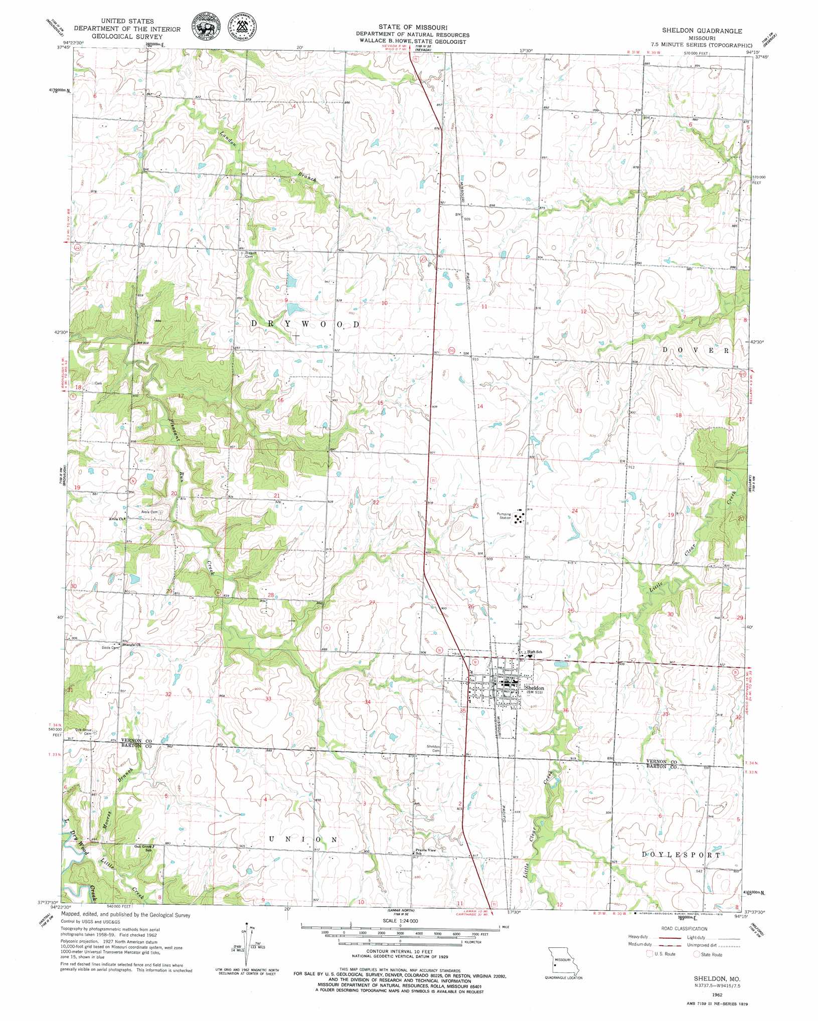
USGS Topo Quad 37094f3 - 1:24,000 scale
| Topo Map Name: | Sheldon |
| USGS Topo Quad ID: | 37094f3 |
| Print Size: | ca. 21 1/4" wide x 27" high |
| Southeast Coordinates: | 37.625° N latitude / 94.25° W longitude |
| Map Center Coordinates: | 37.6875° N latitude / 94.3125° W longitude |
| U.S. State: | MO |
| Filename: | o37094f3.jpg |
| Download Map JPG Image: | Sheldon topo map 1:24,000 scale |
| Map Type: | Topographic |
| Topo Series: | 7.5´ |
| Map Scale: | 1:24,000 |
| Source of Map Images: | United States Geological Survey (USGS) |
| Alternate Map Versions: |
Sheldon MO 1962, updated 1963 Download PDF Buy paper map Sheldon MO 1962, updated 1979 Download PDF Buy paper map Sheldon MO 2011 Download PDF Buy paper map Sheldon MO 2015 Download PDF Buy paper map |
1:24,000 Topo Quads surrounding Sheldon
Richards |
Metz |
Horton |
Harwood |
Eldorado Springs North |
Deerfield |
Moundville |
Nevada |
Dederick |
Eldorado Springs South |
Garland |
Bronaugh |
Sheldon |
Bellamy |
Montevallo |
Liberal |
Iantha |
Lamar North |
Milford |
Jerico Springs |
Mindenmines |
Nashville |
Lamar South |
Kenoma |
Golden City |
> Back to 37094e1 at 1:100,000 scale
> Back to 37094a1 at 1:250,000 scale
> Back to U.S. Topo Maps home
Sheldon topo map: Gazetteer
Sheldon: Populated Places
Sheldon elevation 281m 921′Sheldon: Streams
Little Creek elevation 250m 820′Moores Branch elevation 250m 820′
Sheldon digital topo map on disk
Buy this Sheldon topo map showing relief, roads, GPS coordinates and other geographical features, as a high-resolution digital map file on DVD: