Horton Topo Map Missouri
To zoom in, hover over the map of Horton
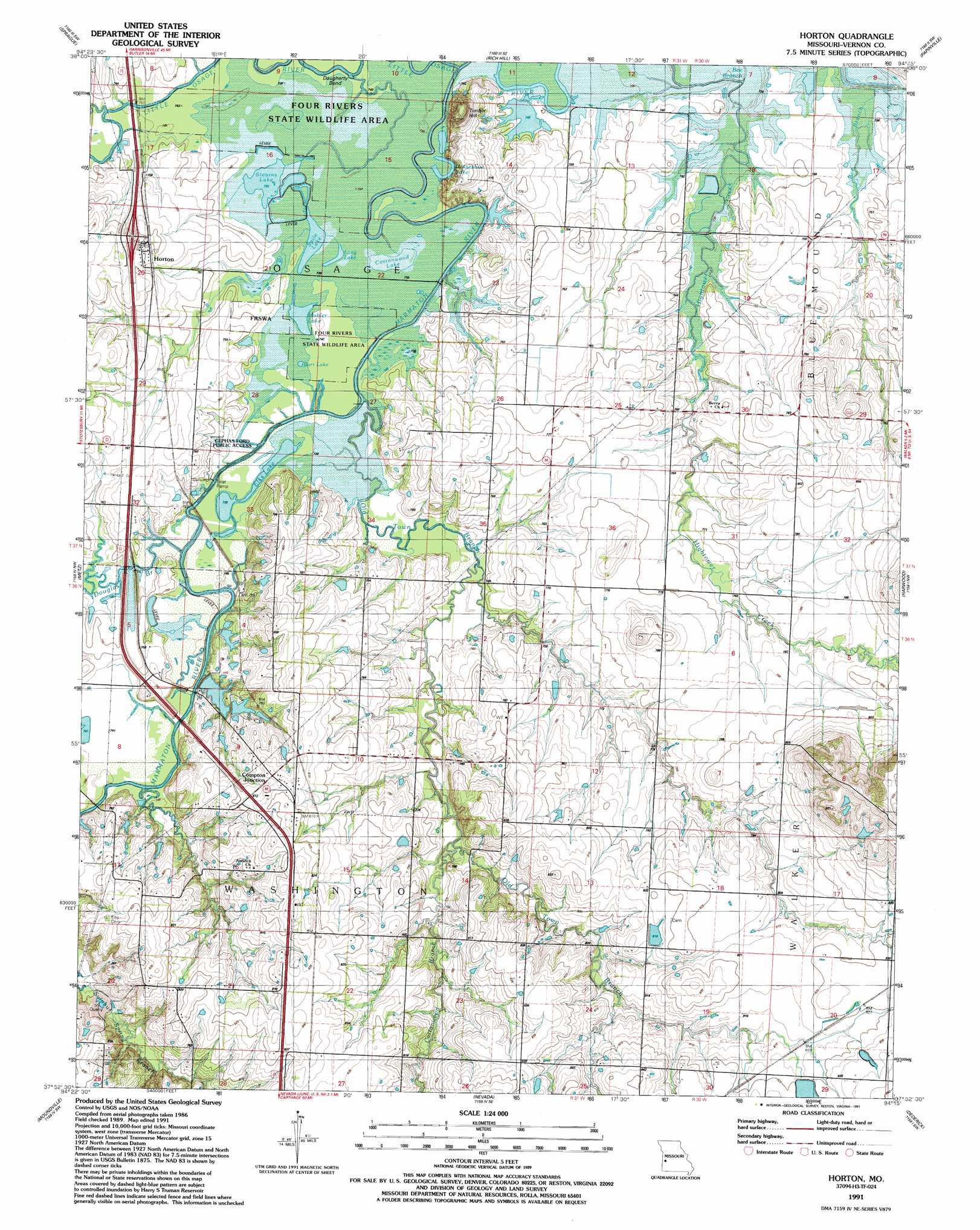
USGS Topo Quad 37094h3 - 1:24,000 scale
| Topo Map Name: | Horton |
| USGS Topo Quad ID: | 37094h3 |
| Print Size: | ca. 21 1/4" wide x 27" high |
| Southeast Coordinates: | 37.875° N latitude / 94.25° W longitude |
| Map Center Coordinates: | 37.9375° N latitude / 94.3125° W longitude |
| U.S. State: | MO |
| Filename: | o37094h3.jpg |
| Download Map JPG Image: | Horton topo map 1:24,000 scale |
| Map Type: | Topographic |
| Topo Series: | 7.5´ |
| Map Scale: | 1:24,000 |
| Source of Map Images: | United States Geological Survey (USGS) |
| Alternate Map Versions: |
Horton MO 1938, updated 1966 Download PDF Buy paper map Horton MO 1938, updated 1977 Download PDF Buy paper map Horton MO 1939 Download PDF Buy paper map Horton MO 1991, updated 1991 Download PDF Buy paper map Horton MO 2011 Download PDF Buy paper map Horton MO 2015 Download PDF Buy paper map |
1:24,000 Topo Quads surrounding Horton
Worland |
New Home |
Butler & Vic |
Pleasant Gap |
Appleton City |
Hume |
Sprague |
Rich Hill |
Papinsville |
Rockville |
Richards |
Metz |
Horton |
Harwood |
Eldorado Springs North |
Deerfield |
Moundville |
Nevada |
Dederick |
Eldorado Springs South |
Garland |
Bronaugh |
Sheldon |
Bellamy |
Montevallo |
> Back to 37094e1 at 1:100,000 scale
> Back to 37094a1 at 1:250,000 scale
> Back to U.S. Topo Maps home
Horton topo map: Gazetteer
Horton: Dams
Long Lower Lake Dam elevation 223m 731′Long Upper Lake Dam elevation 233m 764′
Timber Hill River Bend Incorporated Dam elevation 227m 744′
Horton: Lakes
Burr Lake elevation 226m 741′Cottonwood Lake elevation 224m 734′
Elks Lake elevation 226m 741′
Horseshoe Lake elevation 225m 738′
Hubler Lake elevation 225m 738′
Long Lake elevation 225m 738′
Marshall Cummins Pond (historical) elevation 240m 787′
New Pence Lake elevation 226m 741′
Old Pence Lake elevation 226m 741′
Spile Lake elevation 224m 734′
Stearns Lake elevation 224m 734′
Horton: Parks
Cephas Ford Public Access elevation 227m 744′Horton: Populated Places
Horton elevation 233m 764′Ketterman elevation 232m 761′
Horton: Reservoirs
Irrigation Lake elevation 227m 744′McDowell Lake elevation 223m 731′
Horton: Streams
Cottonwood Branch elevation 231m 757′Douglas Branch elevation 223m 731′
East Fork Bee Branch elevation 223m 731′
Marmaton River elevation 223m 731′
Old Town Branch elevation 223m 731′
Horton: Summits
Timber Hill elevation 262m 859′Horton digital topo map on disk
Buy this Horton topo map showing relief, roads, GPS coordinates and other geographical features, as a high-resolution digital map file on DVD: