Xenia Topo Map Kansas
To zoom in, hover over the map of Xenia
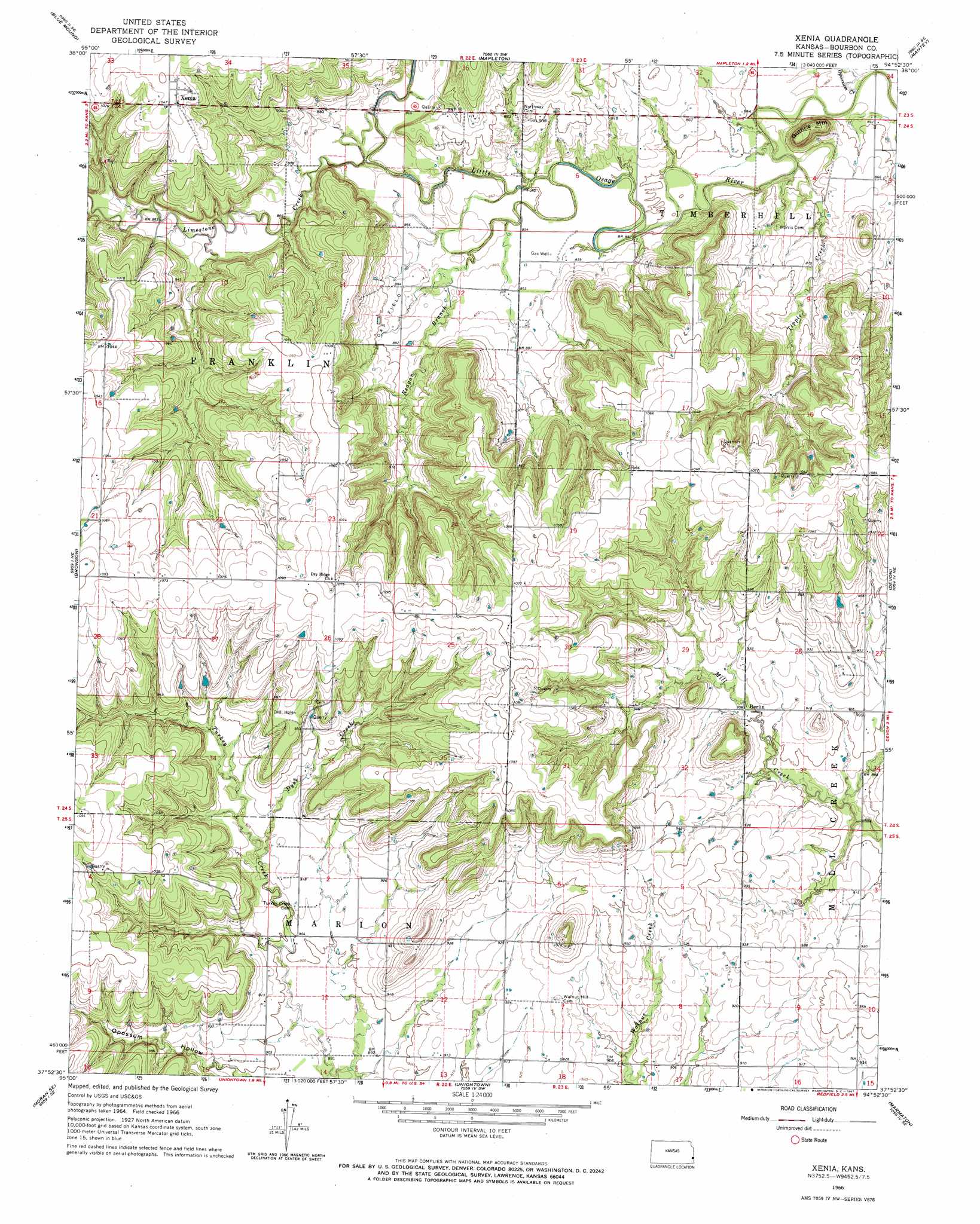
USGS Topo Quad 37094h8 - 1:24,000 scale
| Topo Map Name: | Xenia |
| USGS Topo Quad ID: | 37094h8 |
| Print Size: | ca. 21 1/4" wide x 27" high |
| Southeast Coordinates: | 37.875° N latitude / 94.875° W longitude |
| Map Center Coordinates: | 37.9375° N latitude / 94.9375° W longitude |
| U.S. State: | KS |
| Filename: | o37094h8.jpg |
| Download Map JPG Image: | Xenia topo map 1:24,000 scale |
| Map Type: | Topographic |
| Topo Series: | 7.5´ |
| Map Scale: | 1:24,000 |
| Source of Map Images: | United States Geological Survey (USGS) |
| Alternate Map Versions: |
Xenia KS 1966, updated 1967 Download PDF Buy paper map Xenia KS 2009 Download PDF Buy paper map Xenia KS 2012 Download PDF Buy paper map Xenia KS 2015 Download PDF Buy paper map |
1:24,000 Topo Quads surrounding Xenia
Bush City |
Centerville |
Mound City Nw |
Mound City |
Pleasanton |
Kincaid |
Blue Mound |
Mapleton |
Mantey |
Prescott |
Moran |
Bronson |
Xenia |
Devon |
Hammond |
Elsmore |
Moran Se |
Uniontown |
Marmaton |
Fort Scott |
Stark |
Porterville |
Hepler |
Hiattville |
Cato |
> Back to 37094e1 at 1:100,000 scale
> Back to 37094a1 at 1:250,000 scale
> Back to U.S. Topo Maps home
Xenia topo map: Gazetteer
Xenia: Populated Places
Berlin elevation 277m 908′Xenia elevation 317m 1040′
Xenia: Streams
Dyer Creek elevation 276m 905′Limestone Creek elevation 263m 862′
Opossum Creek elevation 253m 830′
Reagan Branch elevation 259m 849′
Tippie Creek elevation 253m 830′
Xenia: Summits
Guthrie Mountain elevation 309m 1013′Xenia digital topo map on disk
Buy this Xenia topo map showing relief, roads, GPS coordinates and other geographical features, as a high-resolution digital map file on DVD: