Bartlett Topo Map Kansas
To zoom in, hover over the map of Bartlett
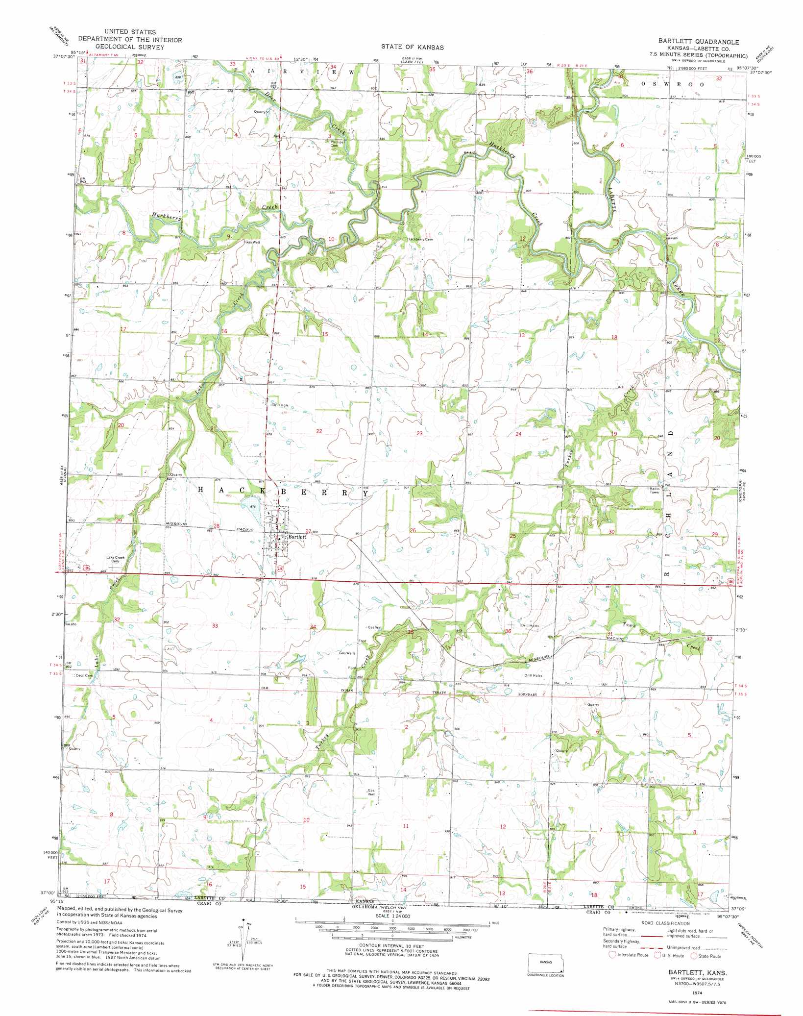
USGS Topo Quad 37095a2 - 1:24,000 scale
| Topo Map Name: | Bartlett |
| USGS Topo Quad ID: | 37095a2 |
| Print Size: | ca. 21 1/4" wide x 27" high |
| Southeast Coordinates: | 37° N latitude / 95.125° W longitude |
| Map Center Coordinates: | 37.0625° N latitude / 95.1875° W longitude |
| U.S. State: | KS |
| Filename: | o37095a2.jpg |
| Download Map JPG Image: | Bartlett topo map 1:24,000 scale |
| Map Type: | Topographic |
| Topo Series: | 7.5´ |
| Map Scale: | 1:24,000 |
| Source of Map Images: | United States Geological Survey (USGS) |
| Alternate Map Versions: |
Bartlett KS 1974, updated 1975 Download PDF Buy paper map Bartlett KS 2010 Download PDF Buy paper map Bartlett KS 2012 Download PDF Buy paper map Bartlett KS 2015 Download PDF Buy paper map |
1:24,000 Topo Quads surrounding Bartlett
Dennis |
Parsons West |
Parsons East |
Mccune |
West Mineral |
Mound Valley |
Altamont |
Labette |
Oswego |
Hallowell |
Valeda |
Edna |
Bartlett |
Chetopa |
Melrose |
Hayrick Mound |
Hollow |
Welch Nw |
Welch North |
Miami Nw |
Sanders |
Centralia |
Pyramid Corners |
Welch South |
Miami Sw |
> Back to 37095a1 at 1:100,000 scale
> Back to 37094a1 at 1:250,000 scale
> Back to U.S. Topo Maps home
Bartlett topo map: Gazetteer
Bartlett: Cliffs
Big Hill elevation 268m 879′Bartlett: Dams
Bartlett Dam elevation 266m 872′Bartlett: Populated Places
Bartlett elevation 272m 892′Bartlett: Streams
Deer Creek elevation 243m 797′Hackberry Creek elevation 241m 790′
Lake Creek elevation 243m 797′
Turkey Creek elevation 241m 790′
Bartlett digital topo map on disk
Buy this Bartlett topo map showing relief, roads, GPS coordinates and other geographical features, as a high-resolution digital map file on DVD: