Altoona Topo Map Kansas
To zoom in, hover over the map of Altoona
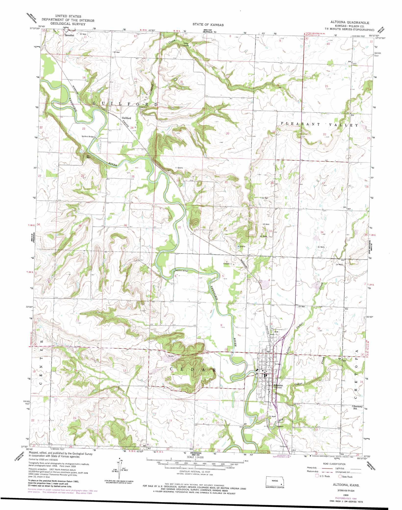
USGS Topo Quad 37095e6 - 1:24,000 scale
| Topo Map Name: | Altoona |
| USGS Topo Quad ID: | 37095e6 |
| Print Size: | ca. 21 1/4" wide x 27" high |
| Southeast Coordinates: | 37.5° N latitude / 95.625° W longitude |
| Map Center Coordinates: | 37.5625° N latitude / 95.6875° W longitude |
| U.S. State: | KS |
| Filename: | o37095e6.jpg |
| Download Map JPG Image: | Altoona topo map 1:24,000 scale |
| Map Type: | Topographic |
| Topo Series: | 7.5´ |
| Map Scale: | 1:24,000 |
| Source of Map Images: | United States Geological Survey (USGS) |
| Alternate Map Versions: |
Altoona KS 1959, updated 1960 Download PDF Buy paper map Altoona KS 1959, updated 1977 Download PDF Buy paper map Altoona KS 1959, updated 1984 Download PDF Buy paper map Altoona KS 2010 Download PDF Buy paper map Altoona KS 2012 Download PDF Buy paper map Altoona KS 2015 Download PDF Buy paper map |
1:24,000 Topo Quads surrounding Altoona
Toronto |
Toronto Se |
Rose |
Yates Center Se |
Humboldt |
Coyville |
Middletown |
Buffalo |
Vilas |
Chanute |
New Albany |
Fredonia |
Altoona |
Five Mounds |
Earlton |
Buxton |
Lafontaine |
Neodesha |
Morehead |
Thayer |
Elk City |
Table Mound |
Sycamore |
Cherryvale |
Dennis |
> Back to 37095e1 at 1:100,000 scale
> Back to 37094a1 at 1:250,000 scale
> Back to U.S. Topo Maps home
Altoona topo map: Gazetteer
Altoona: Bridges
Barnhill Bridge elevation 247m 810′Guilford Bridge elevation 249m 816′
Altoona: Populated Places
Altoona elevation 253m 830′Guilford elevation 257m 843′
Altoona: Streams
Big Cedar Creek elevation 241m 790′Crooked Creek elevation 249m 816′
Little Cedar Creek elevation 243m 797′
Altoona digital topo map on disk
Buy this Altoona topo map showing relief, roads, GPS coordinates and other geographical features, as a high-resolution digital map file on DVD: