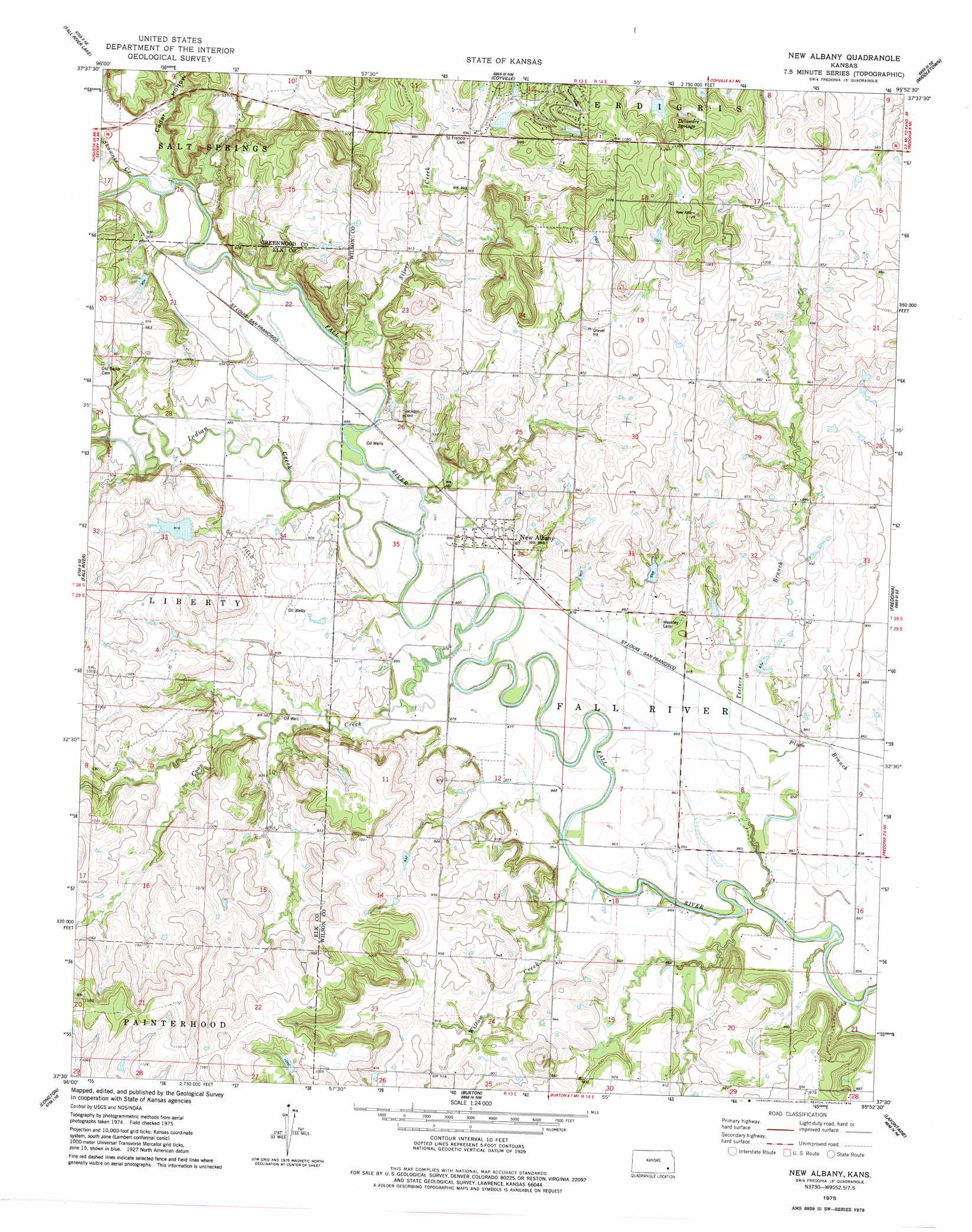
New Albany Topo Map Kansas
To zoom in, hover over the map of New Albany
USGS Topo Quad 37095e8 - 1:24,000 scale
| Topo Map Name: | New Albany |
| USGS Topo Quad ID: | 37095e8 |
| Print Size: | ca. 21 1/4" wide x 27" high |
| Southeast Coordinates: | 37.5° N latitude / 95.875° W longitude |
| Map Center Coordinates: | 37.5625° N latitude / 95.9375° W longitude |
| U.S. State: | KS |
| Filename: | o37095e8.jpg |
| Download Map JPG Image: | New Albany topo map 1:24,000 scale |
| Map Type: | Topographic |
| Topo Series: | 7.5´ |
| Map Scale: | 1:24,000 |
| Source of Map Images: | United States Geological Survey (USGS) |
| Alternate Map Versions: |
New Albany KS 1975, updated 1978 Download PDF Buy paper map New Albany KS 2010 Download PDF Buy paper map New Albany KS 2012 Download PDF Buy paper map New Albany KS 2015 Download PDF Buy paper map |
1:24,000 Topo Quads surrounding New Albany
Tonovay |
Neal |
Toronto |
Toronto Se |
Rose |
Severy North |
Fall River Lake |
Coyville |
Middletown |
Buffalo |
Severy South |
Fall River |
New Albany |
Fredonia |
Altoona |
Longton Nw |
Longton |
Buxton |
Lafontaine |
Neodesha |
Elk Falls |
Oak Valley |
Elk City |
Table Mound |
Sycamore |
> Back to 37095e1 at 1:100,000 scale
> Back to 37094a1 at 1:250,000 scale
> Back to U.S. Topo Maps home
New Albany topo map: Gazetteer
New Albany: Airports
Lakeside Airport elevation 318m 1043′New Albany: Populated Places
New Albany elevation 272m 892′New Albany: Springs
Delaware Springs elevation 319m 1046′New Albany: Streams
Coon Creek elevation 264m 866′Indian Creek elevation 265m 869′
Shawnee Creek elevation 267m 875′
Silver Creek elevation 268m 879′
Teeters Branch elevation 262m 859′
Willow Creek elevation 260m 853′
New Albany: Valleys
Cedar Hollow elevation 276m 905′New Albany digital topo map on disk
Buy this New Albany topo map showing relief, roads, GPS coordinates and other geographical features, as a high-resolution digital map file on DVD: