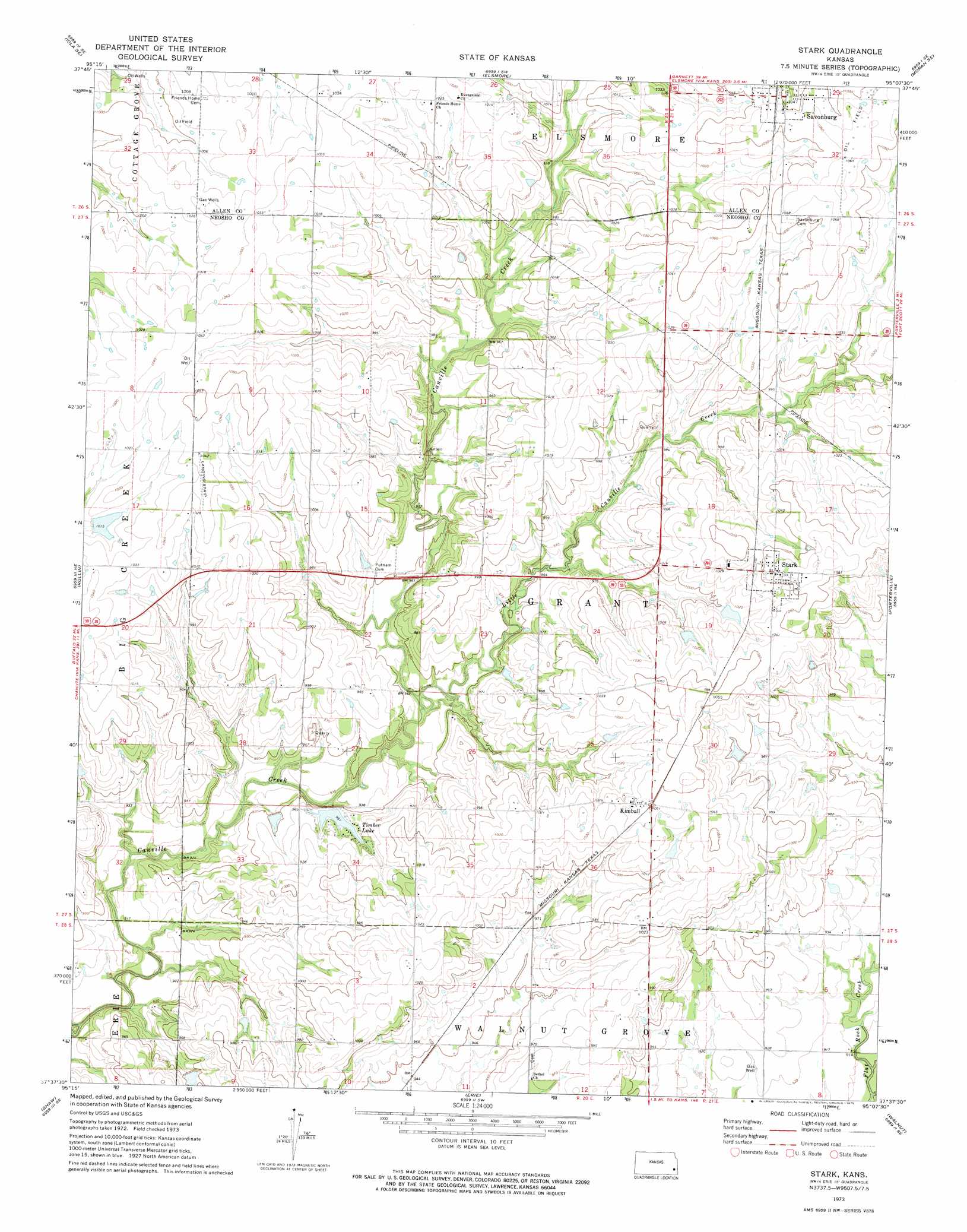
Stark Topo Map Kansas
To zoom in, hover over the map of Stark
USGS Topo Quad 37095f2 - 1:24,000 scale
| Topo Map Name: | Stark |
| USGS Topo Quad ID: | 37095f2 |
| Print Size: | ca. 21 1/4" wide x 27" high |
| Southeast Coordinates: | 37.625° N latitude / 95.125° W longitude |
| Map Center Coordinates: | 37.6875° N latitude / 95.1875° W longitude |
| U.S. State: | KS |
| Filename: | o37095f2.jpg |
| Download Map JPG Image: | Stark topo map 1:24,000 scale |
| Map Type: | Topographic |
| Topo Series: | 7.5´ |
| Map Scale: | 1:24,000 |
| Source of Map Images: | United States Geological Survey (USGS) |
| Alternate Map Versions: |
Stark KS 1973, updated 1975 Download PDF Buy paper map Stark KS 2009 Download PDF Buy paper map Stark KS 2012 Download PDF Buy paper map Stark KS 2015 Download PDF Buy paper map |
1:24,000 Topo Quads surrounding Stark
Iola |
La Harpe |
Moran |
Bronson |
Xenia |
Humboldt |
Iola Se |
Elsmore |
Moran Se |
Uniontown |
Chanute |
Rollin |
Stark |
Porterville |
Hepler |
Earlton |
Shaw |
Erie |
Walnut |
Brazilton |
Thayer |
Galesburg |
South Mound |
Mccune Ne |
Grindstone Creek |
> Back to 37095e1 at 1:100,000 scale
> Back to 37094a1 at 1:250,000 scale
> Back to U.S. Topo Maps home
Stark topo map: Gazetteer
Stark: Airports
Olson Field elevation 316m 1036′Stark: Populated Places
Kimball elevation 317m 1040′Savonburg elevation 321m 1053′
Stark elevation 324m 1062′
Stark: Reservoirs
Timber Lake elevation 292m 958′Stark: Streams
Little Canville Creek elevation 283m 928′Stark digital topo map on disk
Buy this Stark topo map showing relief, roads, GPS coordinates and other geographical features, as a high-resolution digital map file on DVD: