Cedar Vale East Topo Map Kansas
To zoom in, hover over the map of Cedar Vale East
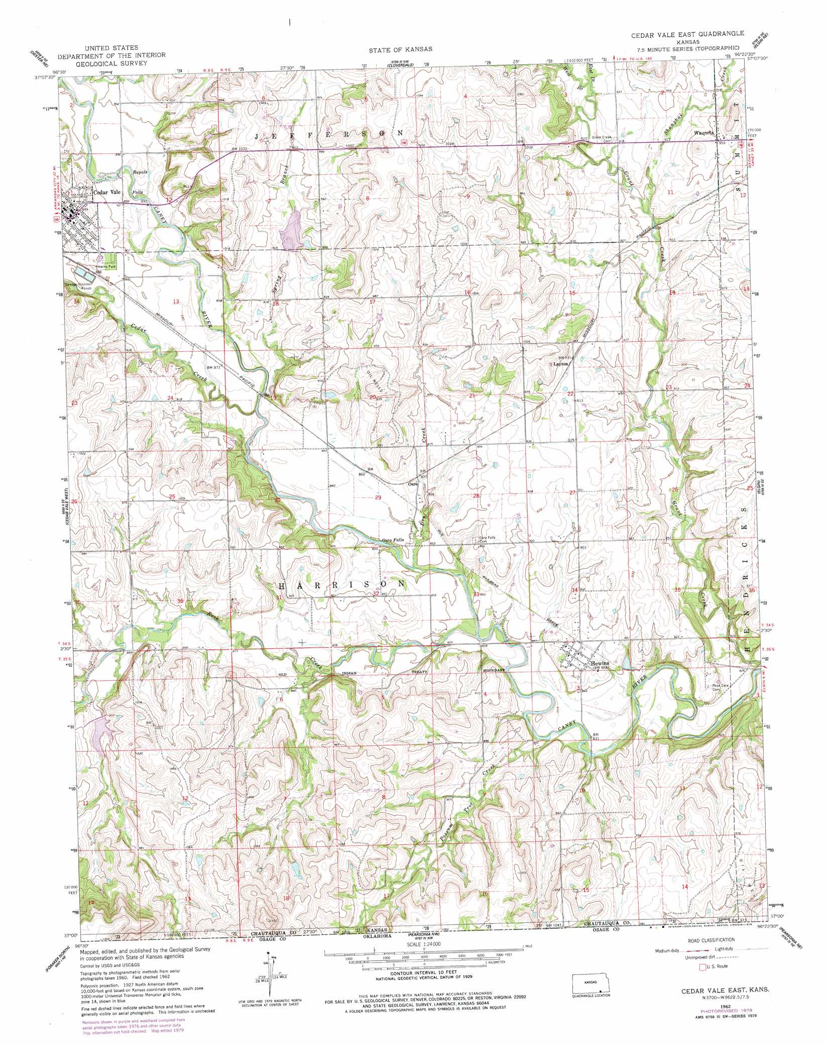
USGS Topo Quad 37096a4 - 1:24,000 scale
| Topo Map Name: | Cedar Vale East |
| USGS Topo Quad ID: | 37096a4 |
| Print Size: | ca. 21 1/4" wide x 27" high |
| Southeast Coordinates: | 37° N latitude / 96.375° W longitude |
| Map Center Coordinates: | 37.0625° N latitude / 96.4375° W longitude |
| U.S. State: | KS |
| Filename: | o37096a4.jpg |
| Download Map JPG Image: | Cedar Vale East topo map 1:24,000 scale |
| Map Type: | Topographic |
| Topo Series: | 7.5´ |
| Map Scale: | 1:24,000 |
| Source of Map Images: | United States Geological Survey (USGS) |
| Alternate Map Versions: |
Cedar Vale East KS 1962, updated 1963 Download PDF Buy paper map Cedar Vale East KS 1962, updated 1977 Download PDF Buy paper map Cedar Vale East KS 1962, updated 1979 Download PDF Buy paper map Cedar Vale East KS 2010 Download PDF Buy paper map Cedar Vale East KS 2012 Download PDF Buy paper map Cedar Vale East KS 2015 Download PDF Buy paper map |
1:24,000 Topo Quads surrounding Cedar Vale East
Cambridge |
Grand Summit |
Grenola |
Moline |
Elk Falls |
Dexter |
Dexter Ne |
Cloverdale |
Elgin Ne |
Sedan |
Dexter Sw |
Cedar Vale West |
Cedar Vale East |
Elgin |
Chautauqua |
Grainola |
Foraker North |
Pearsonia Nw |
Pearsonia Ne |
Whippoorwill |
Shidler |
Foraker South |
Pearsonia |
Nanos |
Herd |
> Back to 37096a1 at 1:100,000 scale
> Back to 37096a1 at 1:250,000 scale
> Back to U.S. Topo Maps home
Cedar Vale East topo map: Gazetteer
Cedar Vale East: Falls
Osro Falls elevation 256m 839′Cedar Vale East: Parks
Hewins Park elevation 277m 908′Cedar Vale East: Populated Places
Hewins elevation 270m 885′Layton elevation 284m 931′
Osro elevation 267m 875′
Wauneta elevation 292m 958′
Cedar Vale East: Streams
Cedar Creek elevation 259m 849′Dry Creek elevation 256m 839′
Possum Trot Creek elevation 250m 820′
Possum Trot Creek elevation 250m 820′
Rock Creek elevation 250m 820′
Shanghai Creek elevation 271m 889′
Spring Branch elevation 262m 859′
Cedar Vale East digital topo map on disk
Buy this Cedar Vale East topo map showing relief, roads, GPS coordinates and other geographical features, as a high-resolution digital map file on DVD: