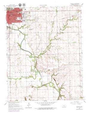
Winfield Topo Map Kansas
To zoom in, hover over the map of Winfield
USGS Topo Quad 37096b8 - 1:24,000 scale
| Topo Map Name: | Winfield |
| USGS Topo Quad ID: | 37096b8 |
| Print Size: | ca. 21 1/4" wide x 27" high |
| Southeast Coordinates: | 37.125° N latitude / 96.875° W longitude |
| Map Center Coordinates: | 37.1875° N latitude / 96.9375° W longitude |
| U.S. State: | KS |
| Filename: | o37096b8.jpg |
| Download Map JPG Image: | Winfield topo map 1:24,000 scale |
| Map Type: | Topographic |
| Topo Series: | 7.5´ |
| Map Scale: | 1:24,000 |
| Source of Map Images: | United States Geological Survey (USGS) |
| Alternate Map Versions: |
Winfield KS 1965, updated 1966 Download PDF Buy paper map Winfield KS 1965, updated 1979 Download PDF Buy paper map Winfield KS 2010 Download PDF Buy paper map Winfield KS 2012 Download PDF Buy paper map Winfield KS 2015 Download PDF Buy paper map |
1:24,000 Topo Quads surrounding Winfield
> Back to 37096a1 at 1:100,000 scale
> Back to 37096a1 at 1:250,000 scale
> Back to U.S. Topo Maps home
Winfield topo map: Gazetteer
Winfield: Crossings
McCollum Ford elevation 330m 1082′Winfield: Oilfields
Posey Oil Field elevation 351m 1151′Seacat Oil Field elevation 338m 1108′
Winfield Oil Field elevation 364m 1194′
Winfield South Oil Field elevation 364m 1194′
Winfield: Parks
Albright Park elevation 346m 1135′Island Park elevation 339m 1112′
Winfield: Populated Places
Winfield elevation 344m 1128′Winfield: Ranges
Cup and Saucer Hills elevation 361m 1184′Winfield: Streams
Big Badger Creek elevation 331m 1085′Black Crook Creek elevation 332m 1089′
East Badger Creek elevation 342m 1122′
Posey Creek elevation 329m 1079′
West Badger Creek elevation 341m 1118′
Winfield: Valleys
Baugh Canyon elevation 333m 1092′Redd Valley elevation 337m 1105′
Winfield digital topo map on disk
Buy this Winfield topo map showing relief, roads, GPS coordinates and other geographical features, as a high-resolution digital map file on DVD:


