Cambridge Topo Map Kansas
To zoom in, hover over the map of Cambridge
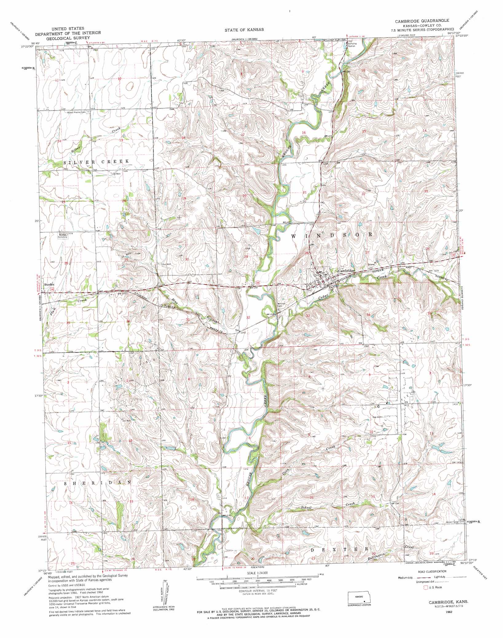
USGS Topo Quad 37096c6 - 1:24,000 scale
| Topo Map Name: | Cambridge |
| USGS Topo Quad ID: | 37096c6 |
| Print Size: | ca. 21 1/4" wide x 27" high |
| Southeast Coordinates: | 37.25° N latitude / 96.625° W longitude |
| Map Center Coordinates: | 37.3125° N latitude / 96.6875° W longitude |
| U.S. State: | KS |
| Filename: | o37096c6.jpg |
| Download Map JPG Image: | Cambridge topo map 1:24,000 scale |
| Map Type: | Topographic |
| Topo Series: | 7.5´ |
| Map Scale: | 1:24,000 |
| Source of Map Images: | United States Geological Survey (USGS) |
| Alternate Map Versions: |
Cambridge KS 1962, updated 1963 Download PDF Buy paper map Cambridge KS 2010 Download PDF Buy paper map Cambridge KS 2012 Download PDF Buy paper map Cambridge KS 2015 Download PDF Buy paper map |
1:24,000 Topo Quads surrounding Cambridge
Gordon |
Augusta Se |
Latham |
Latham Se |
Piedmont Sw |
Wilmot |
Atlanta |
Cambridge Nw |
Cambridge Ne |
Howard Nw |
New Salem |
Burden |
Cambridge |
Grand Summit |
Grenola |
Winfield |
Eaton |
Dexter |
Dexter Ne |
Cloverdale |
Silverdale |
Maple City |
Dexter Sw |
Cedar Vale West |
Cedar Vale East |
> Back to 37096a1 at 1:100,000 scale
> Back to 37096a1 at 1:250,000 scale
> Back to U.S. Topo Maps home
Cambridge topo map: Gazetteer
Cambridge: Populated Places
Cambridge elevation 382m 1253′Cambridge: Ranges
Flint Hills elevation 412m 1351′Cambridge: Streams
Blue Branch elevation 372m 1220′Cedar Creek elevation 373m 1223′
Coon Creek elevation 364m 1194′
School Creek elevation 365m 1197′
Cambridge digital topo map on disk
Buy this Cambridge topo map showing relief, roads, GPS coordinates and other geographical features, as a high-resolution digital map file on DVD: