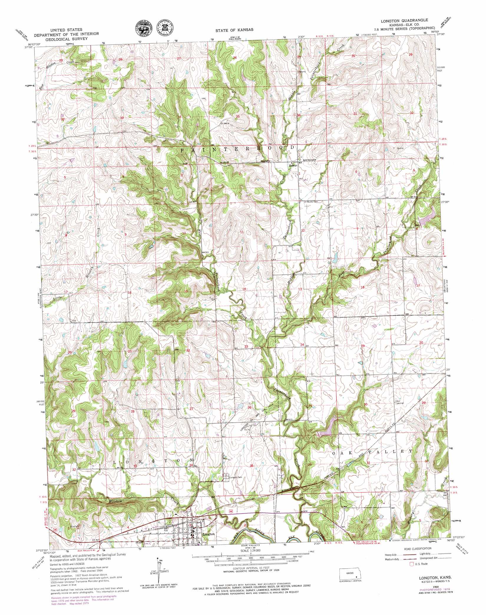
Longton Topo Map Kansas
To zoom in, hover over the map of Longton
USGS Topo Quad 37096d1 - 1:24,000 scale
| Topo Map Name: | Longton |
| USGS Topo Quad ID: | 37096d1 |
| Print Size: | ca. 21 1/4" wide x 27" high |
| Southeast Coordinates: | 37.375° N latitude / 96° W longitude |
| Map Center Coordinates: | 37.4375° N latitude / 96.0625° W longitude |
| U.S. State: | KS |
| Filename: | o37096d1.jpg |
| Download Map JPG Image: | Longton topo map 1:24,000 scale |
| Map Type: | Topographic |
| Topo Series: | 7.5´ |
| Map Scale: | 1:24,000 |
| Source of Map Images: | United States Geological Survey (USGS) |
| Alternate Map Versions: |
Longton KS 1964, updated 1965 Download PDF Buy paper map Longton KS 1964, updated 1979 Download PDF Buy paper map Longton KS 2010 Download PDF Buy paper map Longton KS 2012 Download PDF Buy paper map Longton KS 2015 Download PDF Buy paper map |
1:24,000 Topo Quads surrounding Longton
Piedmont Ne |
Severy North |
Fall River Lake |
Coyville |
Middletown |
Piedmont |
Severy South |
Fall River |
New Albany |
Fredonia |
Howard |
Longton Nw |
Longton |
Buxton |
Lafontaine |
Moline |
Elk Falls |
Oak Valley |
Elk City |
Table Mound |
Elgin Ne |
Sedan |
Hale |
Caney Nw |
Bolton |
> Back to 37096a1 at 1:100,000 scale
> Back to 37096a1 at 1:250,000 scale
> Back to U.S. Topo Maps home
Longton topo map: Gazetteer
Longton: Oilfields
Longton Oil and Gas Field elevation 274m 898′Longton: Populated Places
Busby elevation 287m 941′Longton elevation 281m 921′
Longton: Streams
East Painterhood Creek elevation 264m 866′Hitchen Creek elevation 259m 849′
Mid Painterhood Creek elevation 266m 872′
Painterhood Creek elevation 264m 866′
West Painterhood Creek elevation 264m 866′
Longton digital topo map on disk
Buy this Longton topo map showing relief, roads, GPS coordinates and other geographical features, as a high-resolution digital map file on DVD: