Atlanta Topo Map Kansas
To zoom in, hover over the map of Atlanta
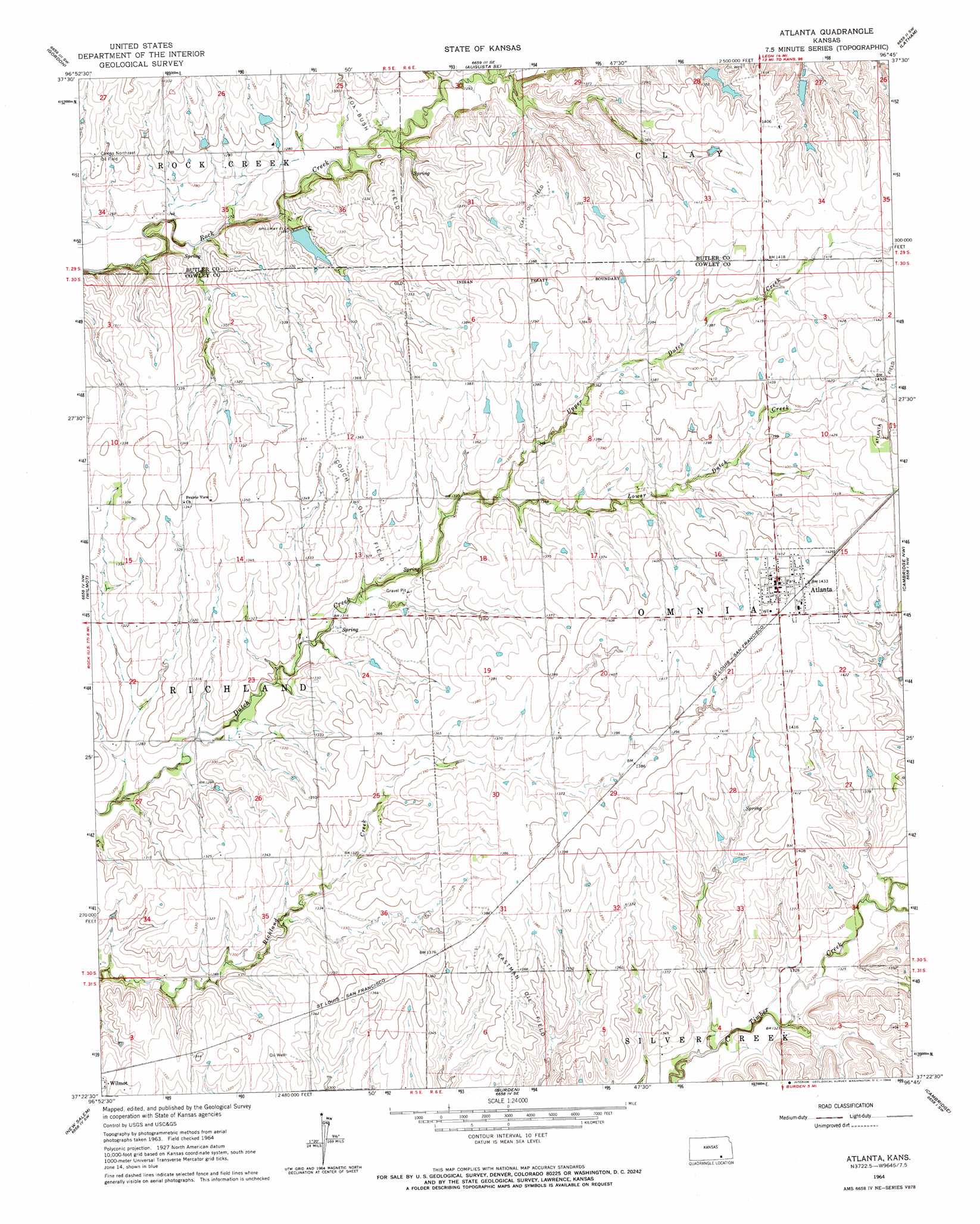
USGS Topo Quad 37096d7 - 1:24,000 scale
| Topo Map Name: | Atlanta |
| USGS Topo Quad ID: | 37096d7 |
| Print Size: | ca. 21 1/4" wide x 27" high |
| Southeast Coordinates: | 37.375° N latitude / 96.75° W longitude |
| Map Center Coordinates: | 37.4375° N latitude / 96.8125° W longitude |
| U.S. State: | KS |
| Filename: | o37096d7.jpg |
| Download Map JPG Image: | Atlanta topo map 1:24,000 scale |
| Map Type: | Topographic |
| Topo Series: | 7.5´ |
| Map Scale: | 1:24,000 |
| Source of Map Images: | United States Geological Survey (USGS) |
| Alternate Map Versions: |
Atlanta KS 1964, updated 1966 Download PDF Buy paper map Atlanta KS 2010 Download PDF Buy paper map Atlanta KS 2012 Download PDF Buy paper map Atlanta KS 2015 Download PDF Buy paper map |
1:24,000 Topo Quads surrounding Atlanta
Santa Fe Lake |
Augusta |
Leon |
Keighley |
Beaumont |
Douglass |
Gordon |
Augusta Se |
Latham |
Latham Se |
Udall |
Wilmot |
Atlanta |
Cambridge Nw |
Cambridge Ne |
Akron |
New Salem |
Burden |
Cambridge |
Grand Summit |
Hackney |
Winfield |
Eaton |
Dexter |
Dexter Ne |
> Back to 37096a1 at 1:100,000 scale
> Back to 37096a1 at 1:250,000 scale
> Back to U.S. Topo Maps home
Atlanta topo map: Gazetteer
Atlanta: Oilfields
Clay Oil Field elevation 423m 1387′Combs Northeast Oil Field elevation 395m 1295′
Couch Oil Field elevation 410m 1345′
Eastman Oil Field elevation 411m 1348′
Atlanta: Populated Places
Atlanta elevation 437m 1433′Atlanta: Streams
Lower Dutch Creek elevation 406m 1332′Upper Dutch Creek elevation 406m 1332′
Atlanta digital topo map on disk
Buy this Atlanta topo map showing relief, roads, GPS coordinates and other geographical features, as a high-resolution digital map file on DVD: