Piedmont Ne Topo Map Kansas
To zoom in, hover over the map of Piedmont Ne
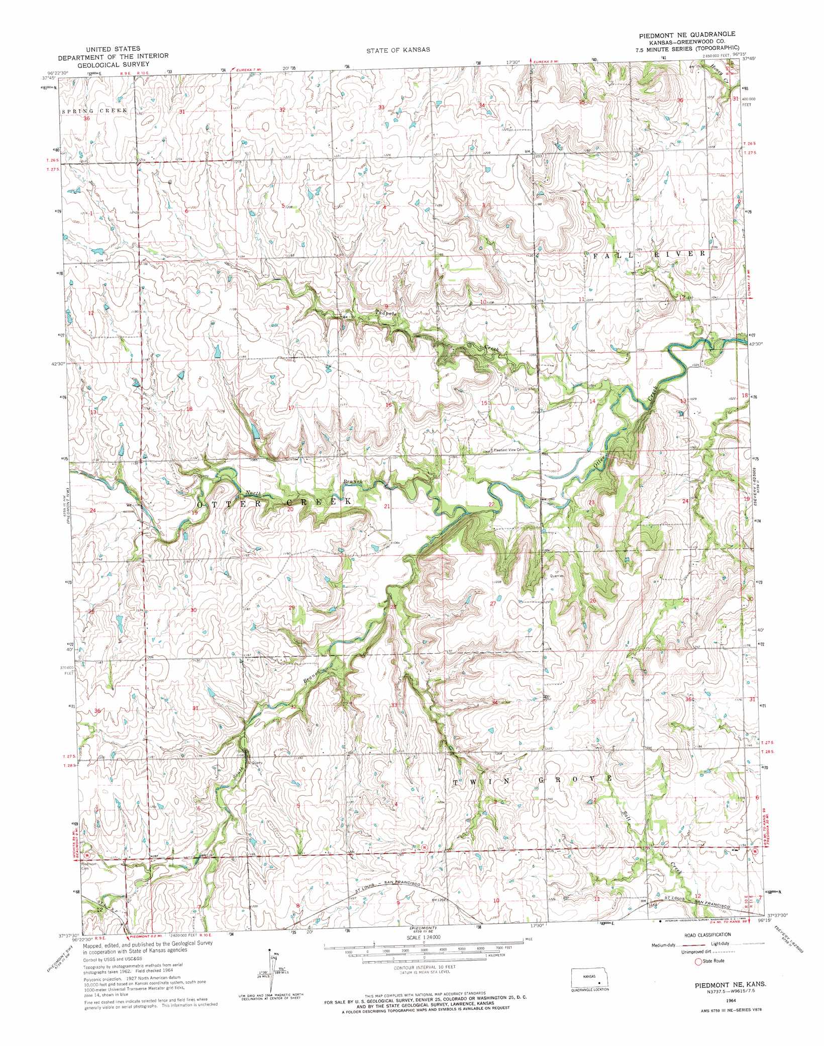
USGS Topo Quad 37096f3 - 1:24,000 scale
| Topo Map Name: | Piedmont Ne |
| USGS Topo Quad ID: | 37096f3 |
| Print Size: | ca. 21 1/4" wide x 27" high |
| Southeast Coordinates: | 37.625° N latitude / 96.25° W longitude |
| Map Center Coordinates: | 37.6875° N latitude / 96.3125° W longitude |
| U.S. State: | KS |
| Filename: | o37096f3.jpg |
| Download Map JPG Image: | Piedmont Ne topo map 1:24,000 scale |
| Map Type: | Topographic |
| Topo Series: | 7.5´ |
| Map Scale: | 1:24,000 |
| Source of Map Images: | United States Geological Survey (USGS) |
| Alternate Map Versions: |
Piedmont NE KS 1964, updated 1965 Download PDF Buy paper map Piedmont NE KS 2009 Download PDF Buy paper map Piedmont NE KS 2012 Download PDF Buy paper map Piedmont NE KS 2015 Download PDF Buy paper map |
1:24,000 Topo Quads surrounding Piedmont Ne
Rosalia Ne |
Lapland |
Eureka Ne |
Hamilton |
Virgil |
Rosalia |
Reece |
Eureka |
Tonovay |
Neal |
Beaumont |
Piedmont Nw |
Piedmont Ne |
Severy North |
Fall River Lake |
Latham Se |
Piedmont Sw |
Piedmont |
Severy South |
Fall River |
Cambridge Ne |
Howard Nw |
Howard |
Longton Nw |
Longton |
> Back to 37096e1 at 1:100,000 scale
> Back to 37096a1 at 1:250,000 scale
> Back to U.S. Topo Maps home
Piedmont Ne topo map: Gazetteer
Piedmont Ne: Airports
Stuber Ranch Airport elevation 385m 1263′Piedmont Ne: Streams
North Branch Otter Creek elevation 320m 1049′South Branch Otter Creek elevation 320m 1049′
Tadpole Creek elevation 311m 1020′
Piedmont Ne digital topo map on disk
Buy this Piedmont Ne topo map showing relief, roads, GPS coordinates and other geographical features, as a high-resolution digital map file on DVD: