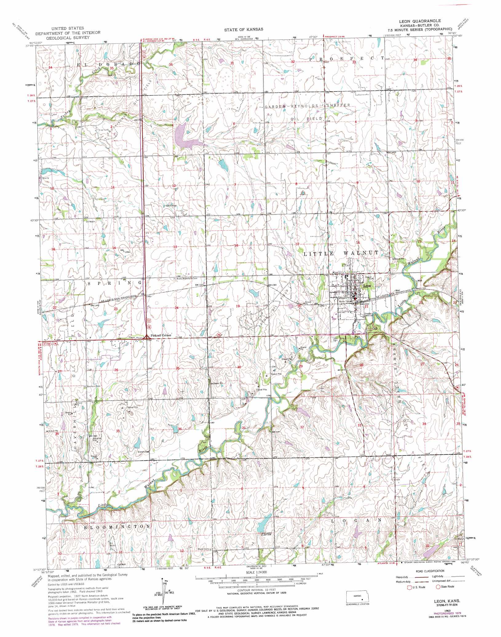
Leon Topo Map Kansas
To zoom in, hover over the map of Leon
USGS Topo Quad 37096f7 - 1:24,000 scale
| Topo Map Name: | Leon |
| USGS Topo Quad ID: | 37096f7 |
| Print Size: | ca. 21 1/4" wide x 27" high |
| Southeast Coordinates: | 37.625° N latitude / 96.75° W longitude |
| Map Center Coordinates: | 37.6875° N latitude / 96.8125° W longitude |
| U.S. State: | KS |
| Filename: | o37096f7.jpg |
| Download Map JPG Image: | Leon topo map 1:24,000 scale |
| Map Type: | Topographic |
| Topo Series: | 7.5´ |
| Map Scale: | 1:24,000 |
| Source of Map Images: | United States Geological Survey (USGS) |
| Alternate Map Versions: |
Leon KS 1963, updated 1964 Download PDF Buy paper map Leon KS 1963, updated 1979 Download PDF Buy paper map Leon KS 1963, updated 1986 Download PDF Buy paper map Leon KS 2009 Download PDF Buy paper map Leon KS 2012 Download PDF Buy paper map Leon KS 2015 Download PDF Buy paper map |
1:24,000 Topo Quads surrounding Leon
Potwin |
El Dorado Nw |
De Graff |
Rosalia Nw |
Rosalia Ne |
Benton |
El Dorado Sw |
El Dorado |
Pontiac |
Rosalia |
Santa Fe Lake |
Augusta |
Leon |
Keighley |
Beaumont |
Douglass |
Gordon |
Augusta Se |
Latham |
Latham Se |
Udall |
Wilmot |
Atlanta |
Cambridge Nw |
Cambridge Ne |
> Back to 37096e1 at 1:100,000 scale
> Back to 37096a1 at 1:250,000 scale
> Back to U.S. Topo Maps home
Leon topo map: Gazetteer
Leon: Oilfields
Garden-Reynolds-Shaffer Oil Field elevation 421m 1381′Haverhill Oil Field elevation 415m 1361′
Kramer-Stern Oil Field elevation 431m 1414′
Leon Oil Field elevation 420m 1377′
Smock-Sluss Oil Field elevation 399m 1309′
Leon: Populated Places
Leon elevation 412m 1351′Pickrell Corner elevation 412m 1351′
Leon digital topo map on disk
Buy this Leon topo map showing relief, roads, GPS coordinates and other geographical features, as a high-resolution digital map file on DVD: