De Graff Topo Map Kansas
To zoom in, hover over the map of De Graff
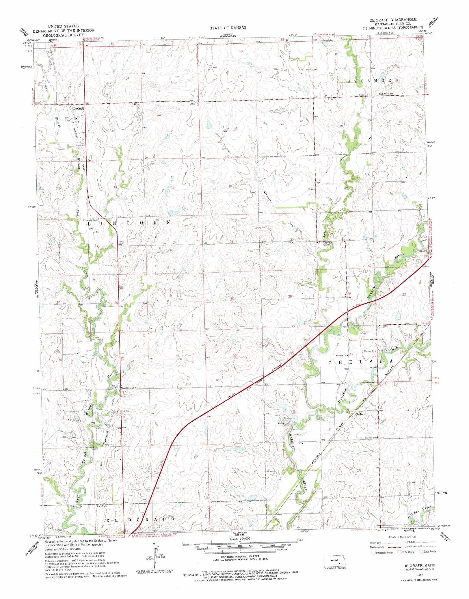
USGS Topo Quad 37096h7 - 1:24,000 scale
| Topo Map Name: | De Graff |
| USGS Topo Quad ID: | 37096h7 |
| Print Size: | ca. 21 1/4" wide x 27" high |
| Southeast Coordinates: | 37.875° N latitude / 96.75° W longitude |
| Map Center Coordinates: | 37.9375° N latitude / 96.8125° W longitude |
| U.S. State: | KS |
| Filename: | o37096h7.jpg |
| Download Map JPG Image: | De Graff topo map 1:24,000 scale |
| Map Type: | Topographic |
| Topo Series: | 7.5´ |
| Map Scale: | 1:24,000 |
| Source of Map Images: | United States Geological Survey (USGS) |
| Alternate Map Versions: |
De Graff KS 1961, updated 1962 Download PDF Buy paper map De Graff KS 1961, updated 1978 Download PDF Buy paper map De Graff KS 2010 Download PDF Buy paper map De Graff KS 2012 Download PDF Buy paper map De Graff KS 2015 Download PDF Buy paper map |
1:24,000 Topo Quads surrounding De Graff
Peabody |
Florence |
Wonsevu |
Homestead |
Matfield Green |
Peabody Se |
Burns |
Florence Se |
Cassoday |
Matfield Green Se |
Potwin |
El Dorado Nw |
De Graff |
Rosalia Nw |
Rosalia Ne |
Benton |
El Dorado Sw |
El Dorado |
Pontiac |
Rosalia |
Santa Fe Lake |
Augusta |
Leon |
Keighley |
Beaumont |
> Back to 37096e1 at 1:100,000 scale
> Back to 37096a1 at 1:250,000 scale
> Back to U.S. Topo Maps home
De Graff topo map: Gazetteer
De Graff: Populated Places
Chelsea elevation 404m 1325′De Graff elevation 427m 1400′
De Graff: Streams
Cole Creek elevation 402m 1318′Durechen Creek elevation 399m 1309′
Gilmore Branch elevation 407m 1335′
De Graff digital topo map on disk
Buy this De Graff topo map showing relief, roads, GPS coordinates and other geographical features, as a high-resolution digital map file on DVD: