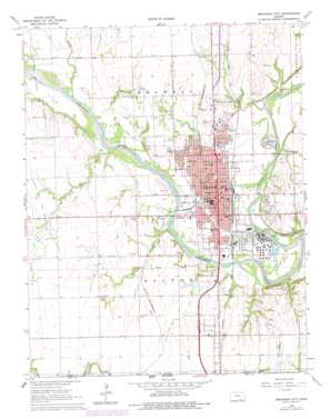
Arkansas City Topo Map Kansas
To zoom in, hover over the map of Arkansas City
USGS Topo Quad 37097a1 - 1:24,000 scale
| Topo Map Name: | Arkansas City |
| USGS Topo Quad ID: | 37097a1 |
| Print Size: | ca. 21 1/4" wide x 27" high |
| Southeast Coordinates: | 37° N latitude / 97° W longitude |
| Map Center Coordinates: | 37.0625° N latitude / 97.0625° W longitude |
| U.S. State: | KS |
| Filename: | o37097a1.jpg |
| Download Map JPG Image: | Arkansas City topo map 1:24,000 scale |
| Map Type: | Topographic |
| Topo Series: | 7.5´ |
| Map Scale: | 1:24,000 |
| Source of Map Images: | United States Geological Survey (USGS) |
| Alternate Map Versions: |
Arkansas City KS 1965, updated 1966 Download PDF Buy paper map Arkansas City KS 1965, updated 1979 Download PDF Buy paper map Arkansas City KS 2010 Download PDF Buy paper map Arkansas City KS 2012 Download PDF Buy paper map Arkansas City KS 2015 Download PDF Buy paper map |
1:24,000 Topo Quads surrounding Arkansas City
> Back to 37097a1 at 1:100,000 scale
> Back to 37096a1 at 1:250,000 scale
> Back to U.S. Topo Maps home
Arkansas City topo map: Gazetteer
Arkansas City: Airports
Haines Landing Field elevation 360m 1181′Arkansas City: Oilfields
Canfield Oil Field elevation 345m 1131′Geuda Springs Oil Field elevation 331m 1085′
Gibson Oil and Gas Field elevation 346m 1135′
Harvey Oil Field elevation 354m 1161′
McKay Oil Field elevation 348m 1141′
Negro Creek Oil Field elevation 329m 1079′
Arkansas City: Parks
Carver Park elevation 329m 1079′Greens Farm Park elevation 328m 1076′
Kaw Wildlife Area elevation 322m 1056′
Paris Park elevation 329m 1079′
Ranney Park elevation 329m 1079′
Spring Hill Park elevation 357m 1171′
Wilson Park elevation 332m 1089′
Arkansas City: Populated Places
Arkansas City elevation 341m 1118′Moxham elevation 355m 1164′
Arkansas City: Reservoirs
Lake Louise elevation 329m 1079′Arkansas City: Streams
Negro Creek elevation 326m 1069′Spring Creek elevation 322m 1056′
Spring Creek elevation 326m 1069′
Spring Creek elevation 327m 1072′
Walnut River elevation 318m 1043′
Arkansas City digital topo map on disk
Buy this Arkansas City topo map showing relief, roads, GPS coordinates and other geographical features, as a high-resolution digital map file on DVD:


