Geuda Springs Topo Map Kansas
To zoom in, hover over the map of Geuda Springs
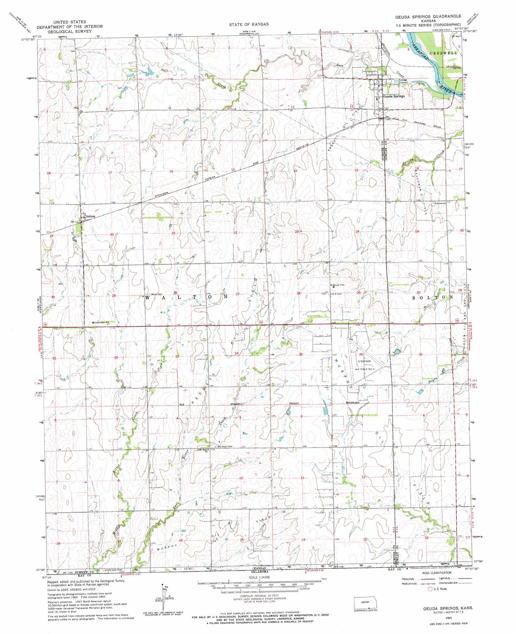
USGS Topo Quad 37097a2 - 1:24,000 scale
| Topo Map Name: | Geuda Springs |
| USGS Topo Quad ID: | 37097a2 |
| Print Size: | ca. 21 1/4" wide x 27" high |
| Southeast Coordinates: | 37° N latitude / 97.125° W longitude |
| Map Center Coordinates: | 37.0625° N latitude / 97.1875° W longitude |
| U.S. State: | KS |
| Filename: | o37097a2.jpg |
| Download Map JPG Image: | Geuda Springs topo map 1:24,000 scale |
| Map Type: | Topographic |
| Topo Series: | 7.5´ |
| Map Scale: | 1:24,000 |
| Source of Map Images: | United States Geological Survey (USGS) |
| Alternate Map Versions: |
Geuda Springs KS 1965, updated 1966 Download PDF Buy paper map Geuda Springs KS 2010 Download PDF Buy paper map Geuda Springs KS 2012 Download PDF Buy paper map Geuda Springs KS 2015 Download PDF Buy paper map |
1:24,000 Topo Quads surrounding Geuda Springs
Wellington |
Dalton |
Oxford |
Akron |
New Salem |
Rome |
South Haven Ne |
Adamsville |
Hackney |
Winfield |
South Haven |
Portland |
Geuda Springs |
Arkansas City |
Silverdale |
Blackwell Nw |
Braman |
Peckham |
Newkirk |
Kaw City Nw |
Nardin |
Blackwell |
Newkirk Sw |
Kildare |
Uncas |
> Back to 37097a1 at 1:100,000 scale
> Back to 37096a1 at 1:250,000 scale
> Back to U.S. Topo Maps home
Geuda Springs topo map: Gazetteer
Geuda Springs: Airports
Strother Air Field Number Two elevation 377m 1236′Geuda Springs: Oilfields
Murphy Oil Field elevation 368m 1207′Padgett Oil Field elevation 367m 1204′
Rauckman Oil Field elevation 344m 1128′
Geuda Springs: Populated Places
Ashton elevation 370m 1213′Geuda Springs elevation 339m 1112′
Geuda Springs: Streams
Salt Creek elevation 329m 1079′Geuda Springs digital topo map on disk
Buy this Geuda Springs topo map showing relief, roads, GPS coordinates and other geographical features, as a high-resolution digital map file on DVD: