Hackney Topo Map Kansas
To zoom in, hover over the map of Hackney
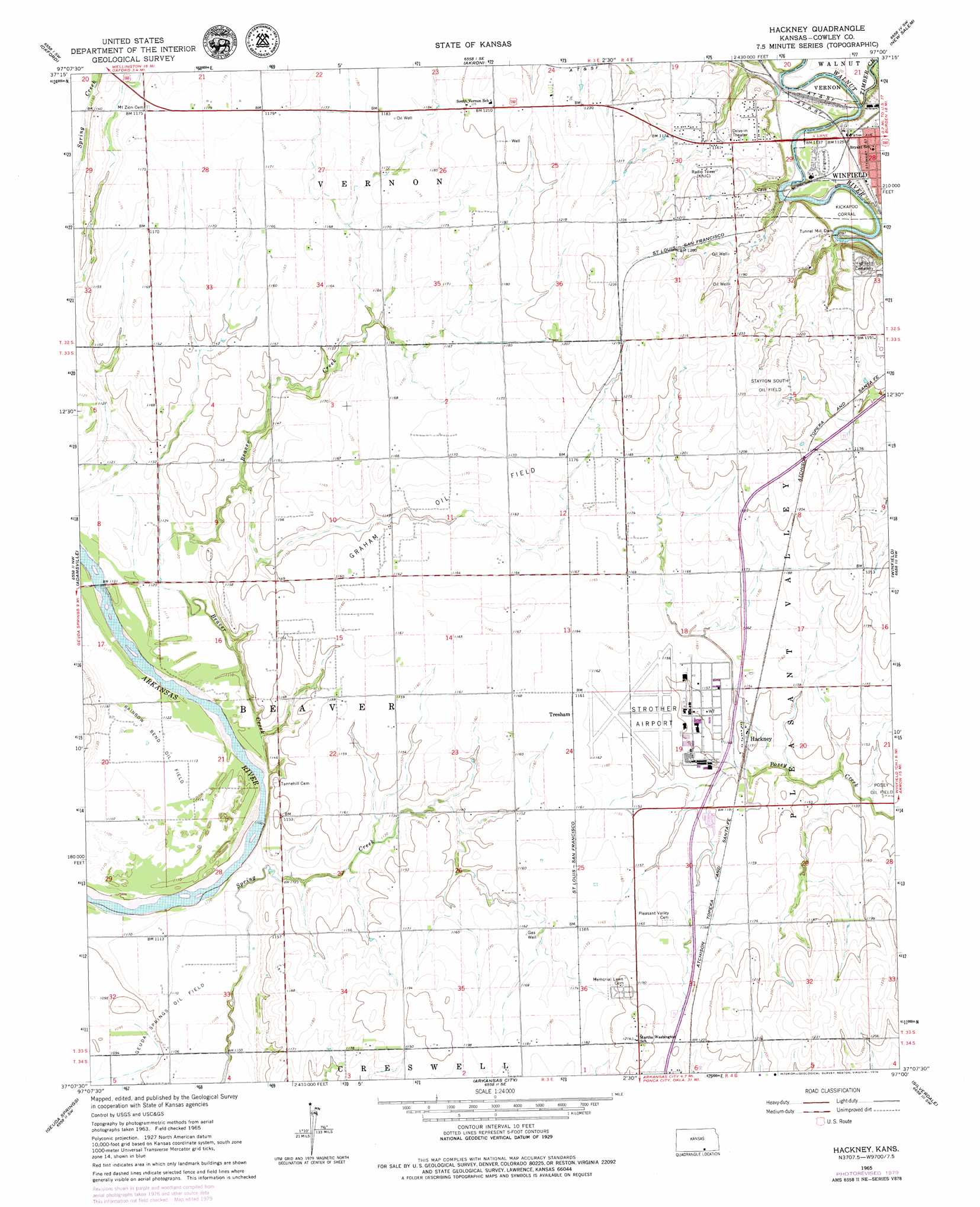
USGS Topo Quad 37097b1 - 1:24,000 scale
| Topo Map Name: | Hackney |
| USGS Topo Quad ID: | 37097b1 |
| Print Size: | ca. 21 1/4" wide x 27" high |
| Southeast Coordinates: | 37.125° N latitude / 97° W longitude |
| Map Center Coordinates: | 37.1875° N latitude / 97.0625° W longitude |
| U.S. State: | KS |
| Filename: | o37097b1.jpg |
| Download Map JPG Image: | Hackney topo map 1:24,000 scale |
| Map Type: | Topographic |
| Topo Series: | 7.5´ |
| Map Scale: | 1:24,000 |
| Source of Map Images: | United States Geological Survey (USGS) |
| Alternate Map Versions: |
Hackney KS 1965, updated 1966 Download PDF Buy paper map Hackney KS 1965, updated 1979 Download PDF Buy paper map Hackney KS 2010 Download PDF Buy paper map Hackney KS 2012 Download PDF Buy paper map Hackney KS 2015 Download PDF Buy paper map |
1:24,000 Topo Quads surrounding Hackney
Belle Plaine |
Mulvane |
Udall |
Wilmot |
Atlanta |
Dalton |
Oxford |
Akron |
New Salem |
Burden |
South Haven Ne |
Adamsville |
Hackney |
Winfield |
Eaton |
Portland |
Geuda Springs |
Arkansas City |
Silverdale |
Maple City |
Braman |
Peckham |
Newkirk |
Kaw City Nw |
Hardy |
> Back to 37097a1 at 1:100,000 scale
> Back to 37096a1 at 1:250,000 scale
> Back to U.S. Topo Maps home
Hackney topo map: Gazetteer
Hackney: Airports
Strother Field elevation 354m 1161′Hackney: Bends
Kickapoo Corral elevation 340m 1115′Hackney: Dams
Tunnel Mill Dam elevation 334m 1095′Hackney: Oilfields
Graham Oil Field elevation 353m 1158′Stayton South Oil Field elevation 374m 1227′
Hackney: Populated Places
Tresham elevation 354m 1161′Hackney: Streams
Beaver Creek elevation 338m 1108′Timber Creek elevation 335m 1099′
Hackney digital topo map on disk
Buy this Hackney topo map showing relief, roads, GPS coordinates and other geographical features, as a high-resolution digital map file on DVD: