Freeport Topo Map Kansas
To zoom in, hover over the map of Freeport
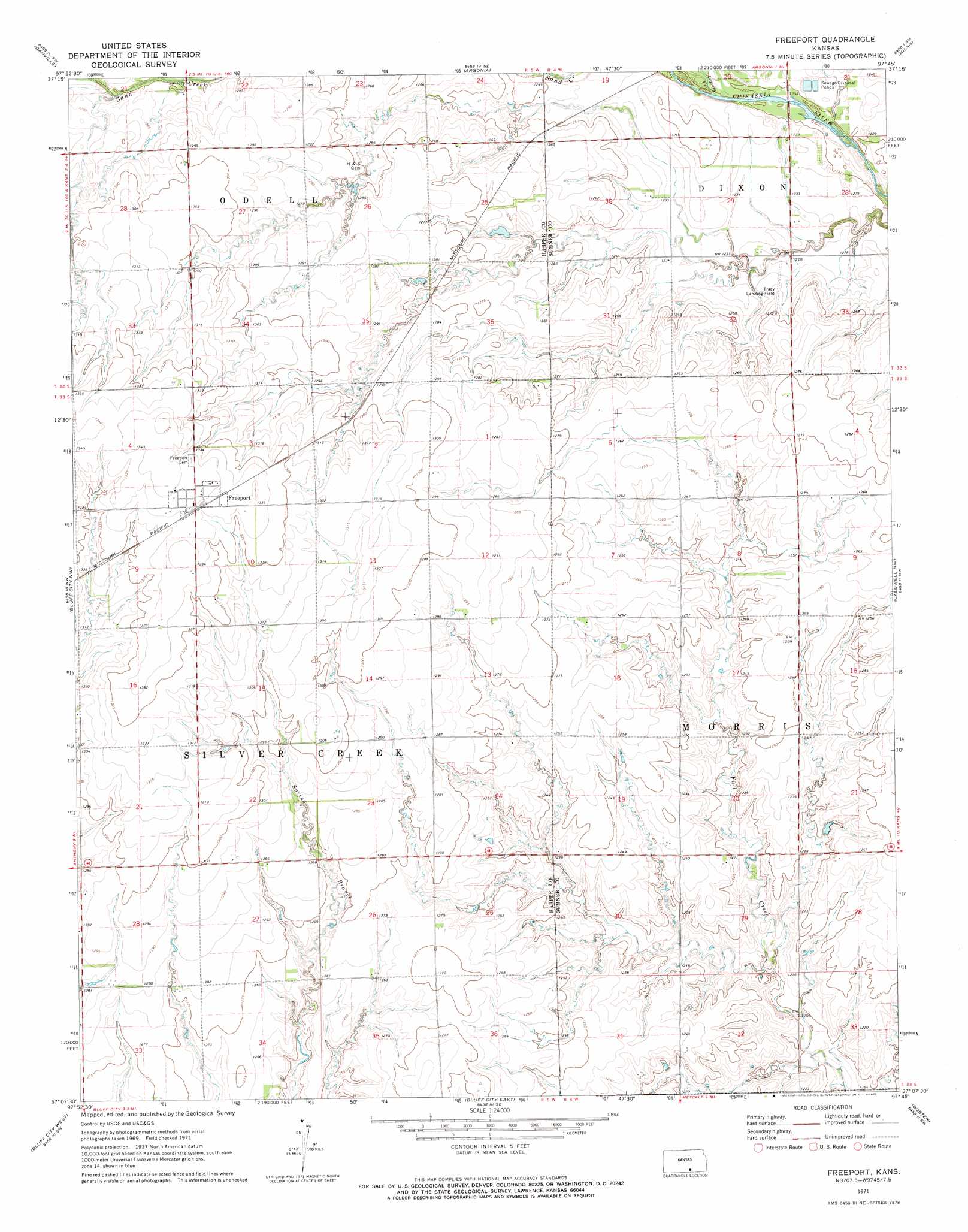
USGS Topo Quad 37097b7 - 1:24,000 scale
| Topo Map Name: | Freeport |
| USGS Topo Quad ID: | 37097b7 |
| Print Size: | ca. 21 1/4" wide x 27" high |
| Southeast Coordinates: | 37.125° N latitude / 97.75° W longitude |
| Map Center Coordinates: | 37.1875° N latitude / 97.8125° W longitude |
| U.S. State: | KS |
| Filename: | o37097b7.jpg |
| Download Map JPG Image: | Freeport topo map 1:24,000 scale |
| Map Type: | Topographic |
| Topo Series: | 7.5´ |
| Map Scale: | 1:24,000 |
| Source of Map Images: | United States Geological Survey (USGS) |
| Alternate Map Versions: |
Freeport KS 1971, updated 1973 Download PDF Buy paper map Freeport KS 2010 Download PDF Buy paper map Freeport KS 2012 Download PDF Buy paper map Freeport KS 2015 Download PDF Buy paper map |
1:24,000 Topo Quads surrounding Freeport
Rago |
Adams |
Norwich |
Conway Springs |
Millerton |
Harper |
Danville |
Argonia |
Milan |
Mayfield |
Anthony |
Bluff City Nw |
Freeport |
Caldwell Nw |
Perth |
Spring |
Bluff City West |
Bluff City East |
Doster |
Caldwell |
Manchester |
Wakita |
Wakita Ne |
Renfrow |
Medford Ne |
> Back to 37097a1 at 1:100,000 scale
> Back to 37096a1 at 1:250,000 scale
> Back to U.S. Topo Maps home
Freeport topo map: Gazetteer
Freeport: Airports
Tracy Landing Field elevation 381m 1250′Freeport: Populated Places
Freeport elevation 407m 1335′Freeport: Streams
Argonia Creek elevation 373m 1223′Freeport digital topo map on disk
Buy this Freeport topo map showing relief, roads, GPS coordinates and other geographical features, as a high-resolution digital map file on DVD: