Oxford Topo Map Kansas
To zoom in, hover over the map of Oxford
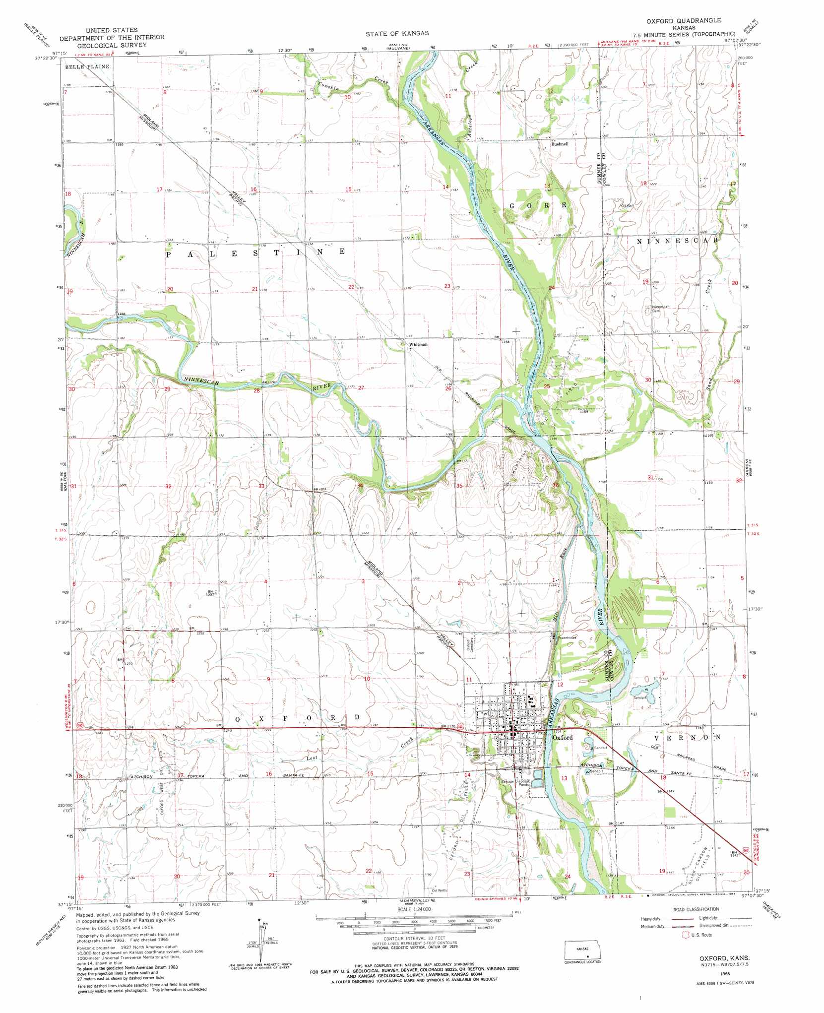
USGS Topo Quad 37097c2 - 1:24,000 scale
| Topo Map Name: | Oxford |
| USGS Topo Quad ID: | 37097c2 |
| Print Size: | ca. 21 1/4" wide x 27" high |
| Southeast Coordinates: | 37.25° N latitude / 97.125° W longitude |
| Map Center Coordinates: | 37.3125° N latitude / 97.1875° W longitude |
| U.S. State: | KS |
| Filename: | o37097c2.jpg |
| Download Map JPG Image: | Oxford topo map 1:24,000 scale |
| Map Type: | Topographic |
| Topo Series: | 7.5´ |
| Map Scale: | 1:24,000 |
| Source of Map Images: | United States Geological Survey (USGS) |
| Alternate Map Versions: |
Oxford KS 1965, updated 1966 Download PDF Buy paper map Oxford KS 1965, updated 1983 Download PDF Buy paper map Oxford KS 2010 Download PDF Buy paper map Oxford KS 2012 Download PDF Buy paper map Oxford KS 2015 Download PDF Buy paper map |
1:24,000 Topo Quads surrounding Oxford
Bayneville |
Derby |
Rose Hill |
Douglass |
Gordon |
Zyba |
Belle Plaine |
Mulvane |
Udall |
Wilmot |
Wellington |
Dalton |
Oxford |
Akron |
New Salem |
Rome |
South Haven Ne |
Adamsville |
Hackney |
Winfield |
South Haven |
Portland |
Geuda Springs |
Arkansas City |
Silverdale |
> Back to 37097a1 at 1:100,000 scale
> Back to 37096a1 at 1:250,000 scale
> Back to U.S. Topo Maps home
Oxford topo map: Gazetteer
Oxford: Canals
Mill Race elevation 351m 1151′Oxford: Oilfields
Churchill Oil Field elevation 354m 1161′Oxford Oil Field elevation 359m 1177′
Oxford West Oil Field elevation 375m 1230′
Slick-Carson Oil Field elevation 348m 1141′
Oxford: Populated Places
Bushnell elevation 363m 1190′Oxford elevation 362m 1187′
Whitman elevation 357m 1171′
Oxford: Streams
Cowskin Creek elevation 356m 1167′Lost Creek elevation 345m 1131′
Ninnescah River elevation 351m 1151′
Oxford digital topo map on disk
Buy this Oxford topo map showing relief, roads, GPS coordinates and other geographical features, as a high-resolution digital map file on DVD: