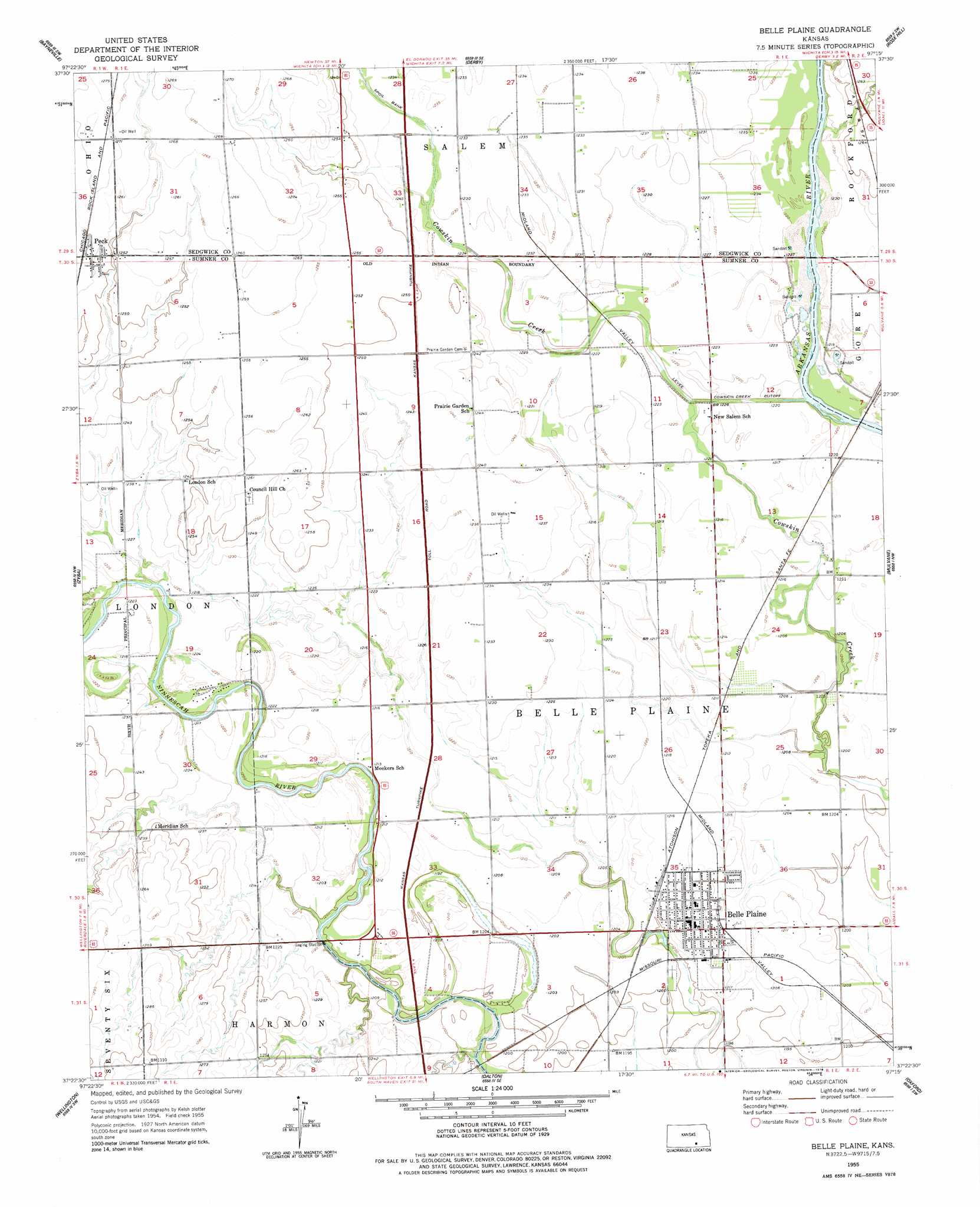
Belle Plaine Topo Map Kansas
To zoom in, hover over the map of Belle Plaine
USGS Topo Quad 37097d3 - 1:24,000 scale
| Topo Map Name: | Belle Plaine |
| USGS Topo Quad ID: | 37097d3 |
| Print Size: | ca. 21 1/4" wide x 27" high |
| Southeast Coordinates: | 37.375° N latitude / 97.25° W longitude |
| Map Center Coordinates: | 37.4375° N latitude / 97.3125° W longitude |
| U.S. State: | KS |
| Filename: | o37097d3.jpg |
| Download Map JPG Image: | Belle Plaine topo map 1:24,000 scale |
| Map Type: | Topographic |
| Topo Series: | 7.5´ |
| Map Scale: | 1:24,000 |
| Source of Map Images: | United States Geological Survey (USGS) |
| Alternate Map Versions: |
Belle Plaine KS 1955, updated 1956 Download PDF Buy paper map Belle Plaine KS 1955, updated 1978 Download PDF Buy paper map Belle Plaine KS 2010 Download PDF Buy paper map Belle Plaine KS 2012 Download PDF Buy paper map Belle Plaine KS 2015 Download PDF Buy paper map |
1:24,000 Topo Quads surrounding Belle Plaine
Goddard |
Wichita West |
Wichita East |
Andover |
Santa Fe Lake |
Clearwater |
Bayneville |
Derby |
Rose Hill |
Douglass |
Millerton |
Zyba |
Belle Plaine |
Mulvane |
Udall |
Mayfield |
Wellington |
Dalton |
Oxford |
Akron |
Perth |
Rome |
South Haven Ne |
Adamsville |
Hackney |
> Back to 37097a1 at 1:100,000 scale
> Back to 37096a1 at 1:250,000 scale
> Back to U.S. Topo Maps home
Belle Plaine topo map: Gazetteer
Belle Plaine: Airports
Kendrigan Airport elevation 378m 1240′Belle Plaine: Canals
Cowskin Creek Cutoff elevation 372m 1220′Belle Plaine: Populated Places
Belle Plaine elevation 373m 1223′Peck elevation 384m 1259′
Riverdale elevation 390m 1279′
Belle Plaine: Post Offices
Belle Plaine Post Office elevation 373m 1223′Belle Plaine digital topo map on disk
Buy this Belle Plaine topo map showing relief, roads, GPS coordinates and other geographical features, as a high-resolution digital map file on DVD: