Lake Afton Topo Map Kansas
To zoom in, hover over the map of Lake Afton
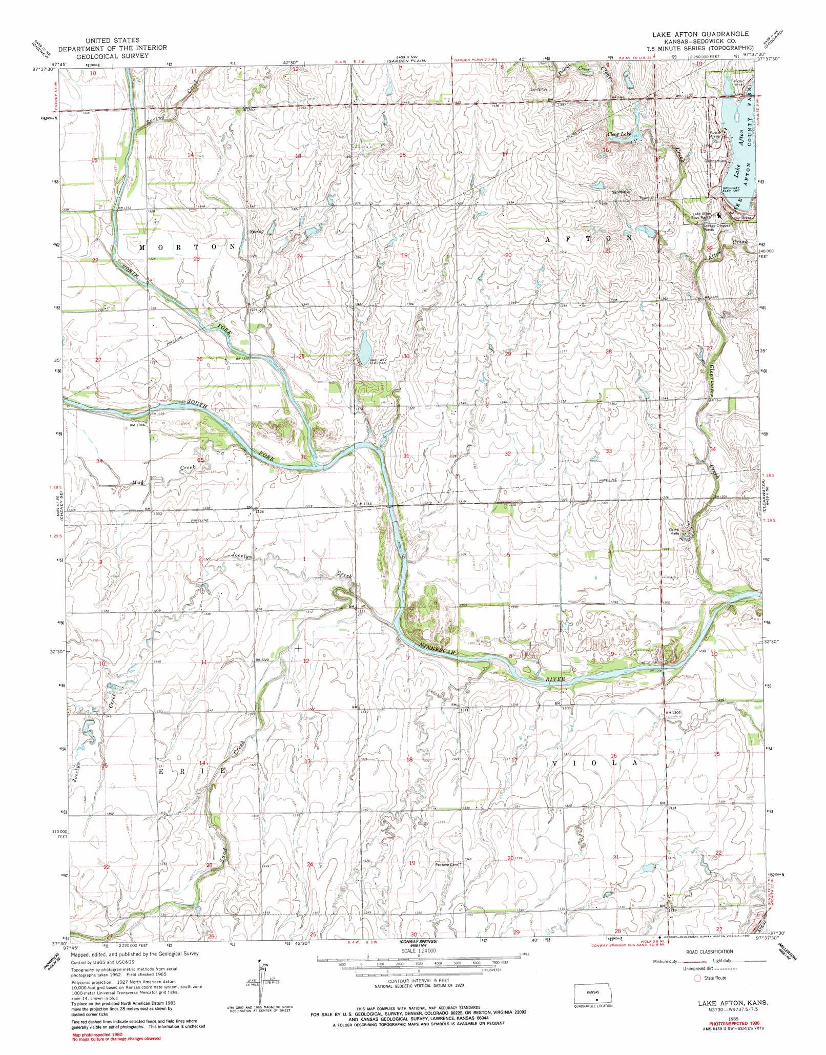
USGS Topo Quad 37097e6 - 1:24,000 scale
| Topo Map Name: | Lake Afton |
| USGS Topo Quad ID: | 37097e6 |
| Print Size: | ca. 21 1/4" wide x 27" high |
| Southeast Coordinates: | 37.5° N latitude / 97.625° W longitude |
| Map Center Coordinates: | 37.5625° N latitude / 97.6875° W longitude |
| U.S. State: | KS |
| Filename: | o37097e6.jpg |
| Download Map JPG Image: | Lake Afton topo map 1:24,000 scale |
| Map Type: | Topographic |
| Topo Series: | 7.5´ |
| Map Scale: | 1:24,000 |
| Source of Map Images: | United States Geological Survey (USGS) |
| Alternate Map Versions: |
Lake Afton KS 1965, updated 1966 Download PDF Buy paper map Lake Afton KS 1965, updated 1983 Download PDF Buy paper map Lake Afton KS 2009 Download PDF Buy paper map Lake Afton KS 2012 Download PDF Buy paper map Lake Afton KS 2015 Download PDF Buy paper map |
1:24,000 Topo Quads surrounding Lake Afton
Castleton |
Haven Se |
Mount Hope |
Colwich |
Maize |
Waterloo |
Cheney |
Garden Plain |
Goddard |
Wichita West |
Murdock |
Cheney Se |
Lake Afton |
Clearwater |
Bayneville |
Adams |
Norwich |
Conway Springs |
Millerton |
Zyba |
Danville |
Argonia |
Milan |
Mayfield |
Wellington |
> Back to 37097e1 at 1:100,000 scale
> Back to 37096a1 at 1:250,000 scale
> Back to U.S. Topo Maps home
Lake Afton topo map: Gazetteer
Lake Afton: Airports
Hovorka Airport elevation 430m 1410′Lake Afton: Parks
Lake Afton County Park elevation 417m 1368′Lake Afton: Reservoirs
Lake Afton elevation 413m 1354′Lake Afton: Streams
Afton Creek elevation 401m 1315′Clear Creek elevation 403m 1322′
Clearwater Creek elevation 391m 1282′
Jocelyn Creek elevation 396m 1299′
Middle Branch Clearwater Creek elevation 401m 1315′
Mod Creek elevation 399m 1309′
North Fork Ninnescah River elevation 398m 1305′
Polecat Creek elevation 414m 1358′
Sand Creek elevation 396m 1299′
South Fork Ninnescah River elevation 398m 1305′
Spring Creek elevation 403m 1322′
Lake Afton digital topo map on disk
Buy this Lake Afton topo map showing relief, roads, GPS coordinates and other geographical features, as a high-resolution digital map file on DVD: