Maize Topo Map Kansas
To zoom in, hover over the map of Maize
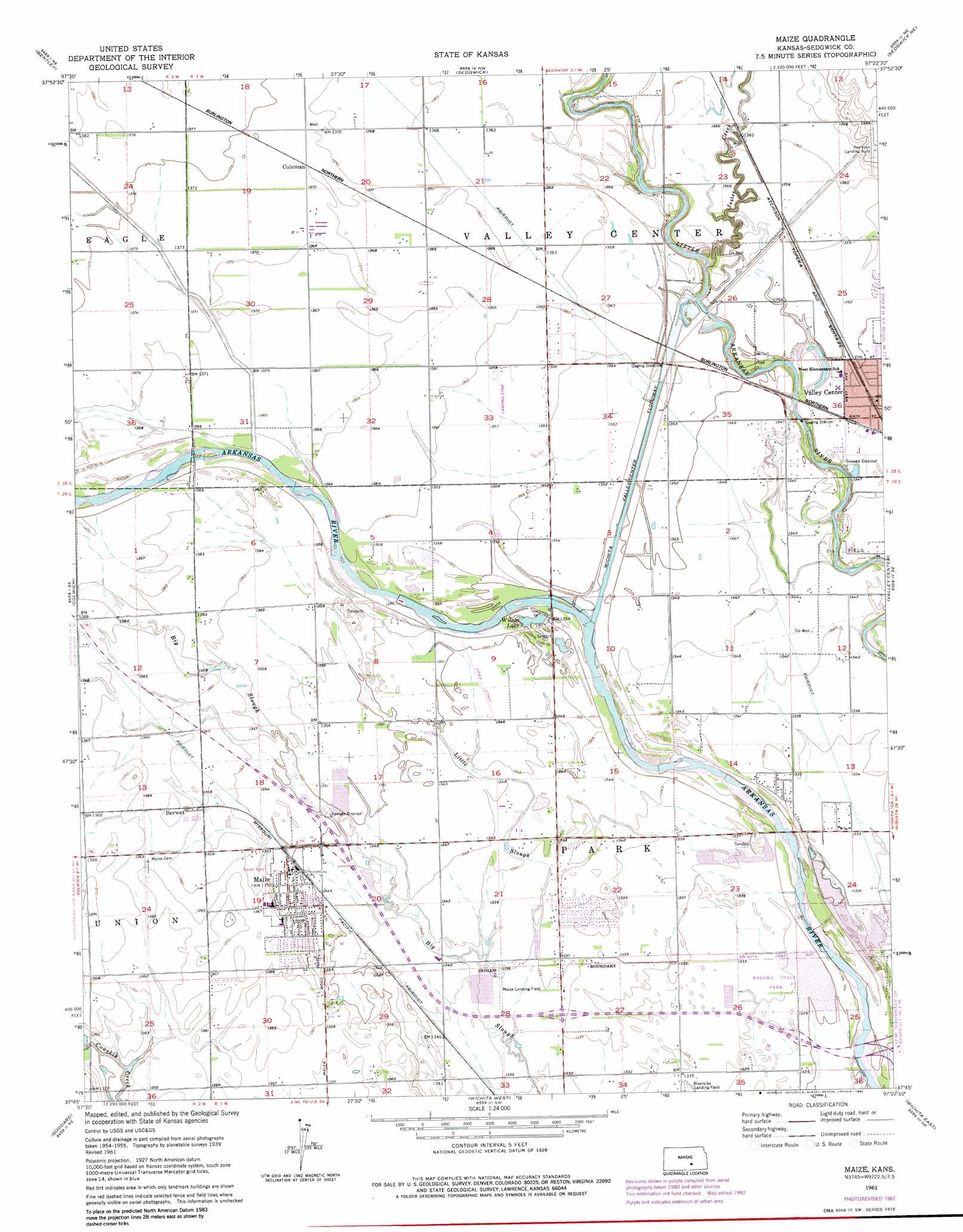
USGS Topo Quad 37097g4 - 1:24,000 scale
| Topo Map Name: | Maize |
| USGS Topo Quad ID: | 37097g4 |
| Print Size: | ca. 21 1/4" wide x 27" high |
| Southeast Coordinates: | 37.75° N latitude / 97.375° W longitude |
| Map Center Coordinates: | 37.8125° N latitude / 97.4375° W longitude |
| U.S. State: | KS |
| Filename: | o37097g4.jpg |
| Download Map JPG Image: | Maize topo map 1:24,000 scale |
| Map Type: | Topographic |
| Topo Series: | 7.5´ |
| Map Scale: | 1:24,000 |
| Source of Map Images: | United States Geological Survey (USGS) |
| Alternate Map Versions: |
Maize KS 1956, updated 1957 Download PDF Buy paper map Maize KS 1961, updated 1961 Download PDF Buy paper map Maize KS 1961, updated 1971 Download PDF Buy paper map Maize KS 1961, updated 1976 Download PDF Buy paper map Maize KS 1961, updated 1982 Download PDF Buy paper map Maize KS 2010 Download PDF Buy paper map Maize KS 2012 Download PDF Buy paper map Maize KS 2015 Download PDF Buy paper map |
1:24,000 Topo Quads surrounding Maize
Burrton |
Halstead |
Zimmerdale |
Newton |
Elbing |
Patterson |
Bentley |
Sedgwick |
Sedgwick Ne |
Whitewater |
Mount Hope |
Colwich |
Maize |
Valley Center |
Greenwich |
Garden Plain |
Goddard |
Wichita West |
Wichita East |
Andover |
Lake Afton |
Clearwater |
Bayneville |
Derby |
Rose Hill |
> Back to 37097e1 at 1:100,000 scale
> Back to 37096a1 at 1:250,000 scale
> Back to U.S. Topo Maps home
Maize topo map: Gazetteer
Maize: Airports
Harrison Landing Field elevation 424m 1391′Luther Airport elevation 412m 1351′
Maize Landing Field elevation 407m 1335′
Maize: Lakes
Wilson Lake elevation 409m 1341′Maize: Parks
Brooks Tract Park elevation 406m 1332′Maize: Populated Places
Berwet elevation 416m 1364′Childs Acres elevation 409m 1341′
Coleman elevation 418m 1371′
Maize elevation 412m 1351′
Oak Court Mobile Home Court elevation 413m 1354′
Rolling Meadows Mobile Home Park elevation 413m 1354′
Maize: Post Offices
Maize Post Office elevation 413m 1354′Maize: Streams
Jester Creek elevation 409m 1341′Little Slough elevation 405m 1328′
Maize digital topo map on disk
Buy this Maize topo map showing relief, roads, GPS coordinates and other geographical features, as a high-resolution digital map file on DVD: