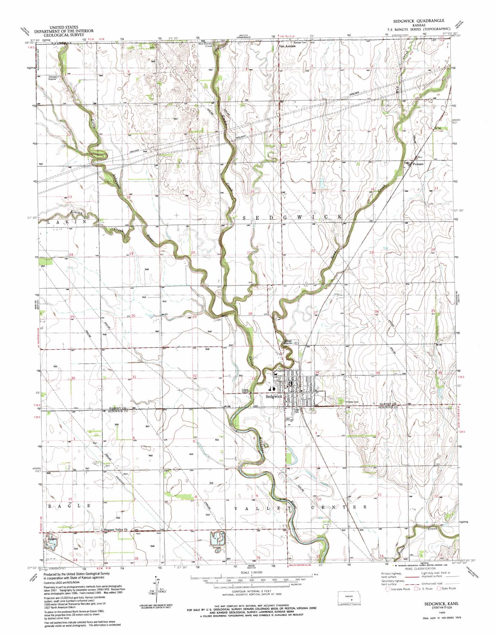
Sedgwick Topo Map Kansas
To zoom in, hover over the map of Sedgwick
USGS Topo Quad 37097h4 - 1:24,000 scale
| Topo Map Name: | Sedgwick |
| USGS Topo Quad ID: | 37097h4 |
| Print Size: | ca. 21 1/4" wide x 27" high |
| Southeast Coordinates: | 37.875° N latitude / 97.375° W longitude |
| Map Center Coordinates: | 37.9375° N latitude / 97.4375° W longitude |
| U.S. State: | KS |
| Filename: | o37097h4.jpg |
| Download Map JPG Image: | Sedgwick topo map 1:24,000 scale |
| Map Type: | Topographic |
| Topo Series: | 7.5´ |
| Map Scale: | 1:24,000 |
| Source of Map Images: | United States Geological Survey (USGS) |
| Alternate Map Versions: |
Sedgwick KS 1959, updated 1960 Download PDF Buy paper map Sedgwick KS 1959, updated 1978 Download PDF Buy paper map Sedgwick KS 1989, updated 1990 Download PDF Buy paper map Sedgwick KS 2009 Download PDF Buy paper map Sedgwick KS 2012 Download PDF Buy paper map Sedgwick KS 2015 Download PDF Buy paper map |
1:24,000 Topo Quads surrounding Sedgwick
Halstead Nw |
Moundridge |
Hesston |
Goessel |
Peabody Nw |
Burrton |
Halstead |
Zimmerdale |
Newton |
Elbing |
Patterson |
Bentley |
Sedgwick |
Sedgwick Ne |
Whitewater |
Mount Hope |
Colwich |
Maize |
Valley Center |
Greenwich |
Garden Plain |
Goddard |
Wichita West |
Wichita East |
Andover |
> Back to 37097e1 at 1:100,000 scale
> Back to 37096a1 at 1:250,000 scale
> Back to U.S. Topo Maps home
Sedgwick topo map: Gazetteer
Sedgwick: Populated Places
Putnam elevation 427m 1400′Sedgwick elevation 421m 1381′
Van Arsdale elevation 427m 1400′
Sedgwick: Post Offices
Sedgwick Post Office elevation 419m 1374′Sedgwick: Streams
East Emma Creek elevation 419m 1374′Emma Creek elevation 412m 1351′
Kisiwa Creek elevation 415m 1361′
Mud Creek elevation 421m 1381′
Sand Creek elevation 412m 1351′
West Emma Creek elevation 419m 1374′
Sedgwick digital topo map on disk
Buy this Sedgwick topo map showing relief, roads, GPS coordinates and other geographical features, as a high-resolution digital map file on DVD: