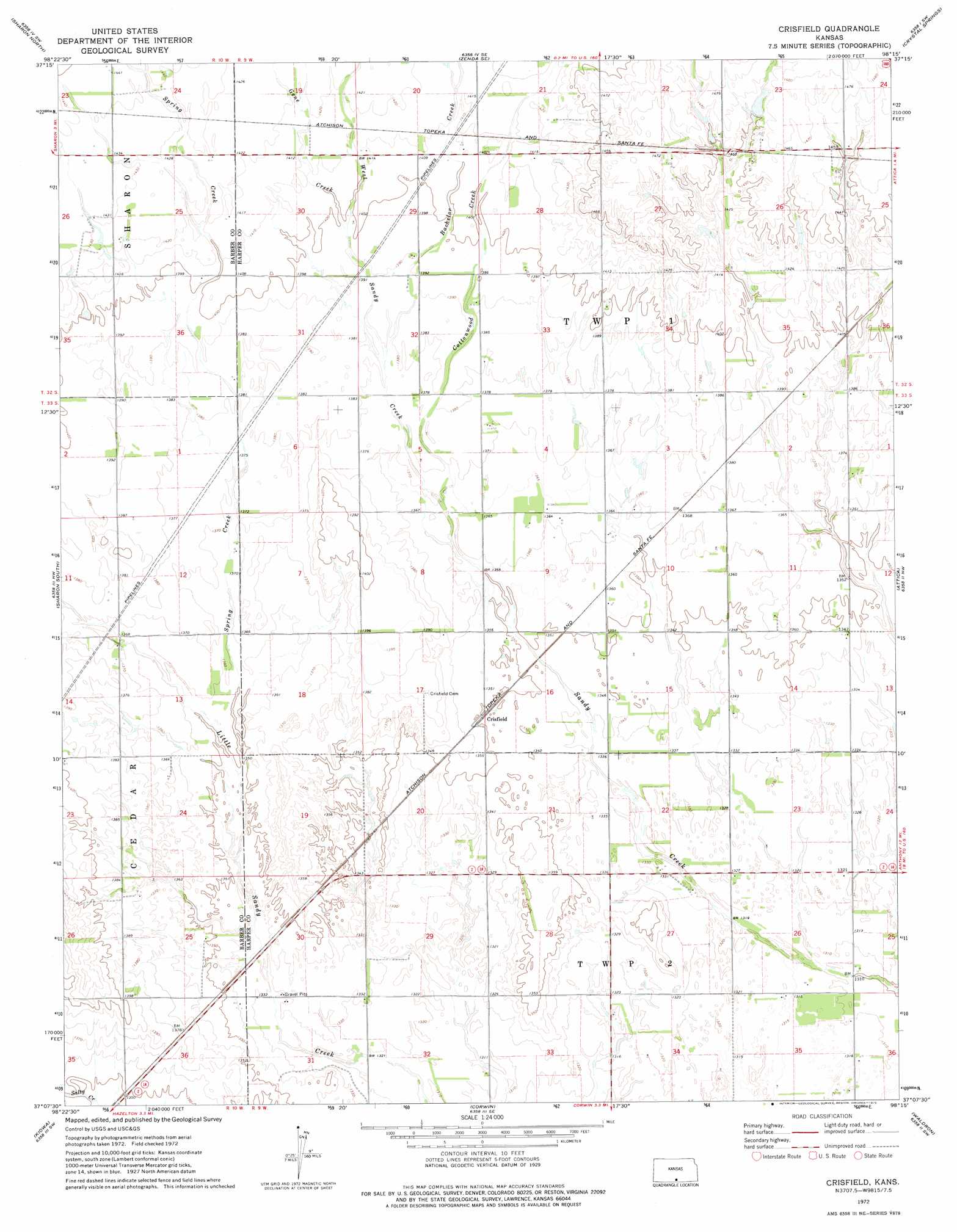
Crisfield Topo Map Kansas
To zoom in, hover over the map of Crisfield
USGS Topo Quad 37098b3 - 1:24,000 scale
| Topo Map Name: | Crisfield |
| USGS Topo Quad ID: | 37098b3 |
| Print Size: | ca. 21 1/4" wide x 27" high |
| Southeast Coordinates: | 37.125° N latitude / 98.25° W longitude |
| Map Center Coordinates: | 37.1875° N latitude / 98.3125° W longitude |
| U.S. State: | KS |
| Filename: | o37098b3.jpg |
| Download Map JPG Image: | Crisfield topo map 1:24,000 scale |
| Map Type: | Topographic |
| Topo Series: | 7.5´ |
| Map Scale: | 1:24,000 |
| Source of Map Images: | United States Geological Survey (USGS) |
| Alternate Map Versions: |
Crisfield KS 1972, updated 1975 Download PDF Buy paper map Crisfield KS 2009 Download PDF Buy paper map Crisfield KS 2012 Download PDF Buy paper map Crisfield KS 2015 Download PDF Buy paper map |
1:24,000 Topo Quads surrounding Crisfield
Isabel |
Nashville |
Zenda |
Spivey |
Rago |
Medicine Lodge |
Sharon North |
Zenda Se |
Crystal Springs |
Harper |
Gerlane |
Sharon South |
Crisfield |
Attica |
Anthony |
Stubbs |
Kiowa |
Corwin |
Waldron |
Spring |
Capron |
Burlington |
Amorita |
Manchester Nw |
Manchester |
> Back to 37098a1 at 1:100,000 scale
> Back to 37098a1 at 1:250,000 scale
> Back to U.S. Topo Maps home
Crisfield topo map: Gazetteer
Crisfield: Populated Places
Crisfield elevation 411m 1348′Crisfield: Streams
Bachelor Creek elevation 419m 1374′Cottonwood Creek elevation 414m 1358′
Gene Creek elevation 424m 1391′
Spring Creek elevation 409m 1341′
West Sandy Creek elevation 414m 1358′
Crisfield digital topo map on disk
Buy this Crisfield topo map showing relief, roads, GPS coordinates and other geographical features, as a high-resolution digital map file on DVD: