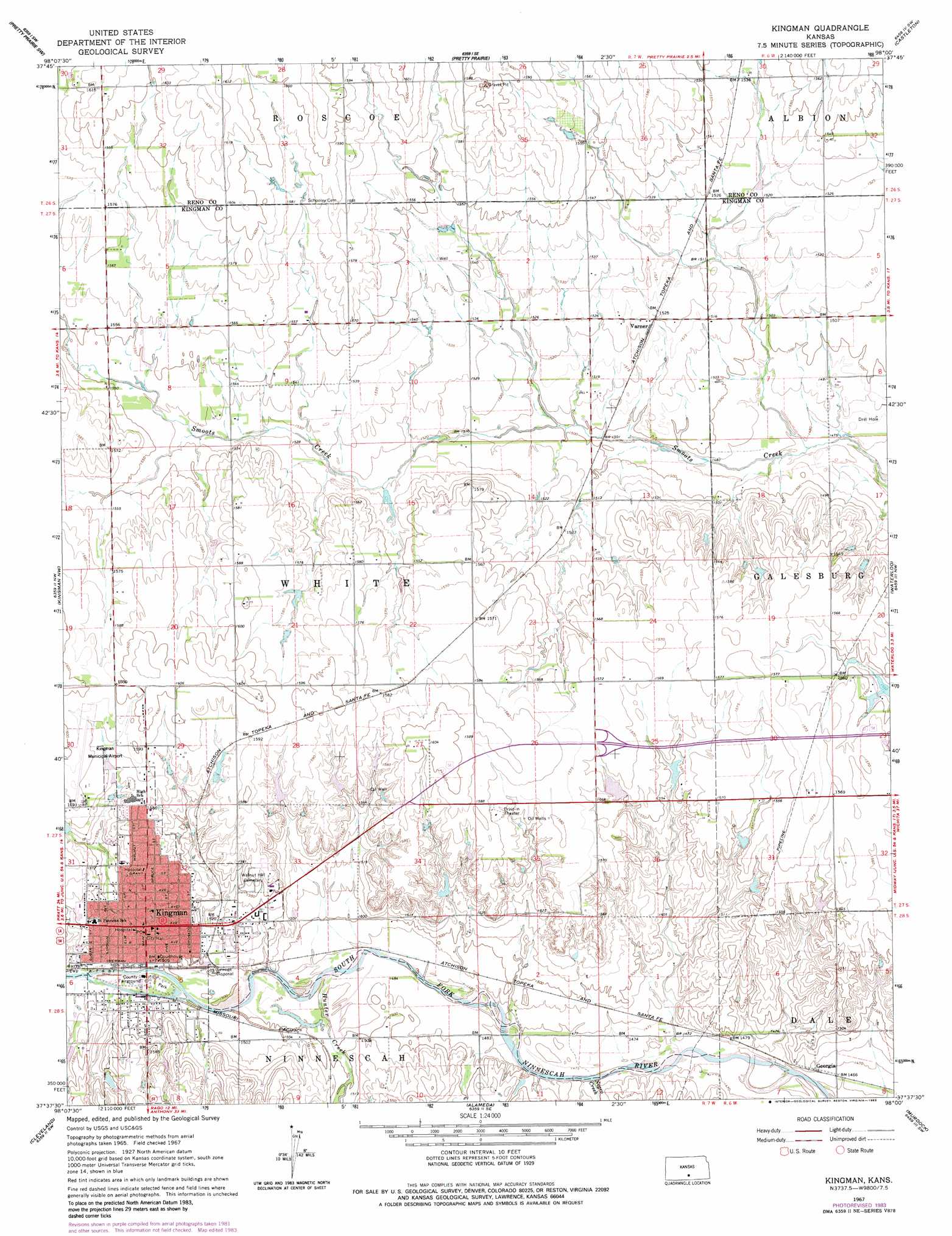
Kingman Topo Map Kansas
To zoom in, hover over the map of Kingman
USGS Topo Quad 37098f1 - 1:24,000 scale
| Topo Map Name: | Kingman |
| USGS Topo Quad ID: | 37098f1 |
| Print Size: | ca. 21 1/4" wide x 27" high |
| Southeast Coordinates: | 37.625° N latitude / 98° W longitude |
| Map Center Coordinates: | 37.6875° N latitude / 98.0625° W longitude |
| U.S. State: | KS |
| Filename: | o37098f1.jpg |
| Download Map JPG Image: | Kingman topo map 1:24,000 scale |
| Map Type: | Topographic |
| Topo Series: | 7.5´ |
| Map Scale: | 1:24,000 |
| Source of Map Images: | United States Geological Survey (USGS) |
| Alternate Map Versions: |
Kingman KS 1967, updated 1968 Download PDF Buy paper map Kingman KS 1967, updated 1983 Download PDF Buy paper map Kingman KS 2009 Download PDF Buy paper map Kingman KS 2012 Download PDF Buy paper map Kingman KS 2016 Download PDF Buy paper map |
1:24,000 Topo Quads surrounding Kingman
Plevna |
Arlington |
Partridge |
Elmer |
Haven |
Langdon |
Pretty Prairie Sw |
Pretty Prairie |
Castleton |
Haven Se |
Penalosa |
Kingman Nw |
Kingman |
Waterloo |
Cheney |
Willowdale |
Cleveland |
Almeda |
Murdock |
Cheney Se |
Zenda |
Spivey |
Rago |
Adams |
Norwich |
> Back to 37098e1 at 1:100,000 scale
> Back to 37098a1 at 1:250,000 scale
> Back to U.S. Topo Maps home
Kingman topo map: Gazetteer
Kingman: Airports
Kingman Municipal Airport elevation 485m 1591′Kingman: Lakes
Lakin Lake elevation 474m 1555′Kingman: Populated Places
Georgia elevation 447m 1466′Kingman elevation 464m 1522′
Varner elevation 464m 1522′
Kingman: Streams
Hunter Creek elevation 454m 1489′Negro Creek elevation 448m 1469′
Kingman digital topo map on disk
Buy this Kingman topo map showing relief, roads, GPS coordinates and other geographical features, as a high-resolution digital map file on DVD: