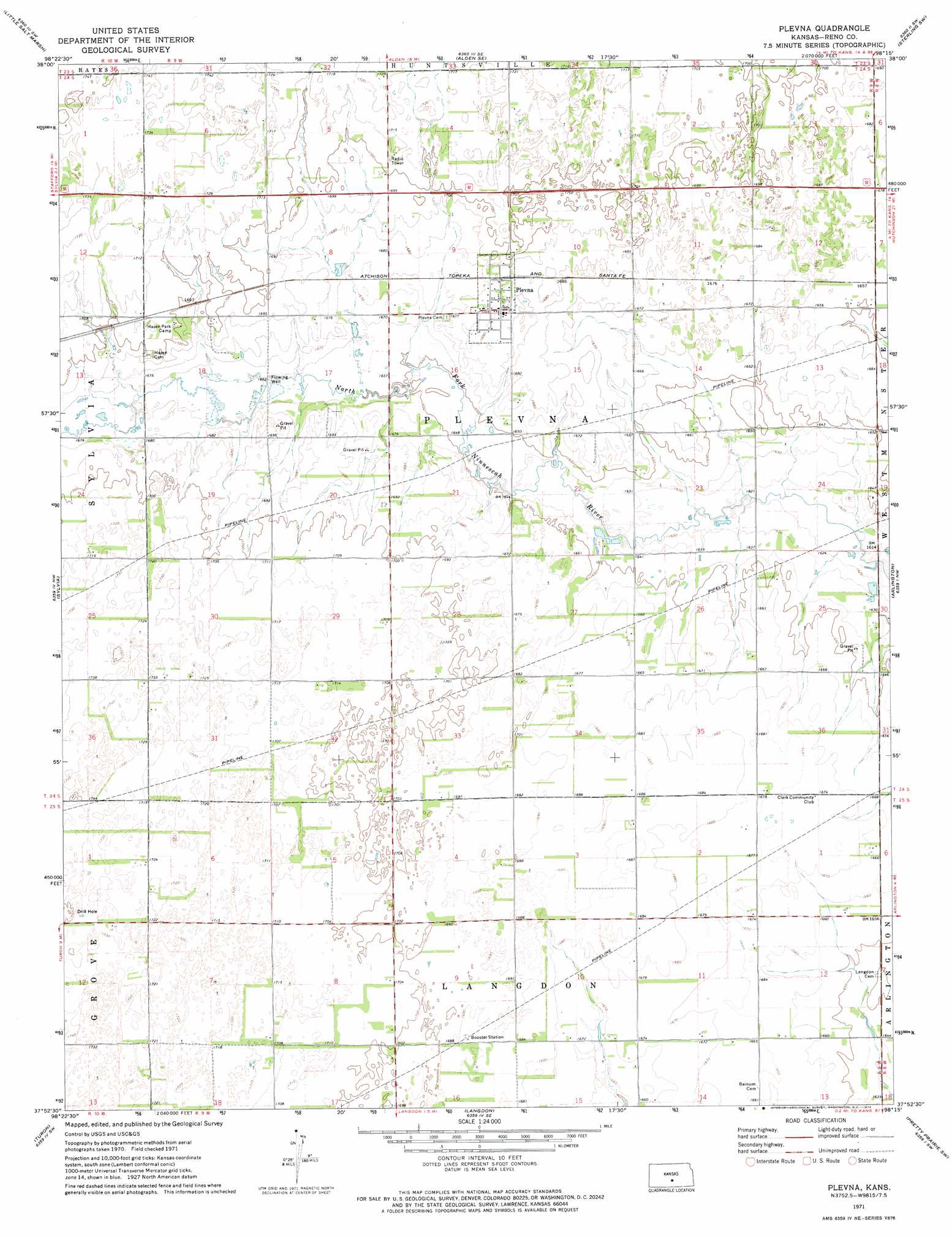
Plevna Topo Map Kansas
To zoom in, hover over the map of Plevna
USGS Topo Quad 37098h3 - 1:24,000 scale
| Topo Map Name: | Plevna |
| USGS Topo Quad ID: | 37098h3 |
| Print Size: | ca. 21 1/4" wide x 27" high |
| Southeast Coordinates: | 37.875° N latitude / 98.25° W longitude |
| Map Center Coordinates: | 37.9375° N latitude / 98.3125° W longitude |
| U.S. State: | KS |
| Filename: | o37098h3.jpg |
| Download Map JPG Image: | Plevna topo map 1:24,000 scale |
| Map Type: | Topographic |
| Topo Series: | 7.5´ |
| Map Scale: | 1:24,000 |
| Source of Map Images: | United States Geological Survey (USGS) |
| Alternate Map Versions: |
Plevna KS 1971, updated 1974 Download PDF Buy paper map Plevna KS 2009 Download PDF Buy paper map Plevna KS 2012 Download PDF Buy paper map Plevna KS 2015 Download PDF Buy paper map |
1:24,000 Topo Quads surrounding Plevna
Big Salt Marsh |
Alden Nw |
Alden |
Sterling |
Nickerson |
Hudson Se |
Little Salt Marsh |
Alden Se |
Sterling Sw |
Yaggy |
Stafford |
Sylvia |
Plevna |
Arlington |
Partridge |
Preston |
Turon |
Langdon |
Pretty Prairie Sw |
Pretty Prairie |
Cairo |
Cunningham |
Penalosa |
Kingman Nw |
Kingman |
> Back to 37098e1 at 1:100,000 scale
> Back to 37098a1 at 1:250,000 scale
> Back to U.S. Topo Maps home
Plevna digital topo map on disk
Buy this Plevna topo map showing relief, roads, GPS coordinates and other geographical features, as a high-resolution digital map file on DVD: