Ashland Se Topo Map Kansas
To zoom in, hover over the map of Ashland Se
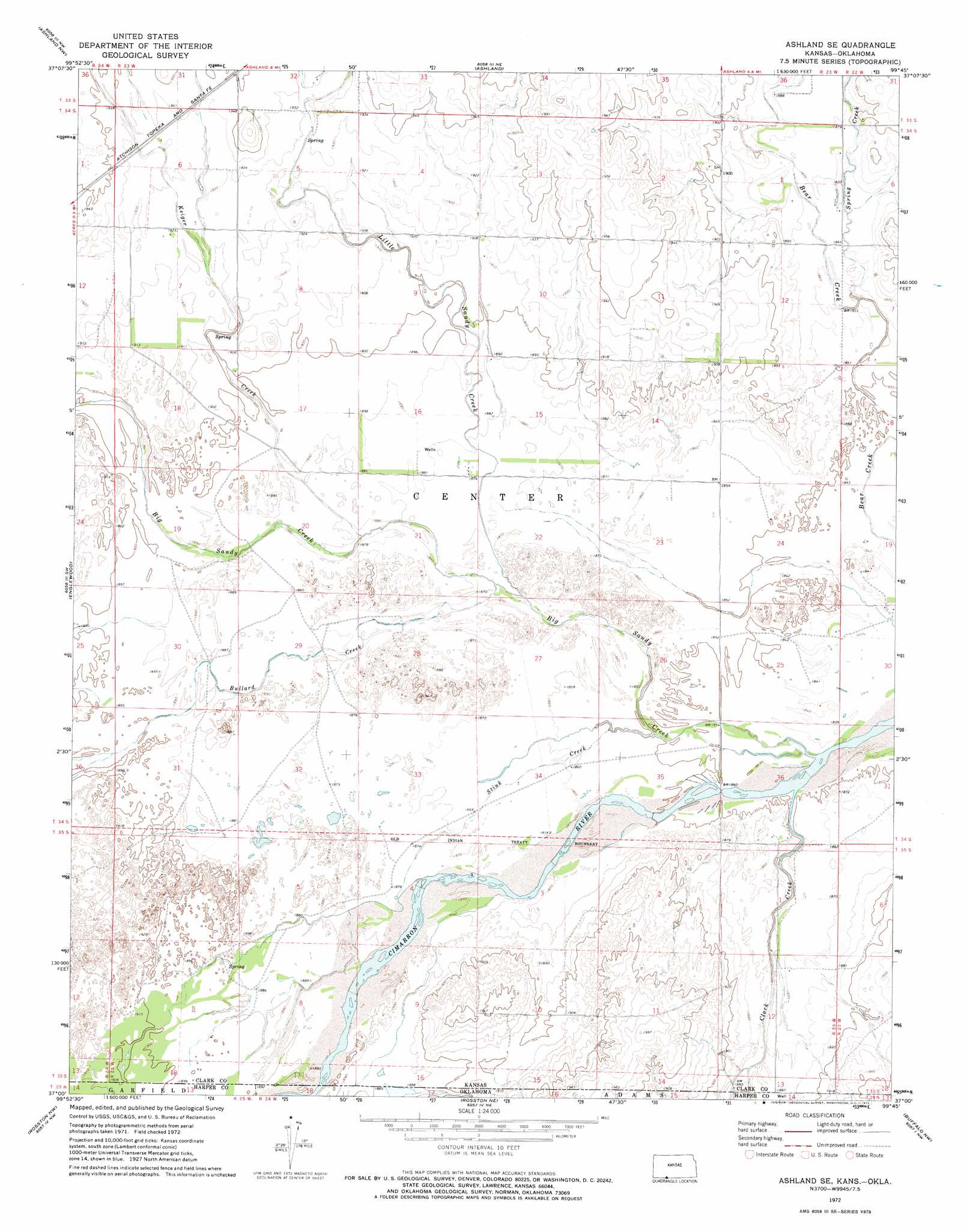
USGS Topo Quad 37099a7 - 1:24,000 scale
| Topo Map Name: | Ashland Se |
| USGS Topo Quad ID: | 37099a7 |
| Print Size: | ca. 21 1/4" wide x 27" high |
| Southeast Coordinates: | 37° N latitude / 99.75° W longitude |
| Map Center Coordinates: | 37.0625° N latitude / 99.8125° W longitude |
| U.S. States: | KS, OK |
| Filename: | o37099a7.jpg |
| Download Map JPG Image: | Ashland Se topo map 1:24,000 scale |
| Map Type: | Topographic |
| Topo Series: | 7.5´ |
| Map Scale: | 1:24,000 |
| Source of Map Images: | United States Geological Survey (USGS) |
| Alternate Map Versions: |
Ashland SE KS 1972, updated 1974 Download PDF Buy paper map Ashland SE KS 2010 Download PDF Buy paper map Ashland SE KS 2012 Download PDF Buy paper map Ashland SE KS 2016 Download PDF Buy paper map |
1:24,000 Topo Quads surrounding Ashland Se
Fowler Se |
Bloom Sw |
Bloom Se |
Mount Jesus |
Lexington |
Proffitt Lake |
Ashland Nw |
Ashland |
Sitka |
Sugarloaf |
Mount Helen |
Englewood |
Ashland Se |
Sitka Sw |
Trout Creek |
Gate Ne |
Rosston Nw |
Rosston Ne |
Buffalo Nw |
Buffalo Ne |
Gate |
Rosston |
Rosston Se |
Buffalo |
Buffalo Se |
> Back to 37099a1 at 1:100,000 scale
> Back to 37098a1 at 1:250,000 scale
> Back to U.S. Topo Maps home
Ashland Se topo map: Gazetteer
Ashland Se: Streams
Big Sandy Creek elevation 561m 1840′Bullard Creek elevation 567m 1860′
Clark Creek elevation 561m 1840′
Keiger Creek elevation 571m 1873′
Little Sandy Creek elevation 573m 1879′
Redoubt Creek elevation 567m 1860′
Spring Creek elevation 564m 1850′
Stink Creek elevation 563m 1847′
Ashland Se digital topo map on disk
Buy this Ashland Se topo map showing relief, roads, GPS coordinates and other geographical features, as a high-resolution digital map file on DVD: