Indian Creek Topo Map Kansas
To zoom in, hover over the map of Indian Creek
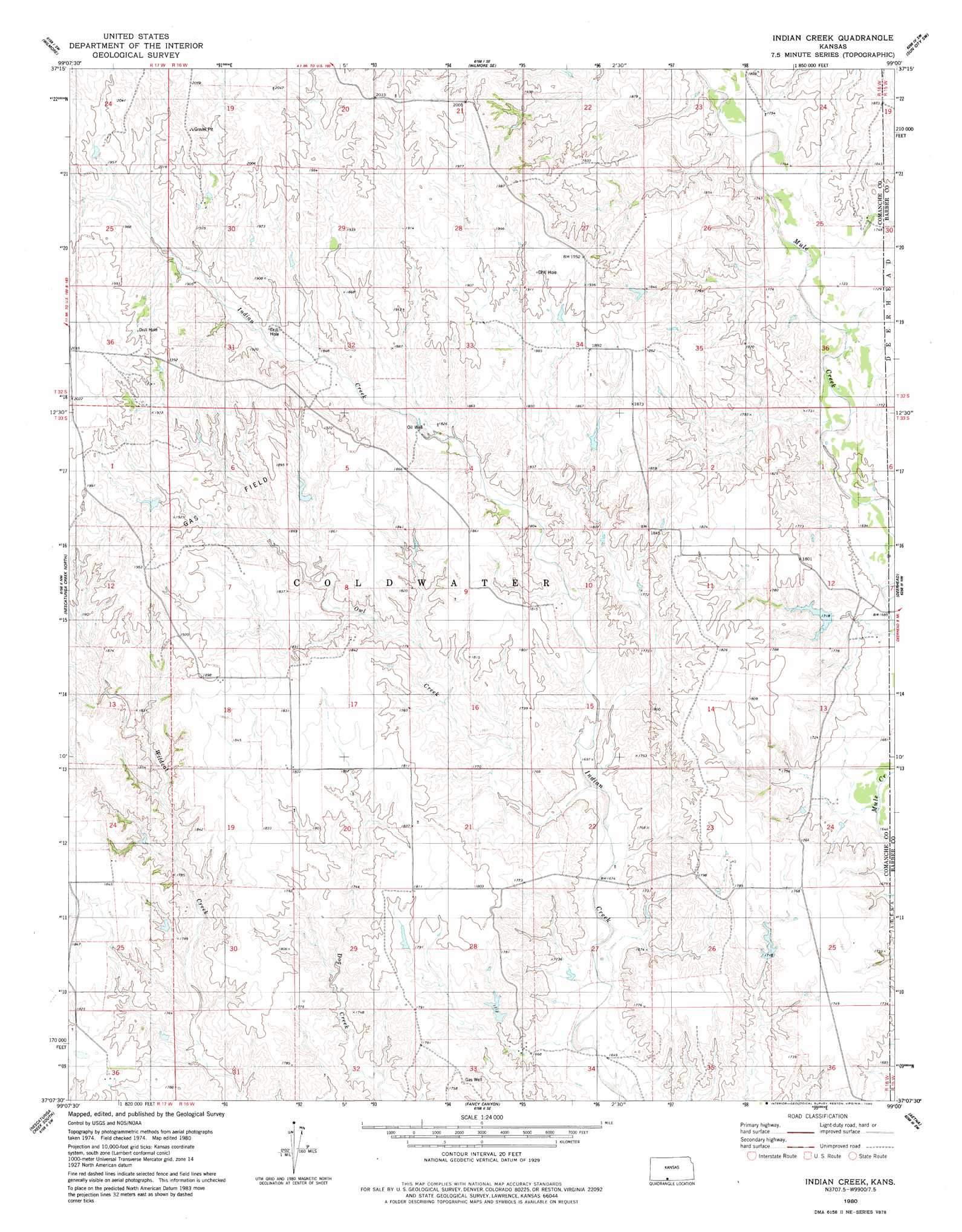
USGS Topo Quad 37099b1 - 1:24,000 scale
| Topo Map Name: | Indian Creek |
| USGS Topo Quad ID: | 37099b1 |
| Print Size: | ca. 21 1/4" wide x 27" high |
| Southeast Coordinates: | 37.125° N latitude / 99° W longitude |
| Map Center Coordinates: | 37.1875° N latitude / 99.0625° W longitude |
| U.S. State: | KS |
| Filename: | o37099b1.jpg |
| Download Map JPG Image: | Indian Creek topo map 1:24,000 scale |
| Map Type: | Topographic |
| Topo Series: | 7.5´ |
| Map Scale: | 1:24,000 |
| Source of Map Images: | United States Geological Survey (USGS) |
| Alternate Map Versions: |
Indian Creek KS 1980, updated 1980 Download PDF Buy paper map Indian Creek KS 2009 Download PDF Buy paper map Indian Creek KS 2012 Download PDF Buy paper map Indian Creek KS 2016 Download PDF Buy paper map |
1:24,000 Topo Quads surrounding Indian Creek
Coldwater Ne |
Iron Mountain |
Belvidere |
Sun City |
Sun City Ne |
Coldwater |
Wilmore |
Wilmore Se |
Sun City Sw |
Lake City |
Protection Ne |
Nescatunga Creek North |
Indian Creek |
Deerhead |
Pump Creek |
Buttermilk |
Nescatunga Creek South |
Fancy Canyon |
Aetna |
Hackberry Creek |
Lookout |
Freedom Nw |
Freedom Ne |
Tegarden Nw |
Tegarden Ne |
> Back to 37099a1 at 1:100,000 scale
> Back to 37098a1 at 1:250,000 scale
> Back to U.S. Topo Maps home
Indian Creek topo map: Gazetteer
Indian Creek: Streams
Inman Creek elevation 512m 1679′Owl Creek elevation 512m 1679′
Indian Creek digital topo map on disk
Buy this Indian Creek topo map showing relief, roads, GPS coordinates and other geographical features, as a high-resolution digital map file on DVD: