Fort Dodge Topo Map Kansas
To zoom in, hover over the map of Fort Dodge
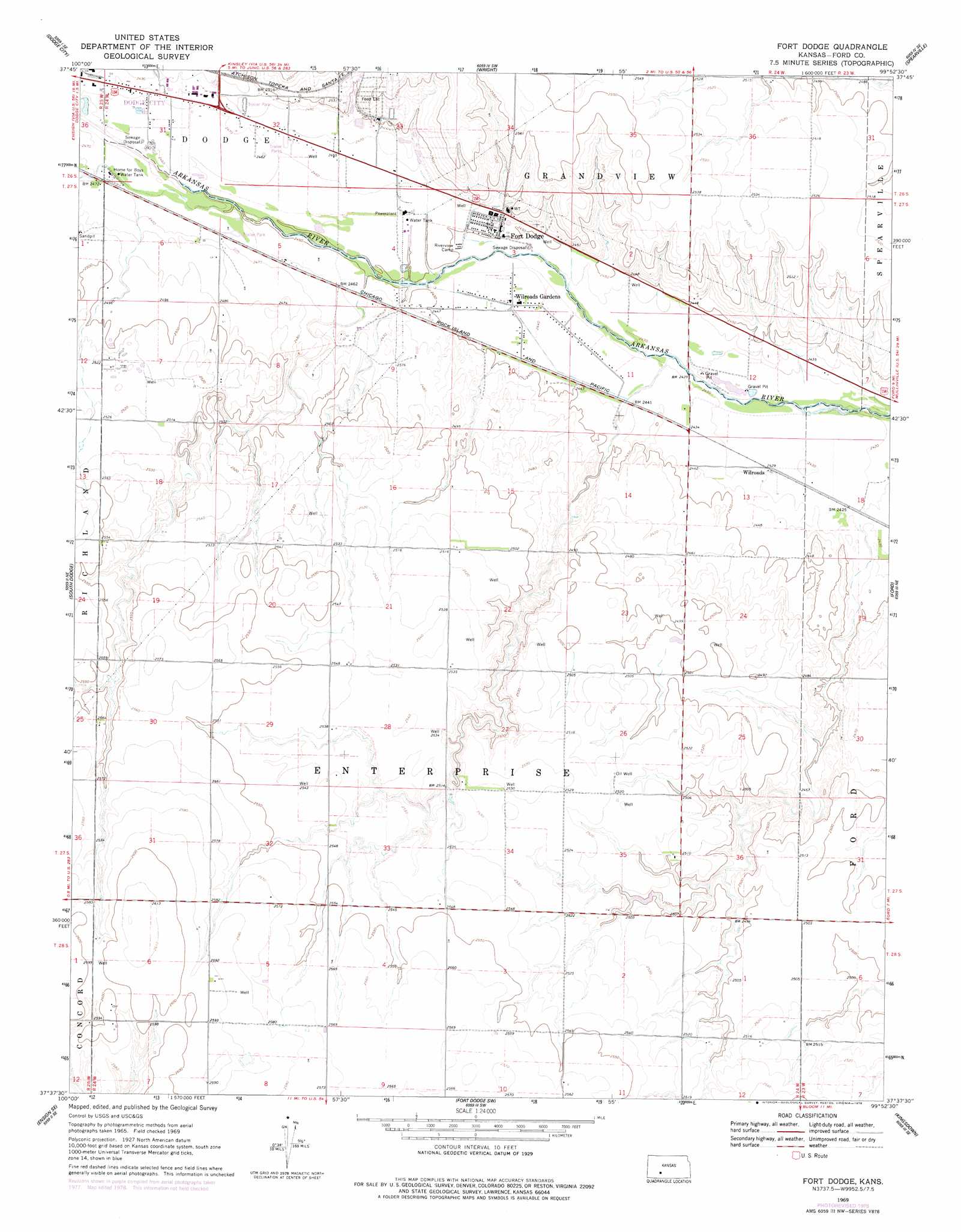
USGS Topo Quad 37099f8 - 1:24,000 scale
| Topo Map Name: | Fort Dodge |
| USGS Topo Quad ID: | 37099f8 |
| Print Size: | ca. 21 1/4" wide x 27" high |
| Southeast Coordinates: | 37.625° N latitude / 99.875° W longitude |
| Map Center Coordinates: | 37.6875° N latitude / 99.9375° W longitude |
| U.S. State: | KS |
| Filename: | o37099f8.jpg |
| Download Map JPG Image: | Fort Dodge topo map 1:24,000 scale |
| Map Type: | Topographic |
| Topo Series: | 7.5´ |
| Map Scale: | 1:24,000 |
| Source of Map Images: | United States Geological Survey (USGS) |
| Alternate Map Versions: |
Fort Dodge KS 1969, updated 1971 Download PDF Buy paper map Fort Dodge KS 1969, updated 1978 Download PDF Buy paper map Fort Dodge KS 2009 Download PDF Buy paper map Fort Dodge KS 2012 Download PDF Buy paper map Fort Dodge KS 2015 Download PDF Buy paper map |
1:24,000 Topo Quads surrounding Fort Dodge
Dodge City Nw |
Dodge City Ne |
Spearville Nw |
Spearville Ne |
Offerle Nw |
Dodge City Sw |
Dodge City |
Wright |
Spearville |
Bellefont |
Ensign |
South Dodge |
Fort Dodge |
Ford |
Bucklin Nw |
Ensign Sw |
Ensign Se |
Fort Dodge Sw |
Kingsdown |
Bucklin |
Fowler |
Minneola |
Bloom |
Simmons Creek |
Mount Jesus Nw |
> Back to 37099e1 at 1:100,000 scale
> Back to 37098a1 at 1:250,000 scale
> Back to U.S. Topo Maps home
Fort Dodge topo map: Gazetteer
Fort Dodge: Airports
Wilroads Gardens Airport elevation 742m 2434′Fort Dodge: Populated Places
Fort Dodge elevation 751m 2463′Wilroads elevation 740m 2427′
Wilroads Gardens elevation 744m 2440′
Fort Dodge: Reservoirs
Home for Boys Water Tank elevation 752m 2467′Fort Dodge digital topo map on disk
Buy this Fort Dodge topo map showing relief, roads, GPS coordinates and other geographical features, as a high-resolution digital map file on DVD: