Lewis Topo Map Kansas
To zoom in, hover over the map of Lewis
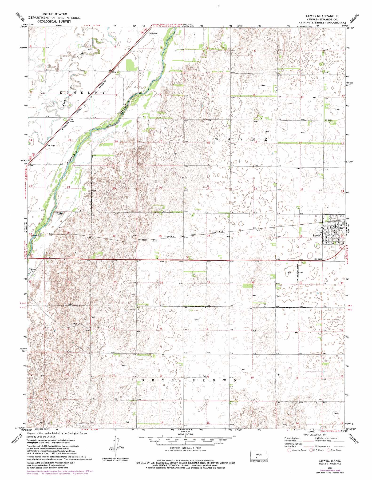
USGS Topo Quad 37099h3 - 1:24,000 scale
| Topo Map Name: | Lewis |
| USGS Topo Quad ID: | 37099h3 |
| Print Size: | ca. 21 1/4" wide x 27" high |
| Southeast Coordinates: | 37.875° N latitude / 99.25° W longitude |
| Map Center Coordinates: | 37.9375° N latitude / 99.3125° W longitude |
| U.S. State: | KS |
| Filename: | o37099h3.jpg |
| Download Map JPG Image: | Lewis topo map 1:24,000 scale |
| Map Type: | Topographic |
| Topo Series: | 7.5´ |
| Map Scale: | 1:24,000 |
| Source of Map Images: | United States Geological Survey (USGS) |
| Alternate Map Versions: |
Lewis KS 1972, updated 1974 Download PDF Buy paper map Lewis KS 1972, updated 1984 Download PDF Buy paper map Lewis KS 2009 Download PDF Buy paper map Lewis KS 2012 Download PDF Buy paper map Lewis KS 2015 Download PDF Buy paper map |
1:24,000 Topo Quads surrounding Lewis
Burdett |
Rozel |
Sanford |
Fort Larned |
Larned |
Hanston Se |
Rozel Sw |
Rozel Se |
Garfield |
Zook |
Offerle |
Kinsley |
Lewis |
Belpre Nw |
Belpre |
Offerle Se |
Kinsley Sw |
Centerview |
Fellsburg |
Trousdale |
Bucklin Ne |
Greensburg Nw |
Greensburg Ne |
Haviland Nw |
Haviland Ne |
> Back to 37099e1 at 1:100,000 scale
> Back to 37098a1 at 1:250,000 scale
> Back to U.S. Topo Maps home
Lewis topo map: Gazetteer
Lewis: Airports
Fox Landing Strip elevation 656m 2152′Lewis: Populated Places
Lewis elevation 654m 2145′Nettleton elevation 647m 2122′
Lewis digital topo map on disk
Buy this Lewis topo map showing relief, roads, GPS coordinates and other geographical features, as a high-resolution digital map file on DVD: