Missler Topo Map Kansas
To zoom in, hover over the map of Missler
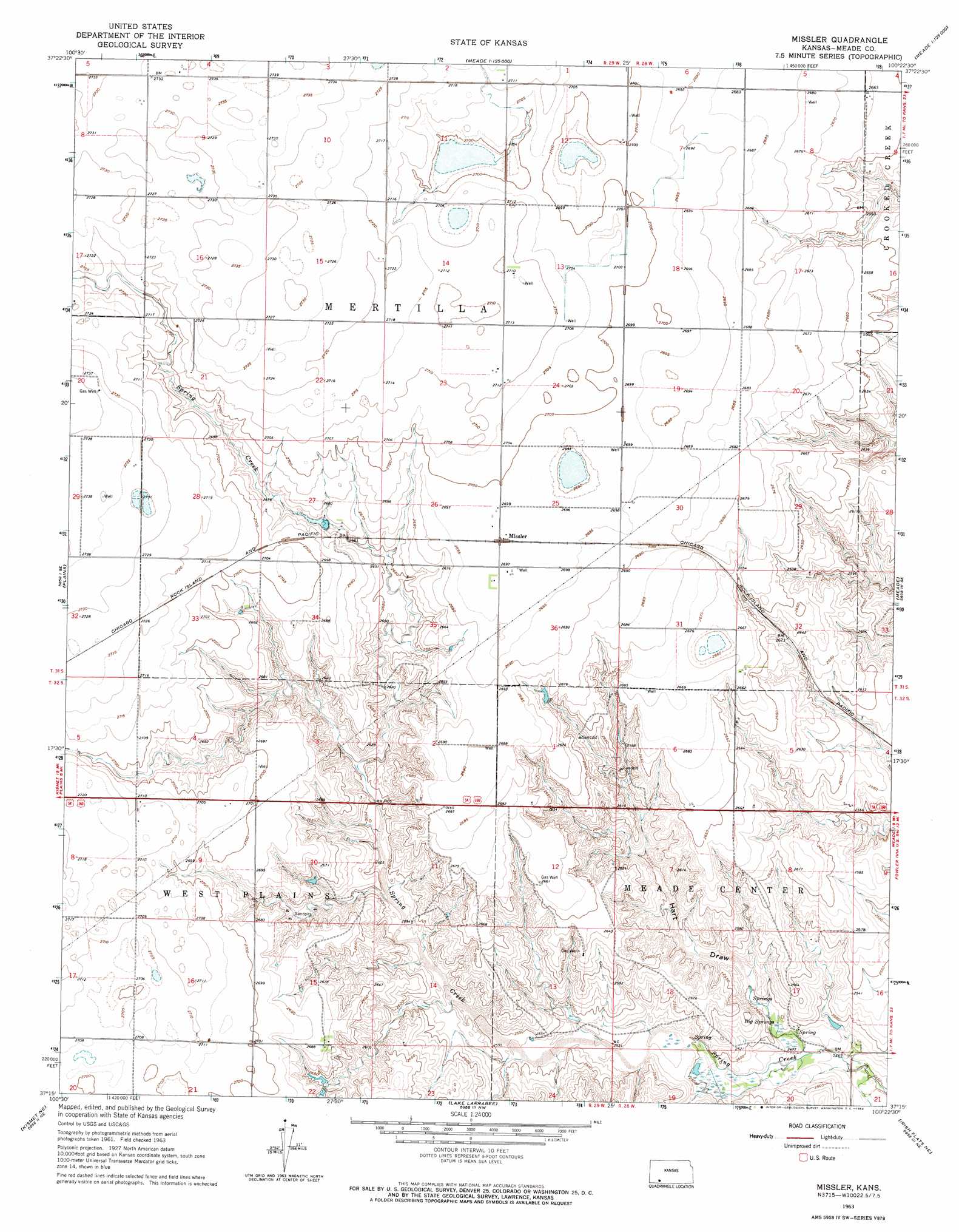
USGS Topo Quad 37100c4 - 1:24,000 scale
| Topo Map Name: | Missler |
| USGS Topo Quad ID: | 37100c4 |
| Print Size: | ca. 21 1/4" wide x 27" high |
| Southeast Coordinates: | 37.25° N latitude / 100.375° W longitude |
| Map Center Coordinates: | 37.3125° N latitude / 100.4375° W longitude |
| U.S. State: | KS |
| Filename: | o37100c4.jpg |
| Download Map JPG Image: | Missler topo map 1:24,000 scale |
| Map Type: | Topographic |
| Topo Series: | 7.5´ |
| Map Scale: | 1:24,000 |
| Source of Map Images: | United States Geological Survey (USGS) |
| Alternate Map Versions: |
Missler KS 1963, updated 1964 Download PDF Buy paper map Missler KS 2010 Download PDF Buy paper map Missler KS 2012 Download PDF Buy paper map Missler KS 2016 Download PDF Buy paper map |
1:24,000 Topo Quads surrounding Missler
Copeland |
Copeland Se |
Montezuma |
Montezuma Se |
Ensign Sw |
Plains Nw |
Plains Ne |
Meade Nw |
Meade Ne |
Fowler |
Plains Sw |
Plains |
Missler |
Meade |
Fowler Sw |
Kismet |
Kismet Ne |
Lake Meade |
Irish Flats Ne |
Proffitt Lake Nw |
Kismet Sw |
Kismet Se |
Irish Flats |
Irish Flats Se |
Proffitt Lake Sw |
> Back to 37100a1 at 1:100,000 scale
> Back to 37100a1 at 1:250,000 scale
> Back to U.S. Topo Maps home
Missler topo map: Gazetteer
Missler: Populated Places
Missler elevation 823m 2700′Missler: Springs
Big Springs elevation 760m 2493′Missler: Valleys
Hart Draw elevation 818m 2683′Missler digital topo map on disk
Buy this Missler topo map showing relief, roads, GPS coordinates and other geographical features, as a high-resolution digital map file on DVD: