Garden City Sw Topo Map Kansas
To zoom in, hover over the map of Garden City Sw
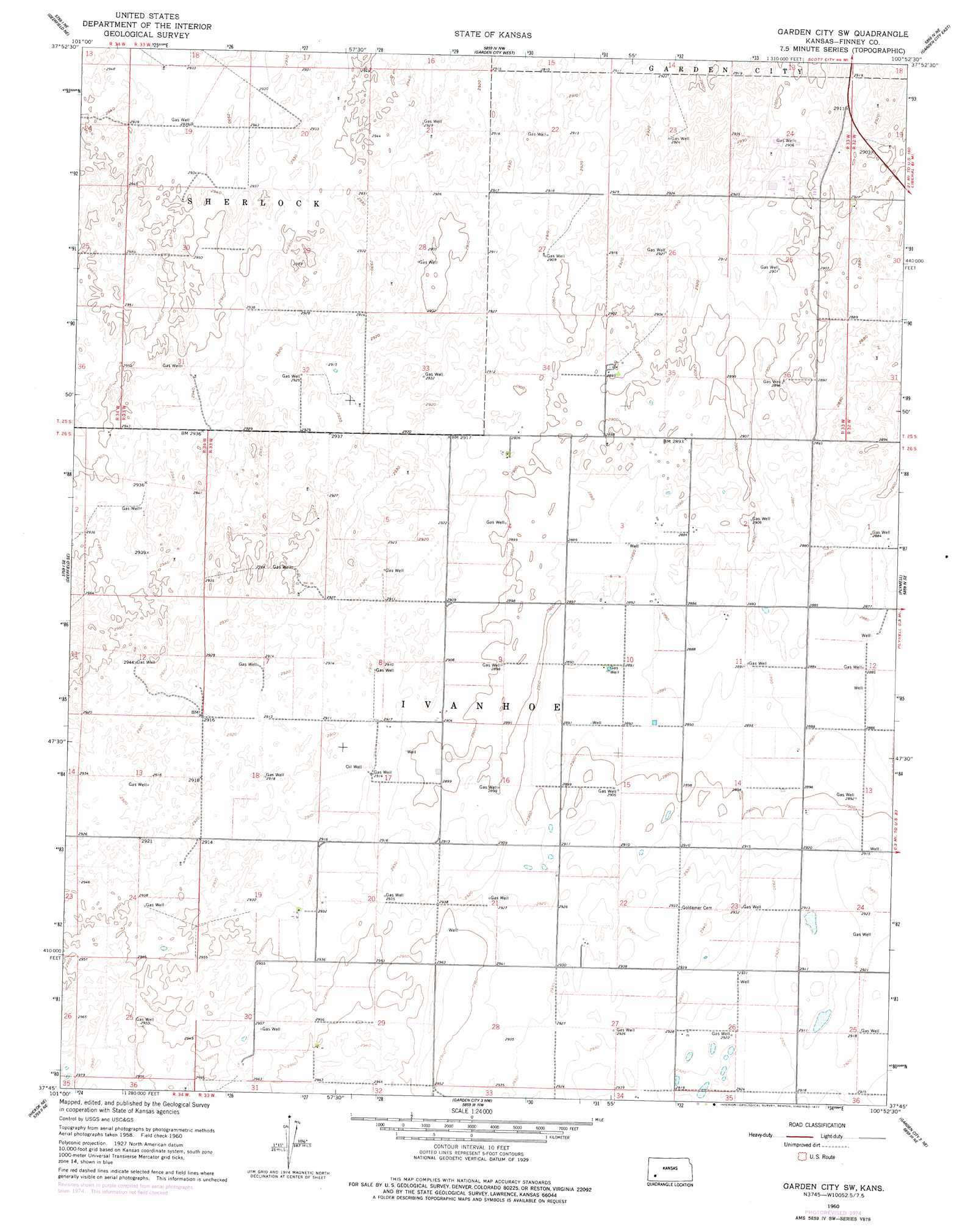
USGS Topo Quad 37100g8 - 1:24,000 scale
| Topo Map Name: | Garden City Sw |
| USGS Topo Quad ID: | 37100g8 |
| Print Size: | ca. 21 1/4" wide x 27" high |
| Southeast Coordinates: | 37.75° N latitude / 100.875° W longitude |
| Map Center Coordinates: | 37.8125° N latitude / 100.9375° W longitude |
| U.S. State: | KS |
| Filename: | o37100g8.jpg |
| Download Map JPG Image: | Garden City Sw topo map 1:24,000 scale |
| Map Type: | Topographic |
| Topo Series: | 7.5´ |
| Map Scale: | 1:24,000 |
| Source of Map Images: | United States Geological Survey (USGS) |
| Alternate Map Versions: |
Garden City SW KS 1960, updated 1961 Download PDF Buy paper map Garden City SW KS 1960, updated 1977 Download PDF Buy paper map Garden City SW KS 2009 Download PDF Buy paper map Garden City SW KS 2012 Download PDF Buy paper map Garden City SW KS 2016 Download PDF Buy paper map |
1:24,000 Topo Quads surrounding Garden City Sw
Wolf Sw |
Wolf |
Lowe |
White Woman Bottoms |
Scott City 4 Sw |
Deerfield |
Deerfield Ne |
Garden City West |
Garden City East |
Pierceville |
Deerfield Sw |
Deerfield Se |
Garden City Sw |
Plymell |
Pierceville Sw |
Hickok Nw |
Hickok Ne |
Garden City 3 Nw |
Garden City 3 Ne |
Copeland Nw |
Hickok |
Hickok Se |
Garden City 3 Sw |
Garden City 3 Se |
Copeland |
> Back to 37100e1 at 1:100,000 scale
> Back to 37100a1 at 1:250,000 scale
> Back to U.S. Topo Maps home
No gazetteer data is available for the Garden City Sw topo map sheet.
Garden City Sw digital topo map on disk
Buy this Garden City Sw topo map showing relief, roads, GPS coordinates and other geographical features, as a high-resolution digital map file on DVD: