Elkhart Nw Topo Map Kansas
To zoom in, hover over the map of Elkhart Nw
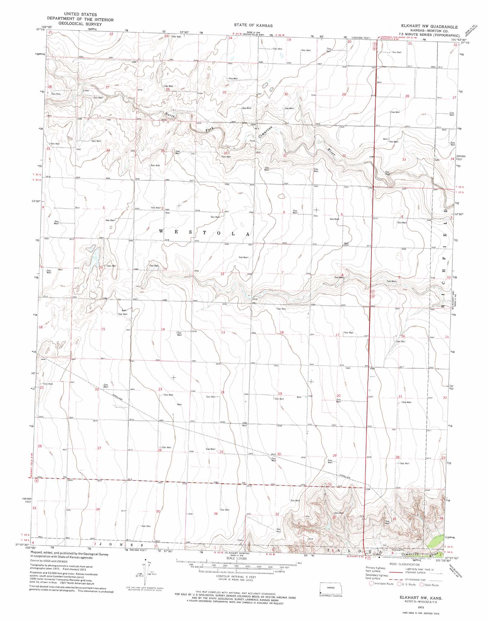
USGS Topo Quad 37101b8 - 1:24,000 scale
| Topo Map Name: | Elkhart Nw |
| USGS Topo Quad ID: | 37101b8 |
| Print Size: | ca. 21 1/4" wide x 27" high |
| Southeast Coordinates: | 37.125° N latitude / 101.875° W longitude |
| Map Center Coordinates: | 37.1875° N latitude / 101.9375° W longitude |
| U.S. State: | KS |
| Filename: | o37101b8.jpg |
| Download Map JPG Image: | Elkhart Nw topo map 1:24,000 scale |
| Map Type: | Topographic |
| Topo Series: | 7.5´ |
| Map Scale: | 1:24,000 |
| Source of Map Images: | United States Geological Survey (USGS) |
| Alternate Map Versions: |
Elkhart NW KS 1973, updated 1975 Download PDF Buy paper map Elkhart NW KS 2011 Download PDF Buy paper map Elkhart NW KS 2012 Download PDF Buy paper map Elkhart NW KS 2015 Download PDF Buy paper map |
| FStopo: | US Forest Service topo Elkhart NW is available: Download FStopo PDF Download FStopo TIF |
1:24,000 Topo Quads surrounding Elkhart Nw
Bartlett |
Saunders |
Richfield Nw |
Richfield Ne |
Shore Airport |
Stonington |
Stonington Se |
Richfield Sw |
Richfield |
Shore Airport Sw |
Midway |
Midway Ne |
Elkhart Nw |
Elkhart Ne |
Rolla Nw |
Midway Sw |
Midway Se |
Elkhart North |
Wilburton |
Rolla |
Sturgis Nw |
Sturgis |
Elkhart South |
Eva Ne |
Hough Nw |
> Back to 37101a1 at 1:100,000 scale
> Back to 37100a1 at 1:250,000 scale
> Back to U.S. Topo Maps home
Elkhart Nw topo map: Gazetteer
Elkhart Nw: Flats
Greenwood Pasture elevation 1065m 3494′North Fork Pasture elevation 1095m 3592′
Pasture Number Eight elevation 1099m 3605′
Pasture Number Eleven elevation 1082m 3549′
Pasture Number Nine elevation 1091m 3579′
Pasture Number Seven elevation 1102m 3615′
Pasture Number Ten elevation 1083m 3553′
Pasture Number Thirtyeight elevation 1077m 3533′
Pasture Number Twelve elevation 1069m 3507′
Pasture Number Twenty elevation 1105m 3625′
Pasture Number Twentyone elevation 1098m 3602′
Pasture Number Twentytwo elevation 1090m 3576′
Elkhart Nw digital topo map on disk
Buy this Elkhart Nw topo map showing relief, roads, GPS coordinates and other geographical features, as a high-resolution digital map file on DVD: