Hickok Ne Topo Map Kansas
To zoom in, hover over the map of Hickok Ne
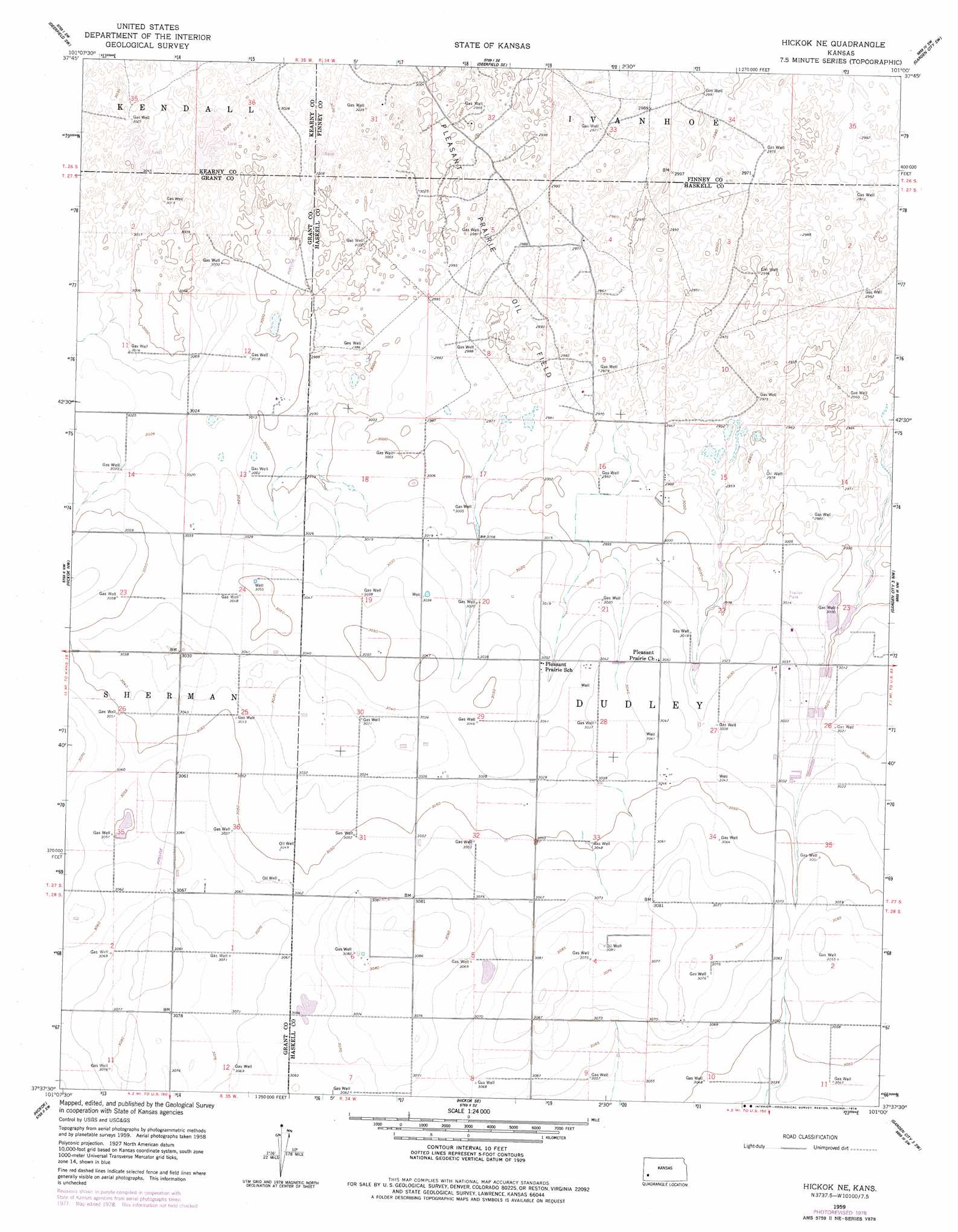
USGS Topo Quad 37101f1 - 1:24,000 scale
| Topo Map Name: | Hickok Ne |
| USGS Topo Quad ID: | 37101f1 |
| Print Size: | ca. 21 1/4" wide x 27" high |
| Southeast Coordinates: | 37.625° N latitude / 101° W longitude |
| Map Center Coordinates: | 37.6875° N latitude / 101.0625° W longitude |
| U.S. State: | KS |
| Filename: | o37101f1.jpg |
| Download Map JPG Image: | Hickok Ne topo map 1:24,000 scale |
| Map Type: | Topographic |
| Topo Series: | 7.5´ |
| Map Scale: | 1:24,000 |
| Source of Map Images: | United States Geological Survey (USGS) |
| Alternate Map Versions: |
Hickok NE KS 1959, updated 1961 Download PDF Buy paper map Hickok NE KS 1959, updated 1978 Download PDF Buy paper map Hickok NE KS 2009 Download PDF Buy paper map Hickok NE KS 2012 Download PDF Buy paper map Hickok NE KS 2015 Download PDF Buy paper map |
1:24,000 Topo Quads surrounding Hickok Ne
Lakin |
Deerfield |
Deerfield Ne |
Garden City West |
Garden City East |
Lakin Se |
Deerfield Sw |
Deerfield Se |
Garden City Sw |
Plymell |
Ulysses Ne |
Hickok Nw |
Hickok Ne |
Garden City 3 Nw |
Garden City 3 Ne |
Ulysses |
Hickok |
Hickok Se |
Garden City 3 Sw |
Garden City 3 Se |
Wagon Bed Spring |
Moscow Nw |
Ryus |
Satanta |
Sublette |
> Back to 37101e1 at 1:100,000 scale
> Back to 37100a1 at 1:250,000 scale
> Back to U.S. Topo Maps home
Hickok Ne topo map: Gazetteer
Hickok Ne: Airports
Master Feeders Eleven Incoporated Airport elevation 926m 3038′Hickok Ne: Oilfields
Pleasant Prairie Oil Field elevation 913m 2995′Hickok Ne digital topo map on disk
Buy this Hickok Ne topo map showing relief, roads, GPS coordinates and other geographical features, as a high-resolution digital map file on DVD: